Skip to content
Menu
p600.org
  • home
  • map
  • trips
  • about
p600.org

Penha d’Águia

hike | 2024-04-07

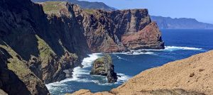
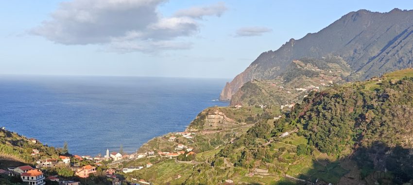
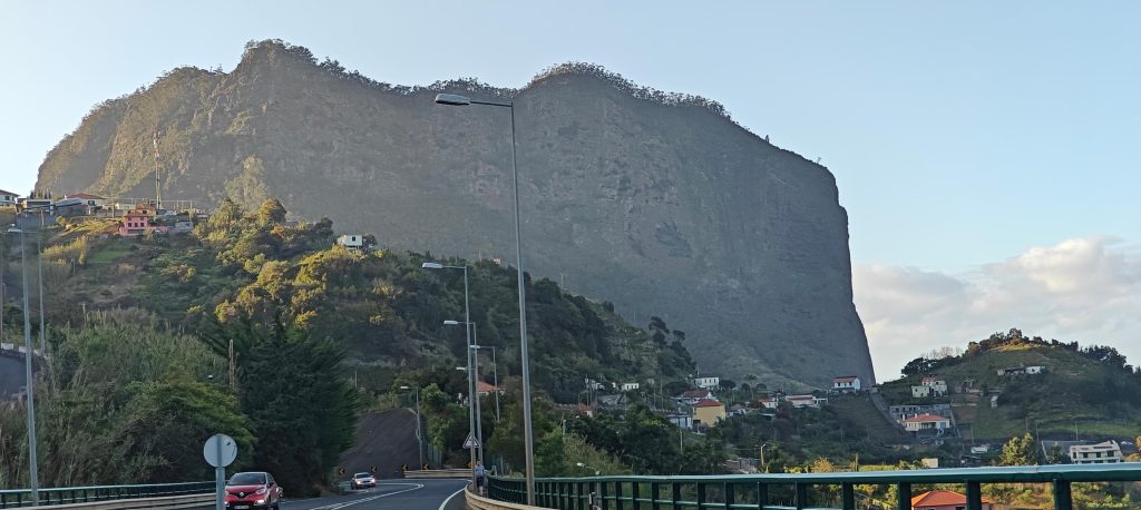
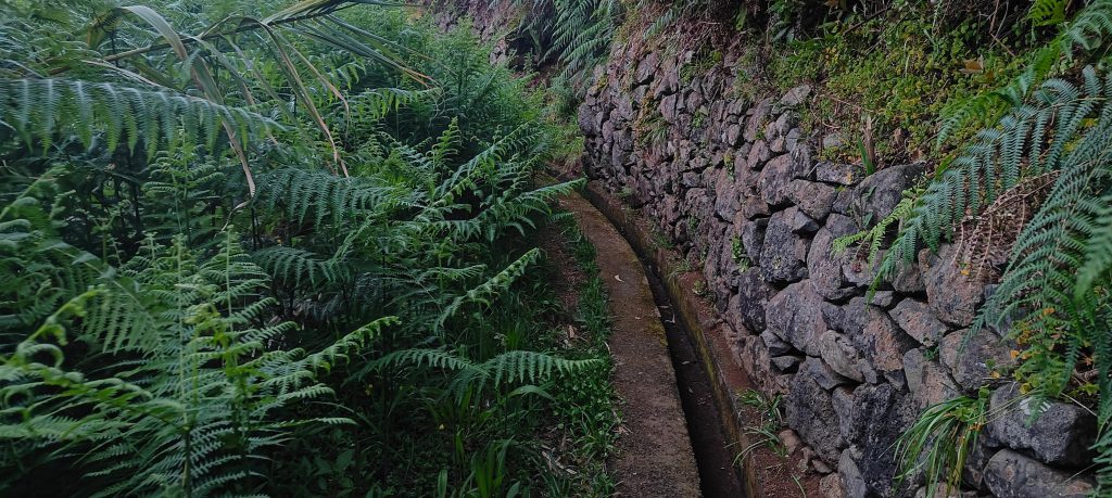
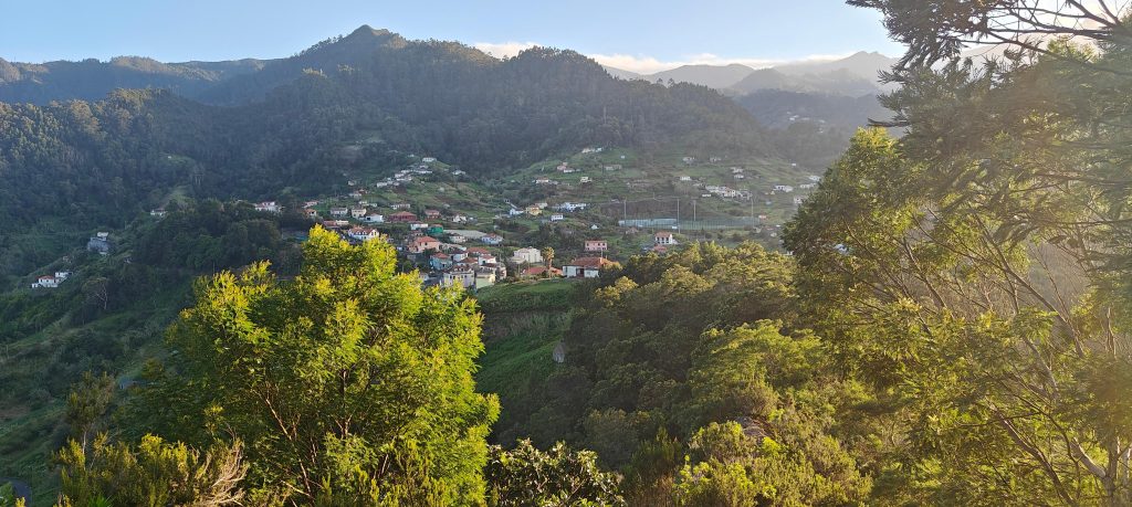
The setting sun ignites the sky in fiery hues as I dash towards a cool rock formation jutting out from the coast, the one I scoped earlier from Pico da Coroa and Pico do Arieiro. Penha d’Águia towers ahead, its impressive cliffs guarding all sides. But thanks to Ben’s tip on the Peakbager app, I know a hidden trail exists. I park in Maçapez village and navigate the narrow streets. A tiny path, easily mistaken for overgrown private property without GPS, leads me towards a water system.

Well, that’s certainly not your average crumb cake. This ‘cake’ rock is a geological wonder.
The trail begins with a scenic stroll alongside the concrete watering system, winding through vibrant gardens.

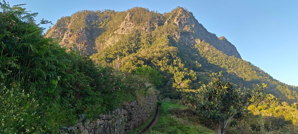
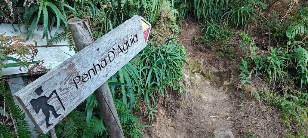
A hundred meters in, an arrow points the way to the summit. The trail’s mostly easy going from here, with a few steeper sections that require some light scrambling. It’s manageable, but after climbing about 200 vertical meters, a worry creeps in: where’s the summit? Turns out, it’s my mistake. I thought it was just a couple hundred meters, but somehow missed that it’s a full 350-meter climb. Now, the sun dips below the horizon as I push upwards – an exciting race against the fading light!

Reaching this arrow marker, I ditch the path for the bushes.
Lombo do Galego village.
I can see both Referta and the Pico da Coroa cliffs – the very peak I reached just over an hour ago.
Nestled atop lava ridges, São Roque do Faial and Lombo de Cima.

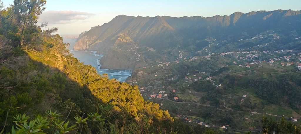
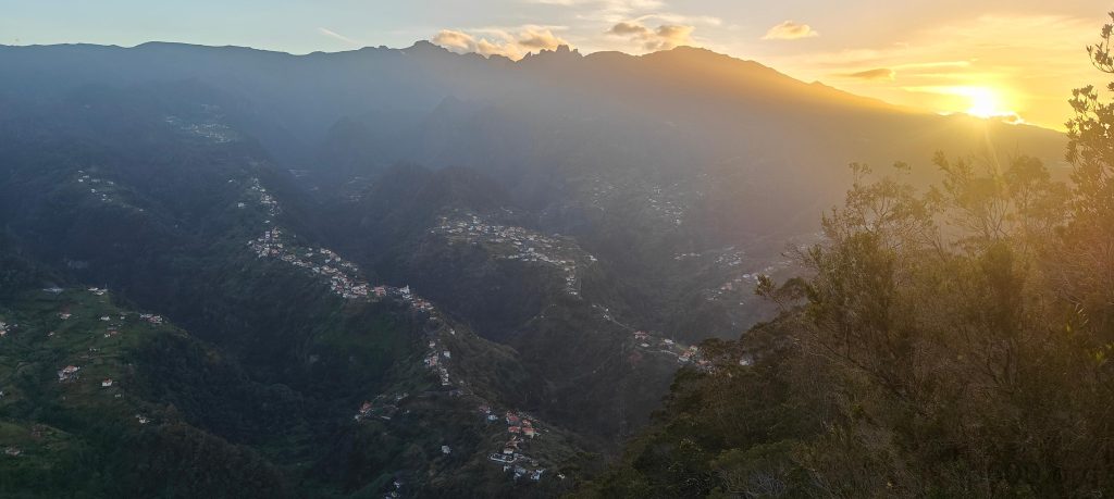
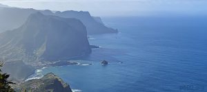
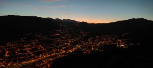
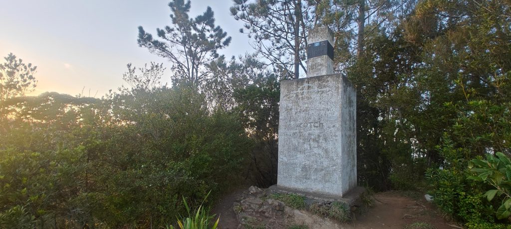
I reach the summit just as the sun dips below the horizon. A sturdy concrete trig pillar marks the peak, and the island sprawls out before me in a breathtaking vista. I turn around and begin my descent. There’s still enough light to get back to my car before darkness falls completely. And I make it! Just in time.

Sturdy trig pillar, atop a 2m concrete base, marks the summit.
Watsonia (bugle lily or Watsonia fulgens) – this beautiful flowering plant honors the legacy of Sir William Watson, an 18th-century British botanist.
There are over 500 species of aloe, all native to warm climates around the world.
Maybe those are the famous banana-pineapple… things? Unlikely, but gotta check!

Another P300 peak bagged today! Time to refuel with a well-deserved dinner, but hold on! As I head back to the hotel, Pico do Facho beckons in the distance. I rather skip soup, but i wll bag this small peak.


Penha d'Águia589 m altitude
349 m prominence
9.51 km isolation
RangesMid-Atlantic Islands - North Atlantic Islands
Countries/regionsPortugal - Madeira
Distance1.00 km up1.00 km down
Elevation356 m gain356 m loss
Time
0h35 up
0h05 other
0h30 down
1h10 total
Trailhead232 m altitude32.7713880, -16.8433880
RouteThe village streets give way to a hidden water system trail. Follow it for maybe 100 meters, where a small forest path branches off, leading deeper into the bushes. This path becomes your guide, winding its way all the way to the summit. The initial terrain is easy, transitioning to steeper sections later on, with a few short parts requiring some easy scrambling. The summit area is flat, offering a welcome respite. Descend using the same route.
DifficultiesA few sections with slightly steeper inclines and some playful scramble.
LinksGPX trail
  • Mid-Atlantic Islands 2024
  • « Pico da Coroa
  • Pico do Facho »

Mountain Ranges

Anatolia
Central Anatolia
Pontic Mountains
Southeast Anatolia
Taurus Mountains
Western Anatolia
Andes
Puna de Atacama
Atlas Mountains
High Atlas
Northwestern Atlas
Central America Ranges
Costa Rica-Panama Ranges
Central Central America
East China
Taiwan
Eastern Europe Ranges
Southeast Baltic Plains
Iberian Peninsula
Cordillera Cantabrica
Castile Ranges
Portugal-Galicia
Pyrenees
Intermountain West
Great Basin Ranges
Korea-Amur Area
Taebaek Sanmae
Malay Archipelago
Java
Nusa Tengarra
Sulawesi
Sumatra
Mid-Atlantic Islands
North Atlantic Islands
Mongolia Ranges
Altai
Gobi Desert Ranges
Hangay Mountains
Northwest Europe
Great Britain
North France-West Rhine Area
Pacific Ranges
Cascade Range
Northwest U.S. Coast Ranges
Sierra Nevada
Central and Southern California Ranges
Philippines
Central Philippines
Luzon
Mindanao
Southeast Asia
Malay Peninsula
Southeast South America
Pampas
Sierras de Cordoba
Southern Africa
Malawi Highlands
West Africa Mountains
Bight of Benin
Cameroon Mountains
Guinea Highlands

Countries / regions

Algeria
Ain Guezzam
Ain Salah
Aïn Témouchent
El Bayadh
Ghardaïa
Oran
Ouargla
Saïda
Sidi Bel Abbès
Tamanrasset
Argentina
Catamarca
Ciudad Autónoma de Buenos Aires
Córdoba
Jujuy
Salta
Tucumán
Belgium
Brussels Capital Region
Flemish Region
Cameroon
Southwest
China
Taiwan
Costa Rica
Alajuela
Cartago
Guanacaste
Heredia
Limón
San José
Czechia
Prague
Denmark
Greenland
France
Hauts-de-France
Occitania
Germany
Berlin
Niedersachsen
Indonesia
Bali
Jambi
Jawa Tengah
Jawa Timur
Nusa Tenggara Barat
Sulawesi Tengah
Sulawesi Utara
Sumatera Barat
Lithuania
Vilnius County
Mongolia
Bayankhongor
Govi-Altai
Khovd
Omnogovi
Ovorkhangai
Ulan Bator
Zavkhan
Morocco
Béni Mellal-Khénifra
Drâa-Tafilalet
Fez-Meknes
Marrakesh-Safi
Souss-Massa
Tangier-Tetouan-Al Hoceima
Mozambique
Zambezia
Netherlands
Gelderland
Noord-Holland
Zeeland
Nicaragua
Chinandega
Managua
Masaya
Rivas
Philippines
Bicol Region (V)
Cagayan Valley (II)
Calabarzon (IV-A)
Central Luzon (III)
Cordillera Administrative Region
Davao Region
Metro Manila
Soccsksargen (XII)
Western Visayas (VI)
Poland
Greater Poland Voivodeship
Masovian Voivodeship
Portugal
Castelo Branco
Leiria
Lisbon
Madeira
Santarém
Qatar
Ad-Dawhah
São Tomé and Príncipe
São Tomé Province
Sierra Leone
Northern Province
Western Area
Singapore
South Korea
Gyeongsangnam-do
Seoul
Spain
Aragón
Asturias
Castilla-La Mancha
Castilla y León
Catalonia
Islas Canarias
Switzerland
Zürich
Turkey
Antalya
Bitlis
Erzincan
Hakkâri
Igdir
Isparta
Kahraman Maras
Muğla
United Kingdom
England
Scotland
United States
California
Delaware
Florida
Maryland
Nevada
New Jersey
New York
Pennsylvania
South Carolina
Utah

TRIPS

2024
Southern Africa 2024
Mid-Atlantic Islands 2024
North America 2024
Anatolia 2024
Korea-Amur Area 2024
East China 2024
2023
Mongolia Ranges 2023
Philippines 2023
West Africa III 2023
West Africa II 2023
Iberian Peninsula 2023
West Africa 2023
Central America 2023
2022
Andes 2022
Northwest Europe 2022
Malay Archipelago III 2022
Malay Archipelago II 2022
Anatolia Mountains 2022
Iberian Peninsula 2022
Atlas Mountains 2022
North France-West Rhine Area 2022

archaeology (3) climb (157) food (2) hike (155) p30 (17) p50 (4) p100 (24) p300 (12) p600 (17) p1000 (11) p1500 (76) ribu (10) sight (46) summary (16) trig (44) ultra (76)

1 591 km walked, 121 298 m climbed

©2025 p600.org | WordPress Theme by Superbthemes.com