Skip to content
Menu
p600.org
  • home
  • map
  • trips
  • about
p600.org

Pico do Furado

hike | 2024-04-07

The Cabo São Lourenço peninsula caught my eye during a rather harrowing landing two days ago. Well, “landing” might be a bit of an understatement—let’s say I “fell,” “dropped,” or even “plummeted” onto the runway. Kudos to the pilots though, they did a stellar job—I even gave them a round of applause. After three attempts, we finally touched down at Funchal Airport. That gave me at least two chances to admire the stunning cliffs of the peninsula. Of course, it was freezing cold, raining, and nothing like the experience I’m having today.

Quinta do Lorde
Ilhéu Chão, Deserta Grande, and Ilha Bugio are visible across the ocean.

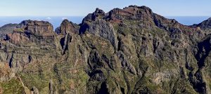
Ah, from the bustling Pico do Arieiro, I made my way to the even more crowded Cabo do Sao Lourenco. Today’s sky is a brilliant blue, a long-awaited moment for many locals and tourists. With everyone vying for parking, I initially attempted to reach the road’s end but quickly realized it was a lost cause. So, I retraced my steps a couple of kilometers and managed to squeeze my rented “smal-small” into the packed parking lot in front of Quinta do Lorde. Space was limited, but I found a way to fit in.

Pico do Furado, my hiking destination, doesn’t seem too far off.
The sea stacks are impressively sharp and colorful.
The cliffs of Cabeço das Pedras Brancas rise sharply.
Ponta do Furado features an arch-shaped entrance.

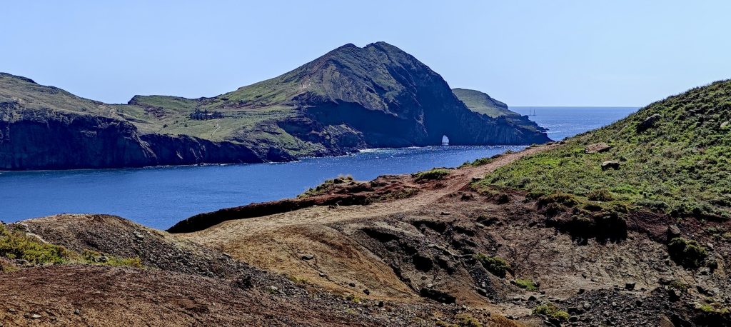
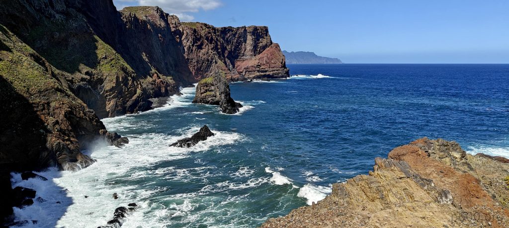
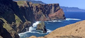
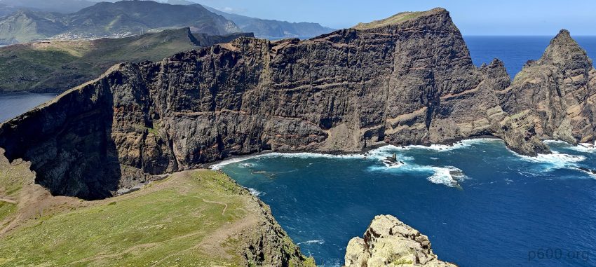
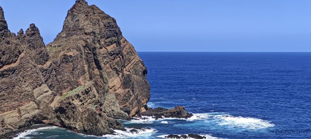
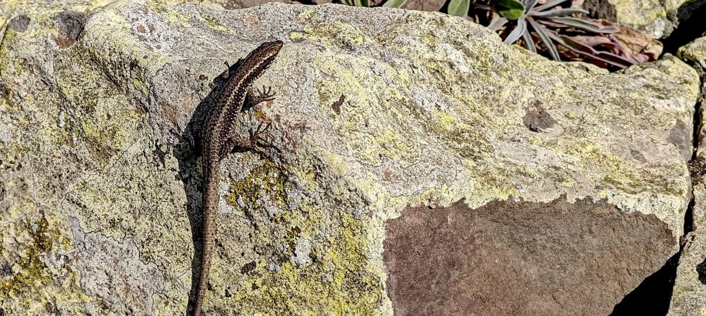
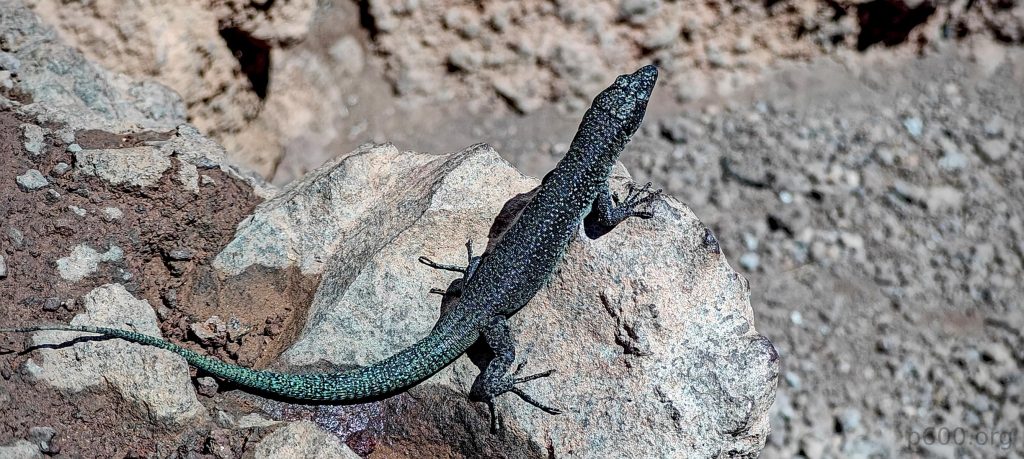
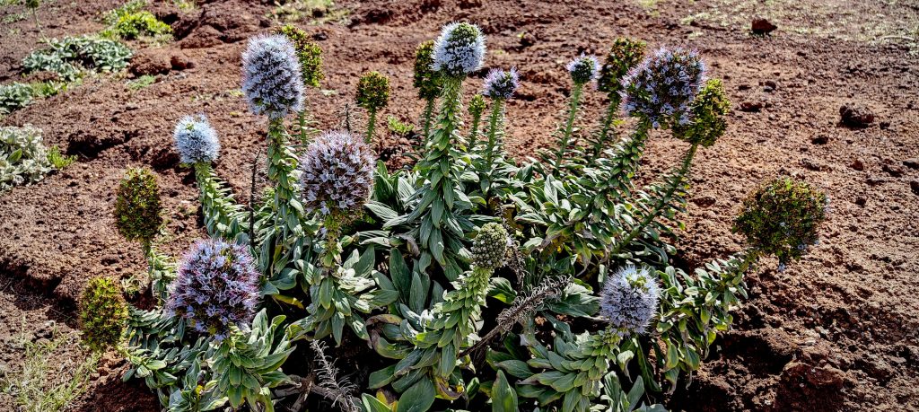
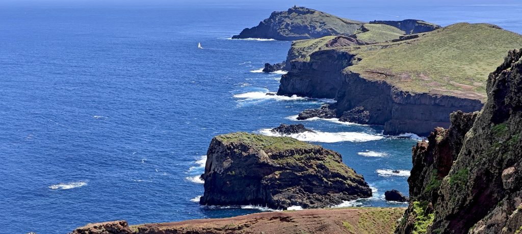
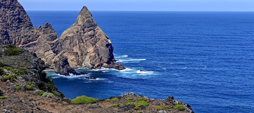
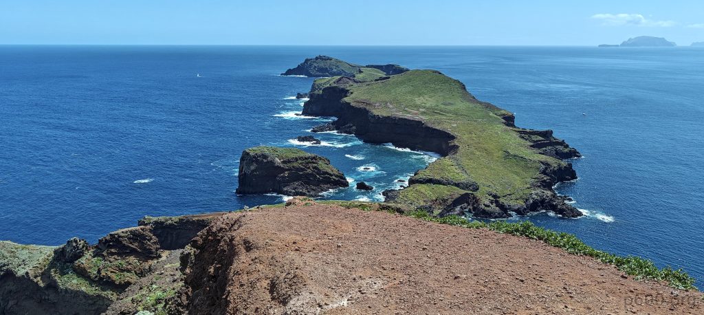
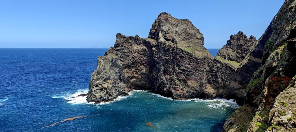
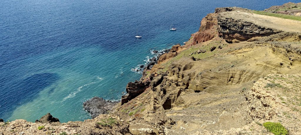
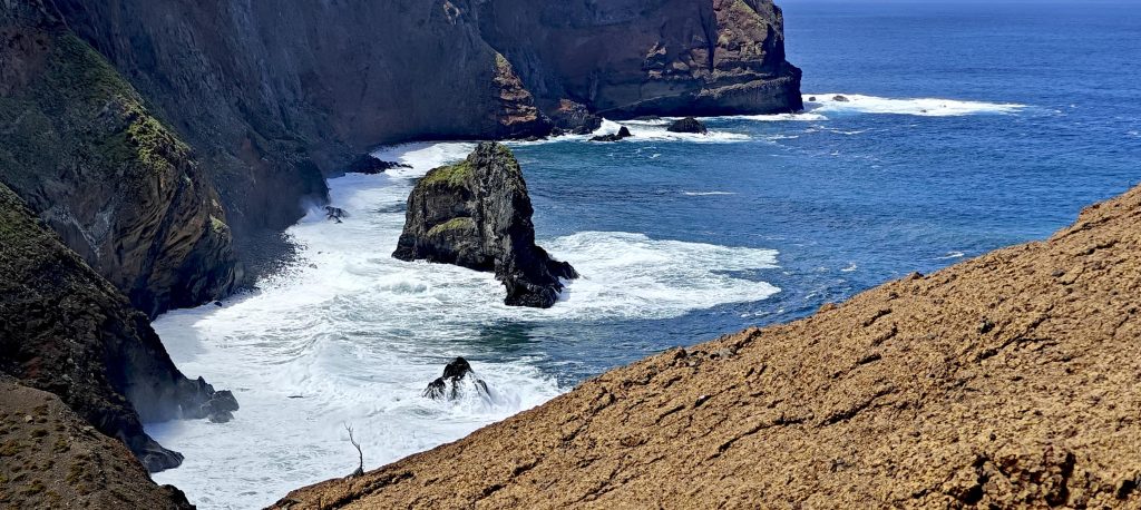
As I stroll along the paved road, I notice everyone making the same mistake I did—driving to the road’s end, then turning around and heading back before finally parking a few kilometers away. Nevertheless, the coastline is stunning. I catch sight of Pico do Furado with its intriguing arch at the base, along with the imposing cliffs. With such promising sights already, I can’t help but anticipate even more impressive views today.

The north coast of Cabo São Lourenço features steep cliffs.
These impressive lava formations stand out, with layers running both horizontally and vertically.
A lot of sea stacks dot the coastline.
Looking back at Madeira Island.

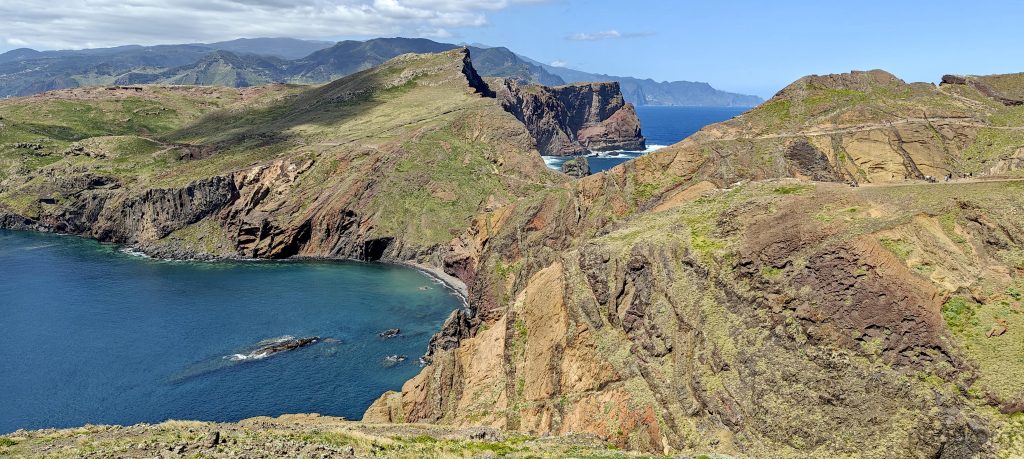
On my way to Pico do Furado, I decide to take a quick detour to the Ponta de São Lourenço peak. It may not be the highest, but who can resist soaking up the Madeira sunshine and enjoying those stunning cliff views? Spotting a faint trail from one of the viewpoints, I choose to ascend. When it’s time to descend, I opt to continue along the cliff line instead of retracing my steps.

Two parts of the peninsula are connected by a narrow ridge that’s steep on both sides. Ponta de São Lourenço peak in the left
Farol de São Lourenço stands on Ilhéu do Farol.
I’ll soon bag the Ponta de São Lourenço peak
The Estreito cliffs are steep and striking.
The Madeiran wall lizard (Teira dugesii) is a Lacertidae species unique to Madeira, Portugal. Its color varies to blend with its environment
The ‘Pride of Madeira’ (Echium candicans) is a flowering plant from the Boraginaceae family and the Echium genus, native to the island of Madeira.

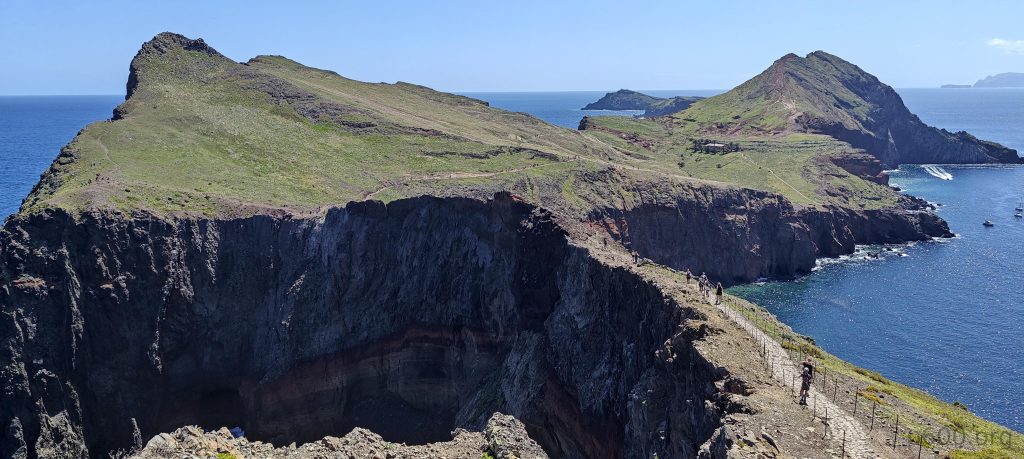
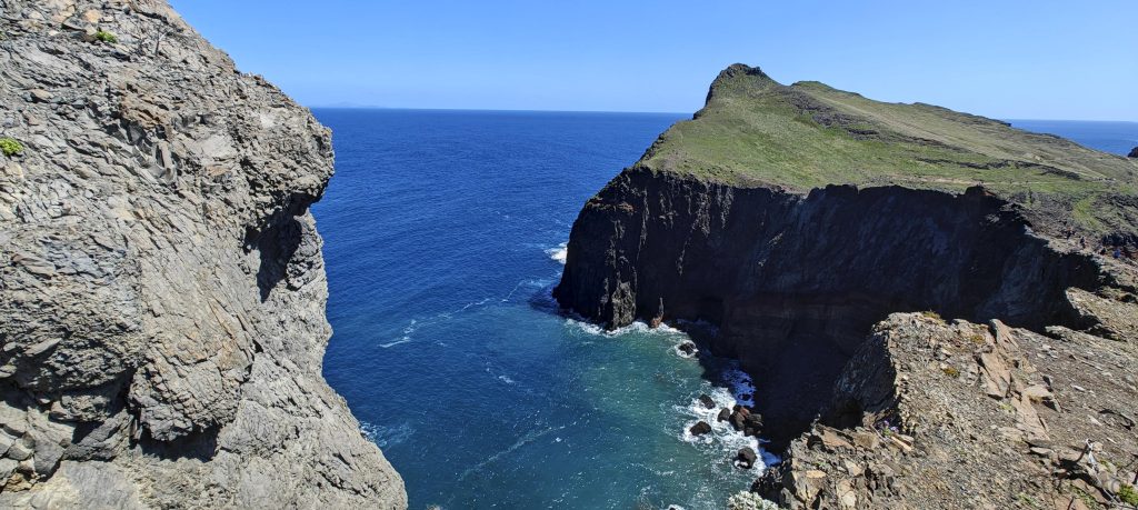
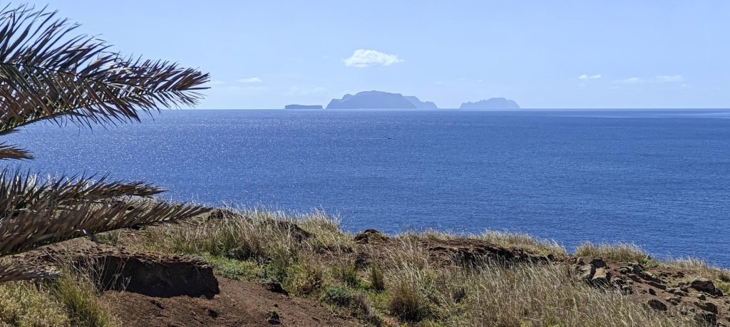
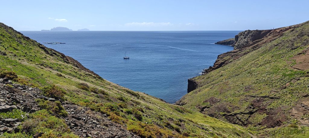
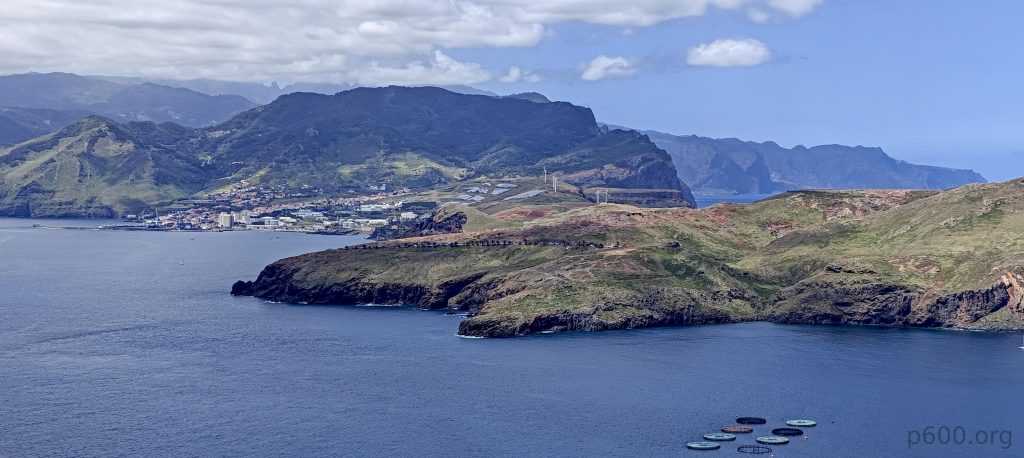
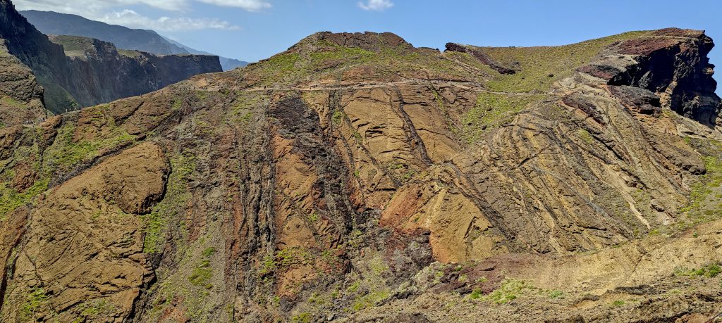
The summit slope is pretty steep, with some broken stairs forcing many people to climb parallel to them. It’s scorching hot today, making the climb even more challenging for some. At the summit, there are about thirty other people enjoying the views—gorgeous vistas of the islets, Madeira, and the cliffs. Let’s sum it up: nice views all around. After snapping a few photos and taking a sip of my drink, I start heading back along the same route. I pick up the pace, partly running and overtaking slower groups along the way.

Ilhéu da Cevada, also known as Ilhéu dos Desembarcadouros, and Ilhéu do Farol islets.
Switzerland isn’t the only place with a “Matterhorn”.
The sun, wind, and ocean have created impressive rock structures and vibrant colors.
I just descended from this cliff.
Looking back, most of the trail is visible.
The summit is nearly the end of Cabo São Lourenço, but two more islets are visible ahead—Ilhéu da Cevada and Ilhéu do Farol.
The slopes feature impressive volcanic patterns, like nature’s own abstract paintings.
The rock structures are impressive.
Yachts are sailing along the shore.
Looking back one more time at Pico do Furado before heading back to the parking lot.
The energetic Atlantic Ocean’s waves crash with relentless force against the shore.

Despite the crowds, I highly recommend this trail. And trust me, on a sunny day, it promises to be a memorable experience. I’m buzzing with 110% energy, and since it’s still early afternoon, I’m off to conquer the next peaks—Pico do Castanho, Pico da Coroa, Penha d’Águia, and I’ll wrap it up with a nighttime view from Pico do Facho.


+-
2 km
1 mi
'CyclOSM | Map data: ©, OpenStreetMap contributors'
Pico do Furado170 m altitude
135 m prominence
23.15 km isolation
RangesMid-Atlantic Islands - North Atlantic Islands
Countries/regionsPortugal - Madeira
Distance5.60 km up5.00 km down
Elevation373 m gain373 m loss
Time
1h30 up
0h05 other
1h30 down
3h05 total
Trailhead24 m altitude32.7442690, -16.7108560
RouteThe trail is mostly paved and well-maintained all the way to the top, with a few descents and re-ascents along the route. While the detour to Pico Sao Lourenco itself is not an official trail, there are visible traces of people climbing it.
DifficultiesCrowds and parking can be an issue.
LinksGPX trail
  • Mid-Atlantic Islands 2024
  • « Pico do Arieiro
  • Pico do Castanho »

Mountain Ranges

Anatolia
Central Anatolia
Pontic Mountains
Southeast Anatolia
Taurus Mountains
Western Anatolia
Andes
Puna de Atacama
Atlas Mountains
High Atlas
Northwestern Atlas
Central America Ranges
Costa Rica-Panama Ranges
Central Central America
East China
Taiwan
Eastern Europe Ranges
Southeast Baltic Plains
Iberian Peninsula
Cordillera Cantabrica
Castile Ranges
Portugal-Galicia
Pyrenees
Intermountain West
Great Basin Ranges
Korea-Amur Area
Taebaek Sanmae
Malay Archipelago
Java
Nusa Tengarra
Sulawesi
Sumatra
Mid-Atlantic Islands
North Atlantic Islands
Mongolia Ranges
Altai
Gobi Desert Ranges
Hangay Mountains
Northwest Europe
Great Britain
North France-West Rhine Area
Pacific Ranges
Cascade Range
Northwest U.S. Coast Ranges
Sierra Nevada
Central and Southern California Ranges
Philippines
Central Philippines
Luzon
Mindanao
Southeast Asia
Malay Peninsula
Southeast South America
Pampas
Sierras de Cordoba
Southern Africa
Malawi Highlands
West Africa Mountains
Bight of Benin
Cameroon Mountains
Guinea Highlands

Countries / regions

Algeria
Ain Guezzam
Ain Salah
Aïn Témouchent
El Bayadh
Ghardaïa
Oran
Ouargla
Saïda
Sidi Bel Abbès
Tamanrasset
Argentina
Catamarca
Ciudad Autónoma de Buenos Aires
Córdoba
Jujuy
Salta
Tucumán
Belgium
Brussels Capital Region
Flemish Region
Cameroon
Southwest
China
Taiwan
Costa Rica
Alajuela
Cartago
Guanacaste
Heredia
Limón
San José
Czechia
Prague
Denmark
Greenland
France
Hauts-de-France
Occitania
Germany
Berlin
Niedersachsen
Indonesia
Bali
Jambi
Jawa Tengah
Jawa Timur
Nusa Tenggara Barat
Sulawesi Tengah
Sulawesi Utara
Sumatera Barat
Lithuania
Vilnius County
Mongolia
Bayankhongor
Govi-Altai
Khovd
Omnogovi
Ovorkhangai
Ulan Bator
Zavkhan
Morocco
Béni Mellal-Khénifra
Drâa-Tafilalet
Fez-Meknes
Marrakesh-Safi
Souss-Massa
Tangier-Tetouan-Al Hoceima
Mozambique
Zambezia
Netherlands
Gelderland
Noord-Holland
Zeeland
Nicaragua
Chinandega
Managua
Masaya
Rivas
Philippines
Bicol Region (V)
Cagayan Valley (II)
Calabarzon (IV-A)
Central Luzon (III)
Cordillera Administrative Region
Davao Region
Metro Manila
Soccsksargen (XII)
Western Visayas (VI)
Poland
Greater Poland Voivodeship
Masovian Voivodeship
Portugal
Castelo Branco
Leiria
Lisbon
Madeira
Santarém
Qatar
Ad-Dawhah
São Tomé and Príncipe
São Tomé Province
Sierra Leone
Northern Province
Western Area
Singapore
South Korea
Gyeongsangnam-do
Seoul
Spain
Aragón
Asturias
Castilla-La Mancha
Castilla y León
Catalonia
Islas Canarias
Switzerland
Zürich
Turkey
Antalya
Bitlis
Erzincan
Hakkâri
Igdir
Isparta
Kahraman Maras
Muğla
United Kingdom
England
Scotland
United States
California
Delaware
Florida
Maryland
Nevada
New Jersey
New York
Pennsylvania
South Carolina
Utah

TRIPS

2024
Southern Africa 2024
Mid-Atlantic Islands 2024
North America 2024
Anatolia 2024
Korea-Amur Area 2024
East China 2024
2023
Mongolia Ranges 2023
Philippines 2023
West Africa III 2023
West Africa II 2023
Iberian Peninsula 2023
West Africa 2023
Central America 2023
2022
Andes 2022
Northwest Europe 2022
Malay Archipelago III 2022
Malay Archipelago II 2022
Anatolia Mountains 2022
Iberian Peninsula 2022
Atlas Mountains 2022
North France-West Rhine Area 2022

archaeology (3) climb (157) food (2) hike (155) p30 (17) p50 (4) p100 (24) p300 (12) p600 (17) p1000 (11) p1500 (76) ribu (10) sight (46) summary (16) trig (44) ultra (76)

1 591 km walked, 121 298 m climbed

©2025 p600.org | WordPress Theme by Superbthemes.com
Menu
p600.org
  • home
  • map
  • trips
  • about