Skip to content
Menu
p600.org
  • home
  • map
  • trips
  • about
p600.org

Babadag

hike | 2022-09-24

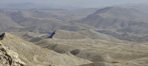
From the top of Uiluk Tepe, I descend at noon, leaving enough time for another peak today. I roll on small roads for almost three hours, although the straight line is only 35.5 kilometers.

Mountain paragliding starting point

When approaching the bottom of the mountain, the navigator offers to drive along a gravel road (from SE). The road is not bad, just very dusty. Later, I will realize that I have saved a few euros. The official road is tolled. A few kilometers before the top, the gravel road joins the main paved road.

View from the road to the south

When I get upstairs, I pass the barrier, behind which I am greeted by a girl who explains that I have to leave the car in front of the barrier. The parking lot has a lot of space, with only a poor curb before the barrier. I leave the car half-inserted into the street, just like the others. Commerce is commerce..

View from the road to the northeast
View from the road to the north

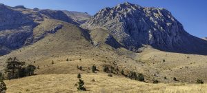
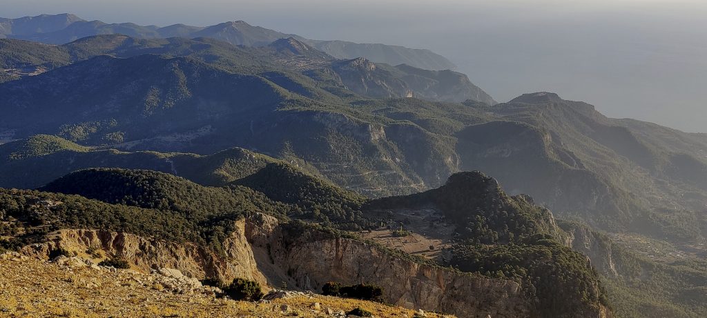
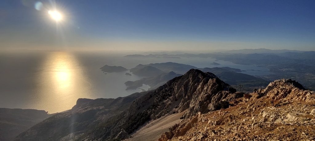
I’m on a easy gradual path to go fast. I pass the elevator, a café, and overtake a few tourists with slippers. Near the top, at the helicopter landing site, from which you can see excellent views.

View from the top to the coast
Reflection
Gigantic flag and observation deck
Selfis

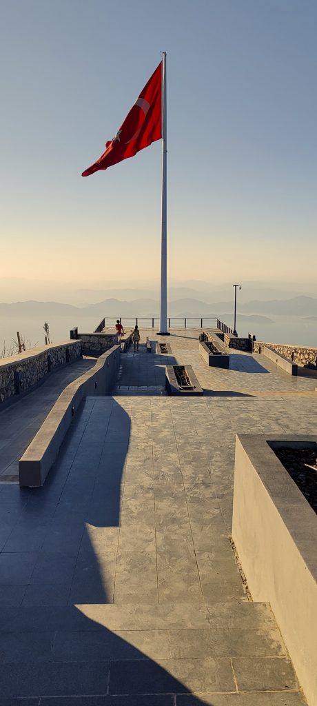
It is difficult to say where the highest point is. Most likely, it is located between or under the buildings. Nearby excellent observation deck with a gigantic Turkish flag.

The couple asks for a picture of themselves. I step back a bit and try to find a position to get beautiful landscapes into the frame. However, I am asked to take a close-up picture of the portrait. That’s what I do. Encouraged by the ‘portraitomans’, I take a picture of my shadow, I’ll be a ‘shadowman’.

Sun and sea
Mediterranean Islands

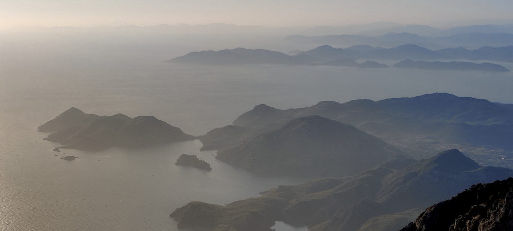
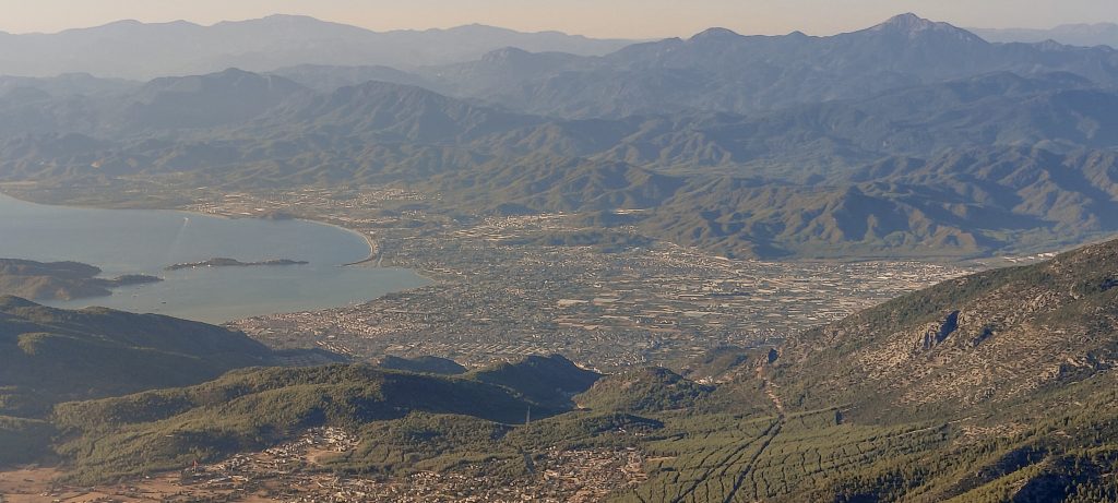
I’m going back pretty fast, towards the car. I visit another observation deck next to the café. But there are so many people out there that I peek into the city of Fethiye, the bay, and sprint from there.

The most arable larger town – Fethiye

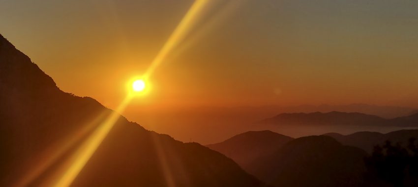
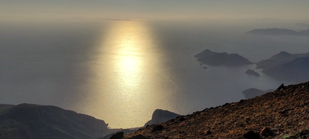
As I drive down, I don’t hold back and stop for another photo of the sunset. A couple of minutes, and the sun goes down. 

When I go to the bottom, I see the barriers raised and realize that I have gone up for free. However, there is no one to boast or pay for. So I move on. The hotel is another 4-5 hours away. Two Ultras had a fantastic day. There are some such days, but they are rare.


Babadag1969 m altitude
1763 m prominence
27.91 km isolation
RangesAsia - Anatolia - Western Anatolia
Countries/regionsTurkey - Muğla
Distance2.10 km up2.10 km down
Elevation256 m gain256 m loss
Time
0h30 up
0h05 other
0h25 down
1h00 total
Trailhead1712 m altitude36.5387220, 29.1711940
Difficulties<p>none</p>
LinksGPX trail
  • Anatolia Mountains 2022
  • « Uyluk Tepe
  • Dedegol Tepesi »

Mountain Ranges

Anatolia
Central Anatolia
Pontic Mountains
Southeast Anatolia
Taurus Mountains
Western Anatolia
Andes
Puna de Atacama
Atlas Mountains
High Atlas
Northwestern Atlas
Central America Ranges
Costa Rica-Panama Ranges
Central Central America
East China
Taiwan
Eastern Europe Ranges
Southeast Baltic Plains
Iberian Peninsula
Cordillera Cantabrica
Castile Ranges
Portugal-Galicia
Pyrenees
Intermountain West
Great Basin Ranges
Korea-Amur Area
Taebaek Sanmae
Malay Archipelago
Java
Nusa Tengarra
Sulawesi
Sumatra
Mid-Atlantic Islands
North Atlantic Islands
Mongolia Ranges
Altai
Gobi Desert Ranges
Hangay Mountains
Northwest Europe
Great Britain
North France-West Rhine Area
Pacific Ranges
Cascade Range
Northwest U.S. Coast Ranges
Sierra Nevada
Central and Southern California Ranges
Philippines
Central Philippines
Luzon
Mindanao
Southeast Asia
Malay Peninsula
Southeast South America
Pampas
Sierras de Cordoba
Southern Africa
Malawi Highlands
West Africa Mountains
Bight of Benin
Cameroon Mountains
Guinea Highlands

Countries / regions

Algeria
Ain Guezzam
Ain Salah
Aïn Témouchent
El Bayadh
Ghardaïa
Oran
Ouargla
Saïda
Sidi Bel Abbès
Tamanrasset
Argentina
Catamarca
Ciudad Autónoma de Buenos Aires
Córdoba
Jujuy
Salta
Tucumán
Belgium
Brussels Capital Region
Flemish Region
Cameroon
Southwest
China
Taiwan
Costa Rica
Alajuela
Cartago
Guanacaste
Heredia
Limón
San José
Czechia
Prague
Denmark
Greenland
France
Hauts-de-France
Occitania
Germany
Berlin
Niedersachsen
Indonesia
Bali
Jambi
Jawa Tengah
Jawa Timur
Nusa Tenggara Barat
Sulawesi Tengah
Sulawesi Utara
Sumatera Barat
Lithuania
Vilnius County
Mongolia
Bayankhongor
Govi-Altai
Khovd
Omnogovi
Ovorkhangai
Ulan Bator
Zavkhan
Morocco
Béni Mellal-Khénifra
Drâa-Tafilalet
Fez-Meknes
Marrakesh-Safi
Souss-Massa
Tangier-Tetouan-Al Hoceima
Mozambique
Zambezia
Netherlands
Gelderland
Noord-Holland
Zeeland
Nicaragua
Chinandega
Managua
Masaya
Rivas
Philippines
Bicol Region (V)
Cagayan Valley (II)
Calabarzon (IV-A)
Central Luzon (III)
Cordillera Administrative Region
Davao Region
Metro Manila
Soccsksargen (XII)
Western Visayas (VI)
Poland
Greater Poland Voivodeship
Masovian Voivodeship
Portugal
Castelo Branco
Leiria
Lisbon
Madeira
Santarém
Qatar
Ad-Dawhah
São Tomé and Príncipe
São Tomé Province
Sierra Leone
Northern Province
Western Area
Singapore
South Korea
Gyeongsangnam-do
Seoul
Spain
Aragón
Asturias
Castilla-La Mancha
Castilla y León
Catalonia
Islas Canarias
Switzerland
Zürich
Turkey
Antalya
Bitlis
Erzincan
Hakkâri
Igdir
Isparta
Kahraman Maras
Muğla
United Kingdom
England
Scotland
United States
California
Delaware
Florida
Maryland
Nevada
New Jersey
New York
Pennsylvania
South Carolina
Utah

TRIPS

2024
Southern Africa 2024
Mid-Atlantic Islands 2024
North America 2024
Anatolia 2024
Korea-Amur Area 2024
East China 2024
2023
Mongolia Ranges 2023
Philippines 2023
West Africa III 2023
West Africa II 2023
Iberian Peninsula 2023
West Africa 2023
Central America 2023
2022
Andes 2022
Northwest Europe 2022
Malay Archipelago III 2022
Malay Archipelago II 2022
Anatolia Mountains 2022
Iberian Peninsula 2022
Atlas Mountains 2022
North France-West Rhine Area 2022

archaeology (3) climb (157) food (2) hike (155) p30 (17) p50 (4) p100 (24) p300 (12) p600 (17) p1000 (11) p1500 (76) ribu (10) sight (46) summary (16) trig (44) ultra (76)

1 591 km walked, 121 298 m climbed

©2025 p600.org | WordPress Theme by Superbthemes.com