Děčínský Sněžník was my first peak of the day, and as an opener it worked very well. It was short, efficient, easy to navigate, and still distinctive enough to feel like a real mountain rather than a glorified walk from a paid car park to a viewpoint. That is a useful combination when the plan is to string several peaks together in one day without doing anything too heroic before lunch. From Prague it made perfect sense as a first stop: a quick borderland mountain with a loop of 4.5 km, about 137 m of ascent, and just under an hour total.
I started from the large west-side parking area at 50.792336, 14.086987, matching the GPX start and finish. The walk began at about 10:24, I reached the true summit around 10:46, spent a short while on the plateau and by the tower, and returned to the car at about 11:23.
The trailhead is practical rather than romantic. The parking area is large, organized, and clearly monetized at about 40 CZK per hour, so this is not one of those charming places where everyone silently pretends the signs do not apply to them. There is infrastructure nearby, including a hotel or restaurant area, and even before I started walking it was obvious that Děčínský Sněžník is a popular mountain, not some secret local bump hidden behind a farm track.
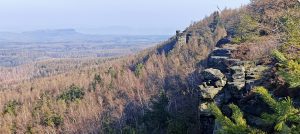
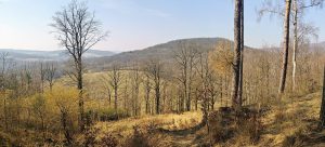
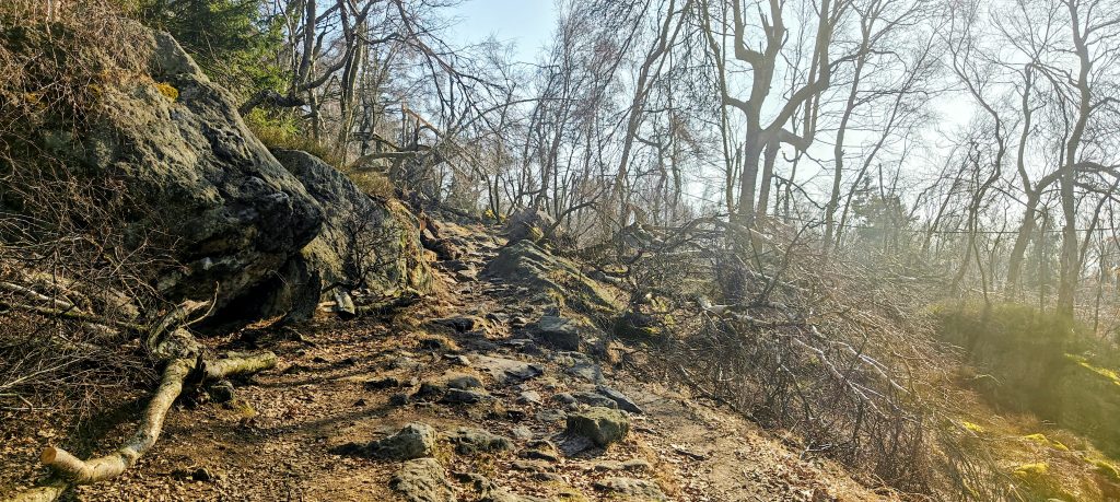
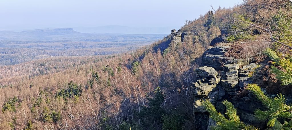
The route itself was straightforward. The lower part used easy, well-kept paths and road-like walking, which made the first section feel more managed than wild. Higher up, the hike improved. I left the easier lower approach and took the shorter upper loop toward the summit on stonier, better-looking footpaths among boulders, moss, birch, and scattered spruce. This was where the mountain started to feel like itself.
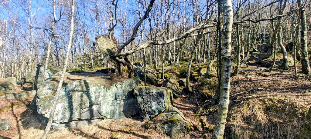
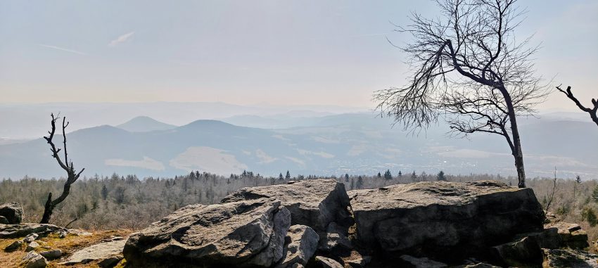
The climb to the highest ground was brief, but this was also the part that mattered most. Table mountains often come with one small nuisance: finding the true summit is not always as obvious as the map makes it sound. Here the mapped summit point in the forest did not look convincing at all. I checked it, but the obvious high point was the rock outcrop near the cliff edge, which stood out clearly as higher on the ground. My GPS recorded the highest point at approximately 50.791289, 14.104636, with a recorded altitude of around 731 m, but the official summit height is 724 m. As usual, GPS altitude wandered a bit, while the terrain itself gave a far more persuasive answer. For practical hiking purposes, and honestly also for common sense, the outcrop by the cliff was the true summit.
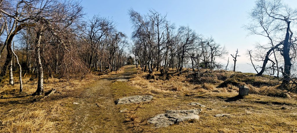
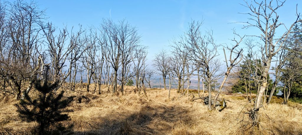
Above the climb, Děčínský Sněžník felt less like a tidy pointed summit and more like a broad high rim and plateau. In places it had a slightly weathered, almost tundra-like early-March feel: dry yellow grass, bare birches, patches of moss, low vegetation, open ground, and scattered rock. The weather made it even stranger in a good way. It was warm enough for short sleeves, and winter survived only in a few traces of ice in wet places. I also noticed signs of animal activity, including what looked like wild boar traces, although the wildlife did not exactly have the mountain to itself. I passed around fifty people, with a noticeable mix of Czech and German visitors, which suited the location on the Czech-Saxon borderland.
The upper area is also where the mountain becomes more interesting historically. Děčínský Sněžník is not just another convenient morning loop above a parking lot. It is the highest table mountain in the Czech Republic and the highest summit of the Elbe Sandstone Mountains, which explains the mountain’s broad shape, flat top, and sudden sandstone edges. The German name Hoher Schneeberg means High Snow Mountain, while another Czech name, Vysoká Sněžka, points in the same direction. Despite the name, there was very little snow left on the plateau.
The lookout tower nearby gives the mountain most of its historical weight. It was built in 1864 by František Antonín Thun, originally as a surveying tower, and it is among the oldest stone lookout towers in the country. The place later picked up a second claim to fame: in 1936, the tower reportedly became the first place in Bohemia where a television signal was received, carrying pictures from the Berlin Olympic Games. That is a surprisingly modern little footnote for a sandstone summit better known for views and wind. The mountain also sits within the wider landscape of Saxon and Bohemian Switzerland, a region long associated with painters such as Caspar David Friedrich and with the romantic appeal of cliffs, haze, and layered horizons.
From the true summit I continued toward the tower, and that made sense as part of the walk. The upper loop gave the summit area more breadth and made the short hike feel fuller than a simple up-and-down. Děčínský Sněžník is one of those mountains where the top is not just a single spot but a wider experience: the cliff edge, the plateau, the tower, the open patches, and the shifting views between trees and rock.
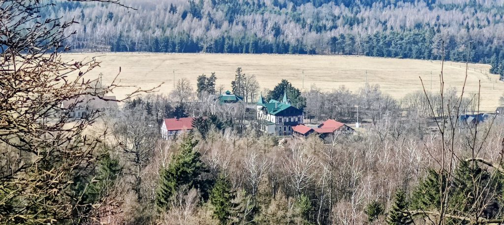
The views were good rather than perfectly sharp. There was some haze in the distance, but the wider setting still came through well: layered hills, forested ridges, sandstone tableland forms, and the lower country spread out below. Děčín lies nearby on the Labe (Elbe) at its confluence with the Ploučnice, and that gives the mountain some useful geographical weight. The city is the lowest city in the Czech Republic and has long mattered as a river port, railway junction, and transport gateway toward Germany. That history still shapes the region. This is not just a scenic sandstone upland. It is also a borderland shaped by the Elbe corridor, tourism, and long cross-border links.
Nearby Tisá adds another layer. The village sits close to the trailhead side of the mountain and is known for the Tisá Walls, one of the best sandstone rock areas in the region. That means Děčínský Sněžník stands at a meeting point of several different landscapes: cliff country, table mountain, forest plateau, border highland, and the transport corridor of the Elbe below. That broader setting gives the hike more depth than the raw numbers suggest.
The descent was the easiest part. After the tower, I completed the loop by following the asphalt road back to the parking area. It was efficient, direct, and exactly the kind of no-nonsense return that works well on a bigger day out. That left me with a route that was simple but not dull: easy lower access, a rockier and more attractive upper section, a true summit outcrop that was worth checking properly, a historic tower, and an uncomplicated road descent.
As a standalone hike, Děčínský Sněžník is short and heavily visited, and anyone expecting remote mountain solitude would be kidding themselves. As peak 1 of 8, though, it was close to ideal. It gave me a real summit, a broad plateau, some character, a little history, and useful regional context without wasting time or energy early in the day. The place is accessible enough to attract crowds and parking meters, but not so over-managed that it stops being interesting. That is a respectable balance, and not one every easy summit manages.
Approx. start / summit / finish: 10:24 / 10:46 / 11:23
Approx. durations: ~22 min ascent, ~12-15 min on the summit plateau and by the tower, ~22-25 min return
Trailhead / parking: West-side parking area at 50.792336, 14.086987; paid parking, about 40 CZK per hour
Highest recorded GPS point: Approx. 50.791289, 14.104636, around 731 m recorded; the rock outcrop by the cliff was the obvious true summit, while the mapped forest point appeared lower
Terrain: Easy lower approach on road and well-maintained paths, then rockier footpaths near the summit, open plateau walking, and asphalt return from the tower
Route: Parking -> upper footpaths to the summit outcrop -> plateau/tower area -> asphalt road back to parking
Sections: Roughly 1.6 km to the true summit, about 0.9 km around the summit plateau and tower area, then about 2.0 km back on the easy return
Difficulty: Easy overall; short hike with minimal navigation issues, though the upper paths are stonier than the road sections
Useful context: Highest table mountain in the Czech Republic; historic 1864 lookout tower; also known as Hoher Schneeberg.
Useful to know: Large, convenient, and popular trailhead. Expect other visitors in good weather. The road higher up may look temptingly drivable, but that does not mean it is available for casual summit laziness.