Skip to content
Menu
p600.org
  • home
  • map
  • trips
  • about
p600.org

Pilot Peak

hike | 2024-06-19

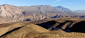
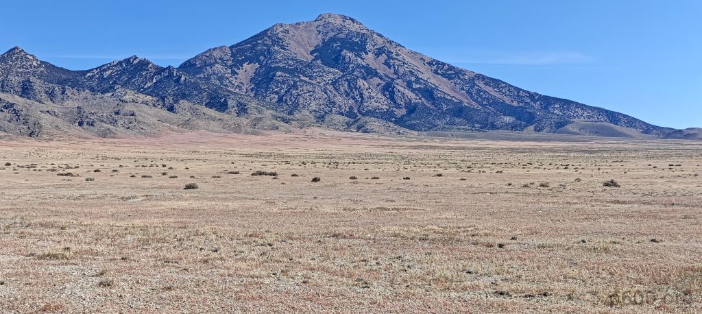
This peak is officially my favorite of the trip. It’s remote, has challenging access, and is wonderfully wild. No real trails mar its landscape. The views are captivating, and it’s just hard enough to remember yet easy enough to conquer in a day. By my standards, it’s almost ideal peak.

A shortcut from Wendover to the Pilot Peak trailhead offers a quicker but rougher, lower-quality route.

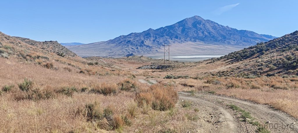
Getting to the trailhead is the first challenge. Even though I bagged the peak, I didn’t properly solve the approach issues. Initially, I drove to the “standard” road, which is perpendicular to the main road and leads straight to the canyon. However, I encountered clear signs indicating private property. So, I retraced my steps for about 5 kilometers and followed some visible car tracks along the south ridge. My inner voice kept nagging that this might also be private property. A few times, I lost the path, but my skills from the Mongolia trip last year came in handy. Eventually, I reached a fork where everyone should go left. I did the same, just in case.

Desert landscapes surround you on the approach.

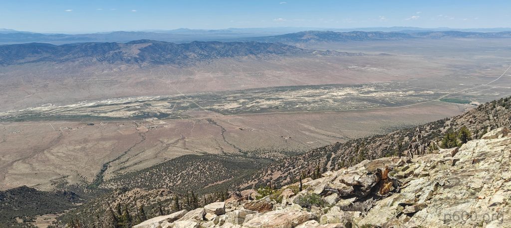
First, I parked the car at a route widening but then checked the map and realized it might be private land. So, I drove a little higher, right to the very end of the trail. According to Gaja, this is BLM land—whatever that means. I just hope it doesn’t offend the local farmer and his cows. After changing, I started climbing.

Park the car at a high point, making sure it’s on BLM land based on my maps.
At least two salt lakes are visible from higher up. Bonneville Salt Flats behind the ridge.

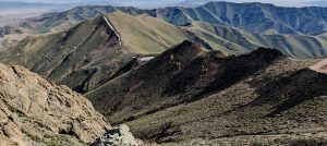
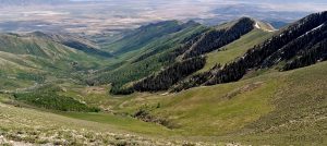
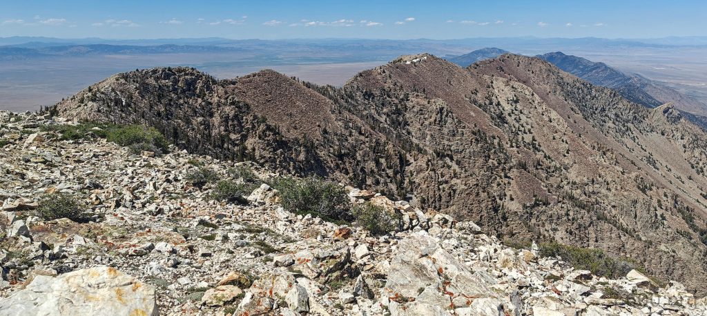
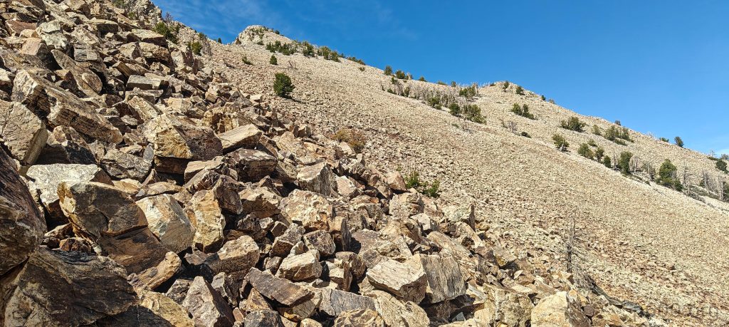
The first part of the hike is quite steep, through bushes and sparse trees, over rocks with some short talus sections. At times, I found myself scrambling, though it was avoidable. A few slabs needed crossing, but again, they were avoidable. I came to a small P20 bump, descended, and then the walk turned into a ridge walk. However, only a few sections were really relaxed and needed little attention. Most parts were quite rocky, requiring constant attention to my steps and planning future directions.

This might be the Ruby Mountains, but I could be wrong.
I can see the ridge and a 20-meter bump I climbed over ten minutes ago.
The salt lakes look like cloud cover.
Finally, I see the summit a bit closer; just a few more hundred meters of rocks, and we’ll meet.

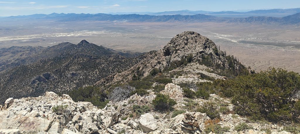
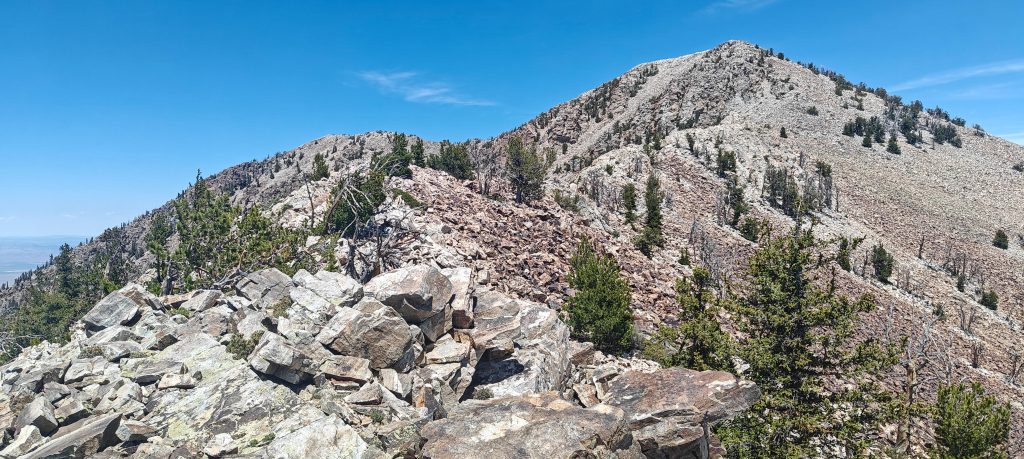
A few more scrambles up, a few down—rocks, talus, bushes, scrambling up and down, and balancing on the ridge. It was quite a fun hike. At one point, I found myself needing to descend a few class 4 steps, maybe class 3. Falling here would have serious consequences. Going up might have been okay, but I evaluated the situation again: quite remote place, I was alone, on a tough trail with no signal. So, I decided not to take chances. Reluctantly, I retraced my steps a few hundred meters, descended about fifty meters, and walked around one of the ridge bumps. Looking up again, I realized that risky step was indeed the only feasible way down.

Montello village and the surrounding Horse Canyon, Debbs Canyon, Happier Canon, Immigrant Canyon, Gamble Canyoun, Patterson Gulch, and Pilot Valley lie in the distance.
Halls Meadow and Willow Canyon spread out below.
Crater Island, Silver Island, Grouse Creek Slinks, Lemay Island, and Donner Reed Pass are visible in the distance.

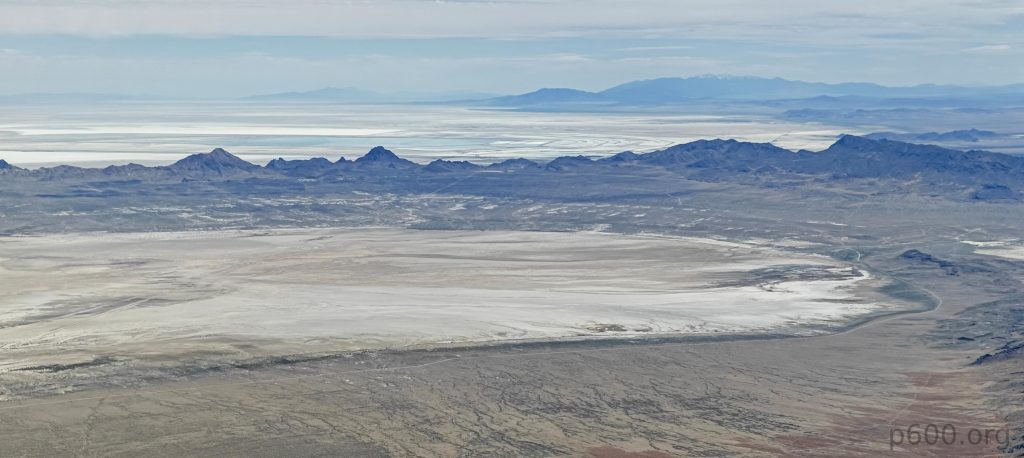
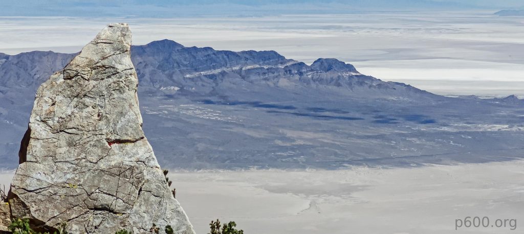
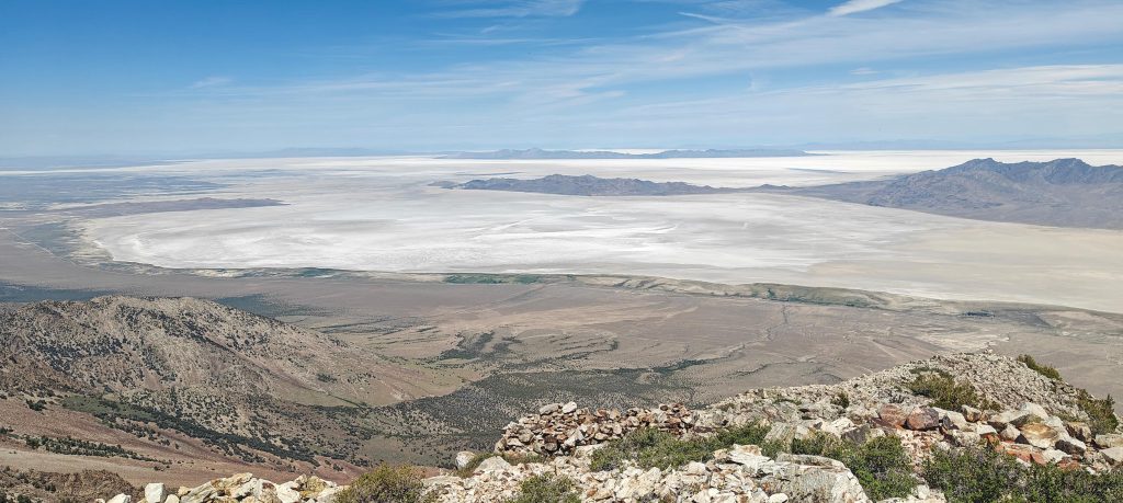
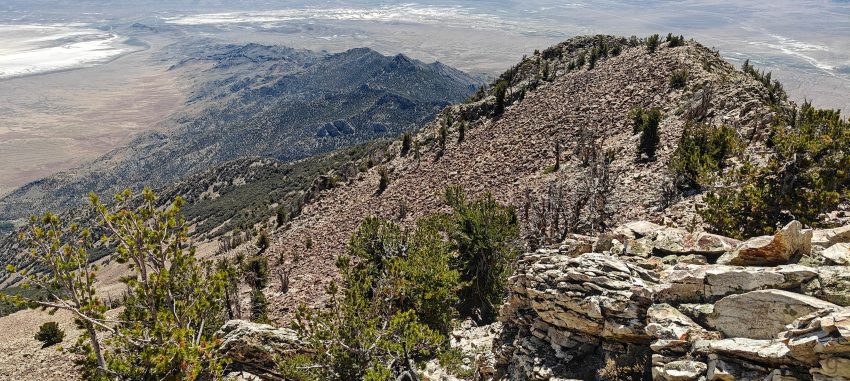
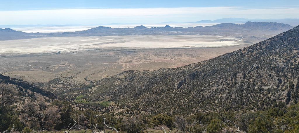
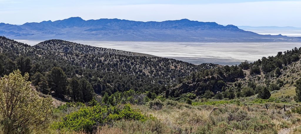
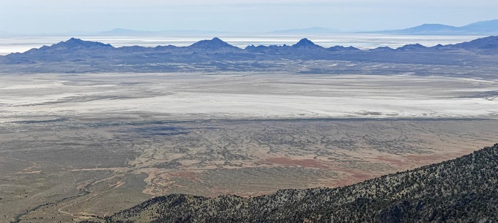
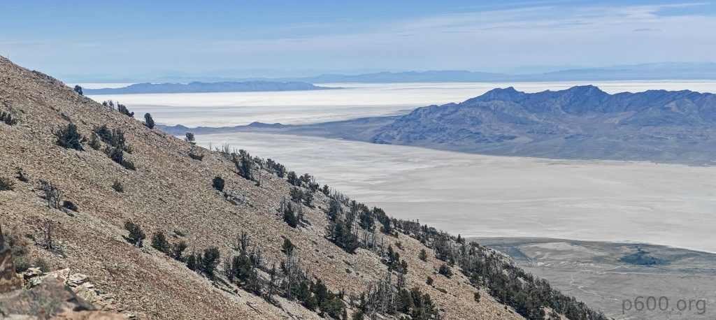
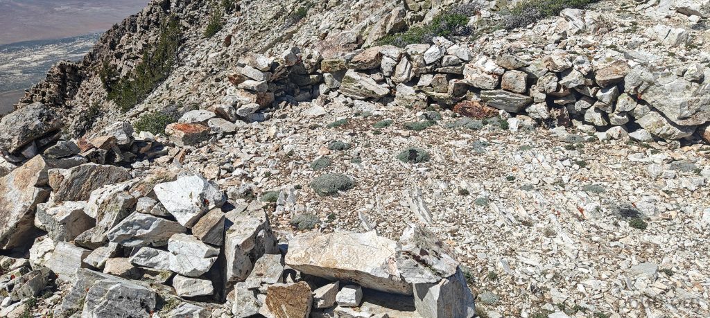
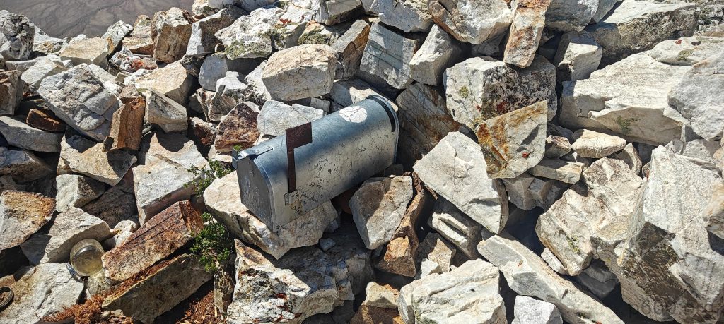
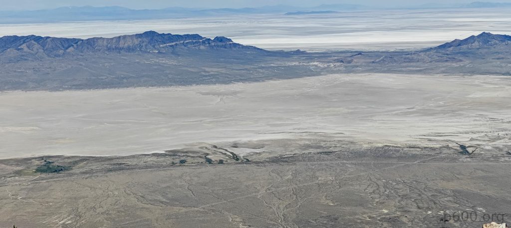
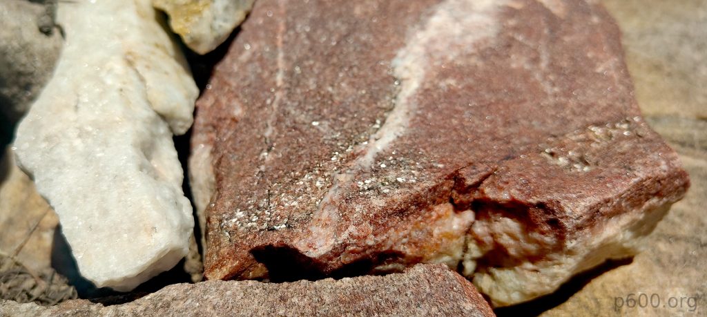
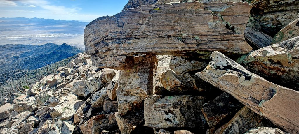
After talus, talus, and yet another talus climb, I finally reached the summit. To my surprise, there were quite a few stony wind shielter at the top. It doesn’t seem like this peak is very popular, but who knows? There was even a post box at the highest point. The views were super interesting, especially the salt flats. Visibility was excellent, revealing very remote areas and surrounding ridges. Four hours of talus jumping definitely paid off.

The summit has a few stone wind shelters and a post box (maybe for email?).
North Ridge stretches before me.
Salt Lakes and Silver Island Pass lie ahead.
Talus, talus, and more talus—just when you think it’s finished, there’s another talus field ahead.
At least one kilometer of talus lies below the summit.

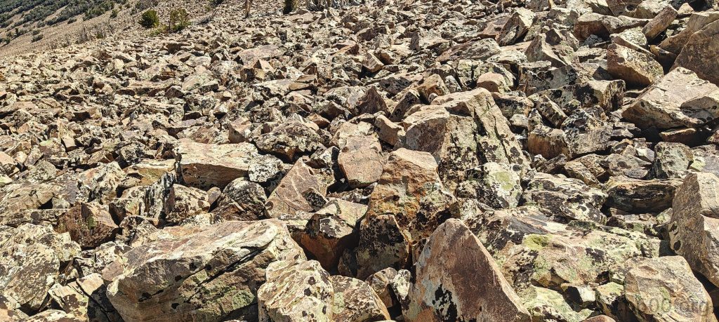
On the way down, I decided to take a shortcut and go for a more direct route, avoiding the ridge line. When faced with two bad routes, shorter is better. After a few kilometers of jumping from rock to rock, I finally reached the trees and normal terrain. Then, it was straight to my sun-heated car with its warm drinks waiting for me.

This range offers a fascinating hike for geology enthusiasts, with plenty of intriguing rocks, colors, shades, and structures.
If not for the talus, there would be more local flora along the way.
Dry, dry, dry.
Looking back one more time through the Golden Valley, the road to the trailhead goes left at the bottom of the ridge.

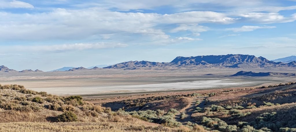
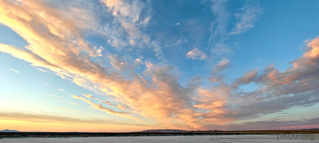
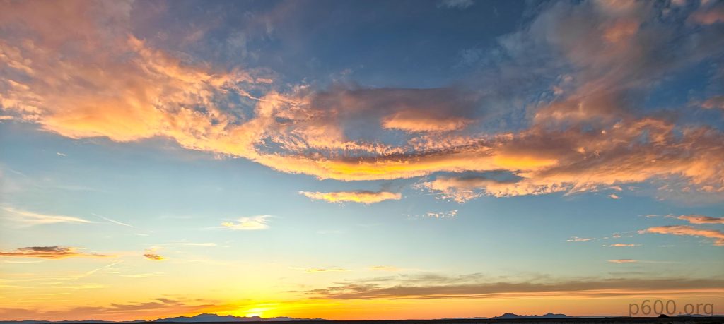
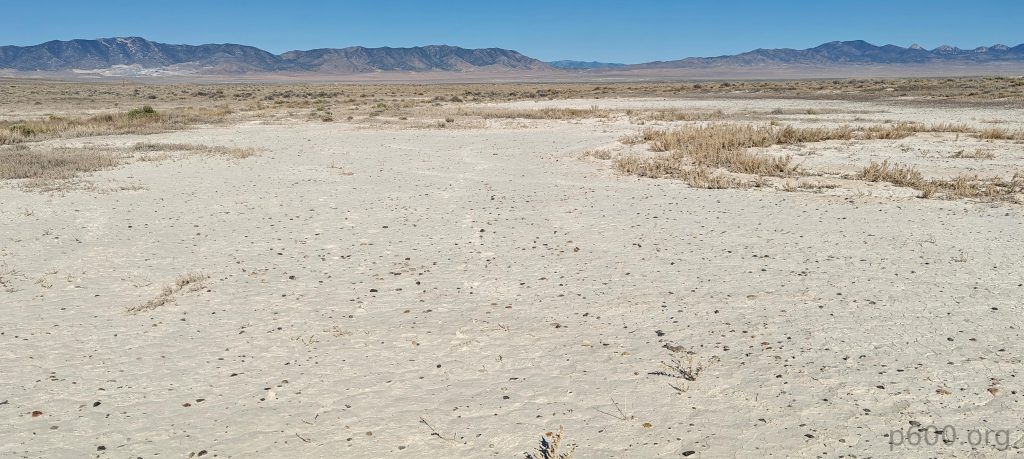
It wasn’t easy, but somehow it was a very enjoyable hike. Another great day with another ultra-prominent peak bagged. Now, I’m driving to Salt Lake City, Utah, heading toward Flat Top Mountain, another ultra-prominent peak. On the way, I’m stopping to explore the Bonneville Salt Flats. The impressive surface and sky make for a surreal experience, and here I am, right in between.

Bonneville Salt Flats at Great Salt Lake Desert during sunset create a stunning, surreal landscape.

Pilot Peak3266 m altitude
1745 m prominence
86.42 km isolation
Ranges Intermountain West- Great Basin Ranges
Countries/regionsUnited States - Nevada
Distance4.20 km up3.90 km down
Elevation1216 m gain1216 m loss
Time
4h00 up
0h10 other
3h00 down
7h10 total
Trailhead2050 m altitude40.9954040, -114.0836650
RouteI drive up a steep, unpaved road and park at the end of the tracks located at 40.99540, -114.08367, at approximately 2032 meters in altitude. The perpendicular road from the main road has a sign clearly stating it is private property, so I drive back a few kilometers and enter the valley via a road parallel to the ridges, keeping left at the recommended spot. The hike starts with talus underfoot and continues with a few stretches free of rocks. Following the ridge, I occasionally spot a trail, though it's rare. On the way down, I take a shortcut, choosing the shortest path among several poor options, leading to another three hours of jumping from rock to rock, some unstable.
DifficultiesAccess the trailhead through private land. There is no established trail, and the area can be very hot.
LinksGPX trail
  • North America 2024
  • « Mount Lewis
  • Flat Top Mountain »

Mountain Ranges

Anatolia
Central Anatolia
Pontic Mountains
Southeast Anatolia
Taurus Mountains
Western Anatolia
Andes
Puna de Atacama
Atlas Mountains
High Atlas
Northwestern Atlas
Central America Ranges
Costa Rica-Panama Ranges
Central Central America
East China
Taiwan
Eastern Europe Ranges
Southeast Baltic Plains
Iberian Peninsula
Cordillera Cantabrica
Castile Ranges
Portugal-Galicia
Pyrenees
Intermountain West
Great Basin Ranges
Korea-Amur Area
Taebaek Sanmae
Malay Archipelago
Java
Nusa Tengarra
Sulawesi
Sumatra
Mid-Atlantic Islands
North Atlantic Islands
Mongolia Ranges
Altai
Gobi Desert Ranges
Hangay Mountains
Northwest Europe
Great Britain
North France-West Rhine Area
Pacific Ranges
Cascade Range
Northwest U.S. Coast Ranges
Sierra Nevada
Central and Southern California Ranges
Philippines
Central Philippines
Luzon
Mindanao
Southeast Asia
Malay Peninsula
Southeast South America
Pampas
Sierras de Cordoba
Southern Africa
Malawi Highlands
West Africa Mountains
Bight of Benin
Cameroon Mountains
Guinea Highlands

Countries / regions

Algeria
Ain Guezzam
Ain Salah
Aïn Témouchent
El Bayadh
Ghardaïa
Oran
Ouargla
Saïda
Sidi Bel Abbès
Tamanrasset
Argentina
Catamarca
Ciudad Autónoma de Buenos Aires
Córdoba
Jujuy
Salta
Tucumán
Belgium
Brussels Capital Region
Flemish Region
Cameroon
Southwest
China
Taiwan
Costa Rica
Alajuela
Cartago
Guanacaste
Heredia
Limón
San José
Czechia
Prague
Denmark
Greenland
France
Hauts-de-France
Occitania
Germany
Berlin
Niedersachsen
Indonesia
Bali
Jambi
Jawa Tengah
Jawa Timur
Nusa Tenggara Barat
Sulawesi Tengah
Sulawesi Utara
Sumatera Barat
Lithuania
Vilnius County
Mongolia
Bayankhongor
Govi-Altai
Khovd
Omnogovi
Ovorkhangai
Ulan Bator
Zavkhan
Morocco
Béni Mellal-Khénifra
Drâa-Tafilalet
Fez-Meknes
Marrakesh-Safi
Souss-Massa
Tangier-Tetouan-Al Hoceima
Mozambique
Zambezia
Netherlands
Gelderland
Noord-Holland
Zeeland
Nicaragua
Chinandega
Managua
Masaya
Rivas
Philippines
Bicol Region (V)
Cagayan Valley (II)
Calabarzon (IV-A)
Central Luzon (III)
Cordillera Administrative Region
Davao Region
Metro Manila
Soccsksargen (XII)
Western Visayas (VI)
Poland
Greater Poland Voivodeship
Masovian Voivodeship
Portugal
Castelo Branco
Leiria
Lisbon
Madeira
Santarém
Qatar
Ad-Dawhah
São Tomé and Príncipe
São Tomé Province
Sierra Leone
Northern Province
Western Area
Singapore
South Korea
Gyeongsangnam-do
Seoul
Spain
Aragón
Asturias
Castilla-La Mancha
Castilla y León
Catalonia
Islas Canarias
Switzerland
Zürich
Turkey
Antalya
Bitlis
Erzincan
Hakkâri
Igdir
Isparta
Kahraman Maras
Muğla
United Kingdom
England
Scotland
United States
California
Delaware
Florida
Maryland
Nevada
New Jersey
New York
Pennsylvania
South Carolina
Utah

TRIPS

2024
Southern Africa 2024
Mid-Atlantic Islands 2024
North America 2024
Anatolia 2024
Korea-Amur Area 2024
East China 2024
2023
Mongolia Ranges 2023
Philippines 2023
West Africa III 2023
West Africa II 2023
Iberian Peninsula 2023
West Africa 2023
Central America 2023
2022
Andes 2022
Northwest Europe 2022
Malay Archipelago III 2022
Malay Archipelago II 2022
Anatolia Mountains 2022
Iberian Peninsula 2022
Atlas Mountains 2022
North France-West Rhine Area 2022

archaeology (3) climb (157) food (2) hike (155) p30 (17) p50 (4) p100 (24) p300 (12) p600 (17) p1000 (11) p1500 (76) ribu (10) sight (46) summary (16) trig (44) ultra (76)

1 591 km walked, 121 298 m climbed

©2025 p600.org | WordPress Theme by Superbthemes.com