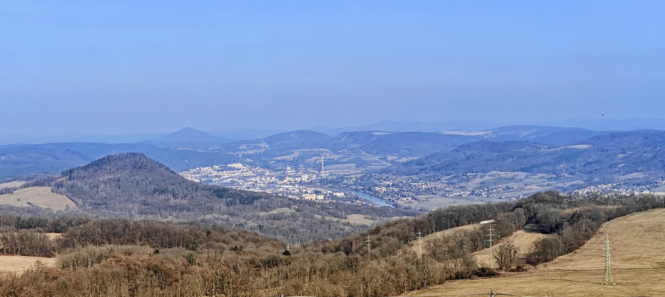
Some days are built around one mountain. This one was built around rhythm. On 7 March 2026, I linked eight short peaks around Ústí nad Labem and the Elbe valley, starting on the broad plateau of Děčínský Sněžník and finishing in the evening quiet of Vaňovský vrch. None of the individual walks was especially long, but together they made a full and surprisingly varied day: a table mountain, a broad wooded traverse, a quiet cairned top, an open grassy viewpoint hill, a compact forest summit with a trig point, a small summit puzzle under power lines, an urban-edge P100, and one last prominent hill above the river.
Using the route figures from the individual reports, the day came to about 20 km of walking in total, with roughly 900 to 1,000 metres of ascent depending on how generously one chooses to interpret a few noisy GPX elevation traces. In practice, this was not a hard day so much as an efficient one. The terrain stayed straightforward throughout, the driving links were short enough to keep momentum, and the sequence worked well because the hills kept changing character before any one style could become repetitive.
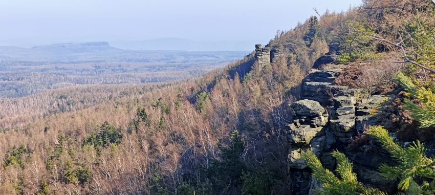
Děčínský Sněžník was the natural opener: short, easy to navigate, and still distinctive enough to feel like a proper mountain rather than a warm-up stroll. Starting from the large paid parking area on the west side, the route climbed easily before improving on the upper mountain, where boulders, sparse trees, moss, and open ground gave the plateau more character. The true summit made more sense on the rock outcrop by the cliff edge than at the less convincing mapped point in the forest, and the nearby historic tower helped the whole outing feel fuller than a simple up-and-down.
As the first peak of the day, it did exactly what I wanted. It delivered a real summit, a recognisable landscape, and a little regional context without wasting time or energy early in the outing.
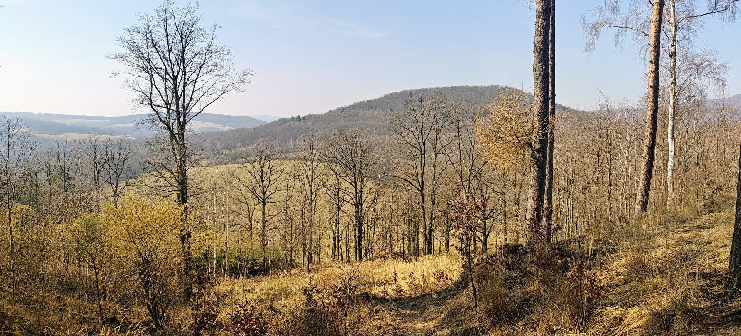
Chmelník was where the day began to feel like a proper hill crossing rather than a series of quick summit errands. From the east-side start, the route climbed through dry woodland onto a broad upper ridge where several bumps competed for attention and the exact high point needed a little judgment rather than blind faith in GPS. The hill had more character than its modest numbers suggest: a summit grave, a picnic scene, carved markers, open clearings, and partial views into the valley below.
What stayed with me most was not one dramatic summit feature but the overall texture of the walk. Chmelník was short, practical, and surprisingly likeable, with enough route character and summit ambiguity to make it memorable on its own.
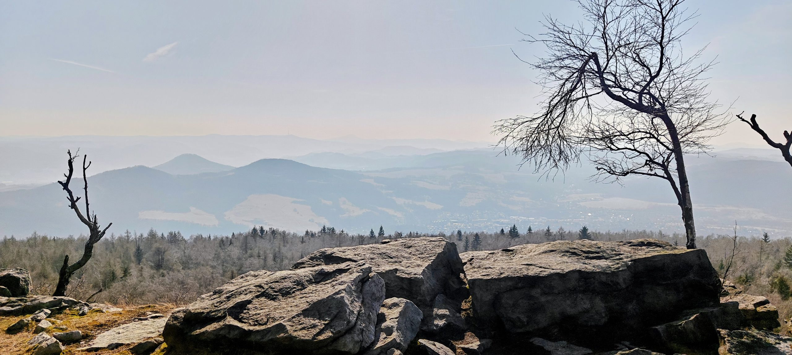
From the Chmelník saddle, Lotarův vrch made a very natural continuation. The approach crossed open meadow before entering quiet deciduous woodland, and the summit itself was easy to recognise thanks to its large stone cairn. The top was forested and not especially scenic, but the approach and descent gave wider views across the surrounding ridges, meadows, and the busier world below.
This was one of the quieter hills of the day, and that suited it well. It did not need drama. A clear summit, a pleasant approach, and a clean link from the previous peak were more than enough.
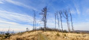
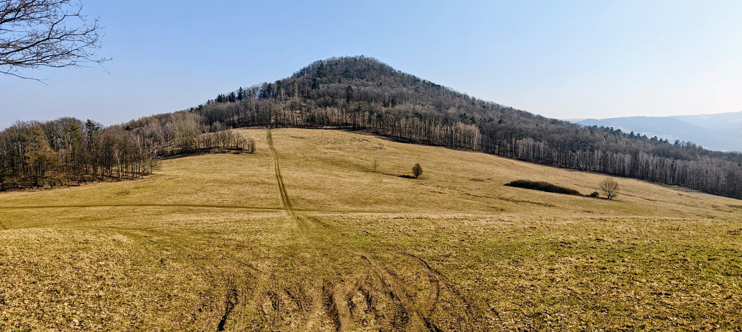
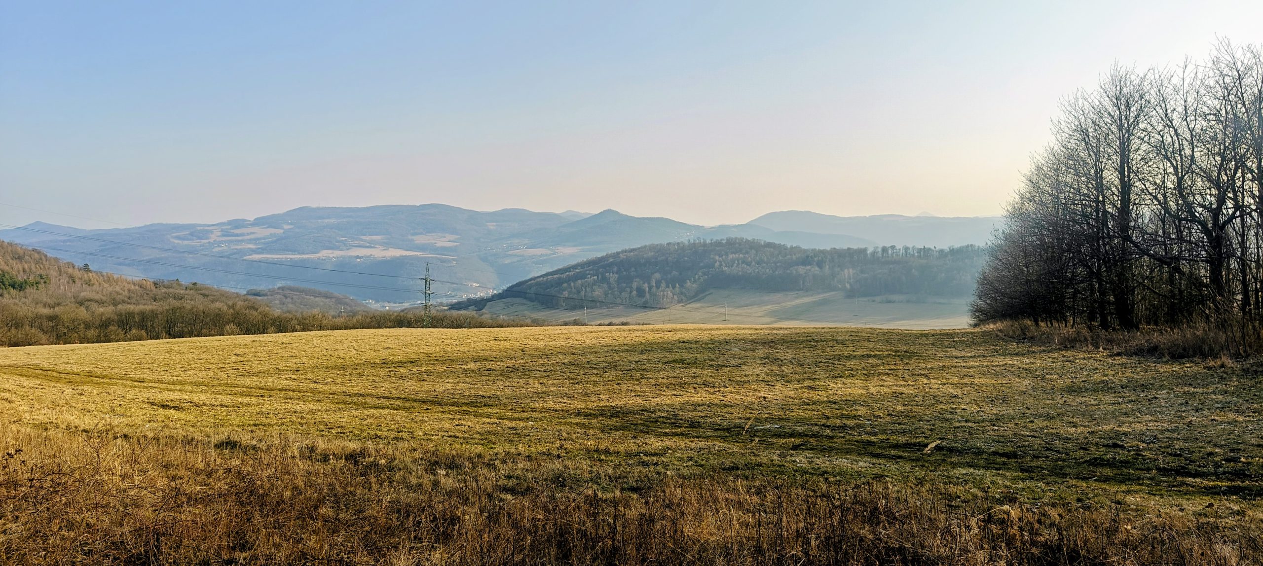
Javorský vrch changed the mood again by getting out of the forest and into open ground. From the roadside start west of Javory, the route went directly across the meadow to the broad summit pasture, with views opening almost immediately and continuing nearly the whole way. The summit itself was only mildly ambiguous, marked by low stones and scrub rather than anything formal, and the open position gave it a much wider feel than many enclosed hills of similar height.
It was also one of the most memorable stops of the day for a more absurd reason: an unexpected summit picnic and grill on such a modest hill. That made the place oddly charming and far more memorable than its statistics would predict.
Vysoký kámen was one of the most efficient climbs of the day. A small forest turnout gave easy access, and from there the walk was a very short out-and-back on a forest road and simple woodland path. The summit itself was fully wooded, but a small concrete trig point and a rocky crest gave it enough identity to stop it from feeling anonymous.
This was not one of the dramatic peaks, but it was an excellent practical stop: short, clear, and just distinctive enough to justify the detour.
Radešín was another short and efficient climb, but one with a mild summit puzzle that made it more interesting than the raw numbers suggest. The route followed a straight old access road uphill, but the summit area itself needed a little care: the obvious mound under the power line looked artificial, while the true top was better represented by the small concrete trig point tucked a few metres away in the woods.
There were no grand summit views here, but the route still had a sense of place, with worked countryside, bits of forest, and late-afternoon light doing more for the hill than the summit itself.
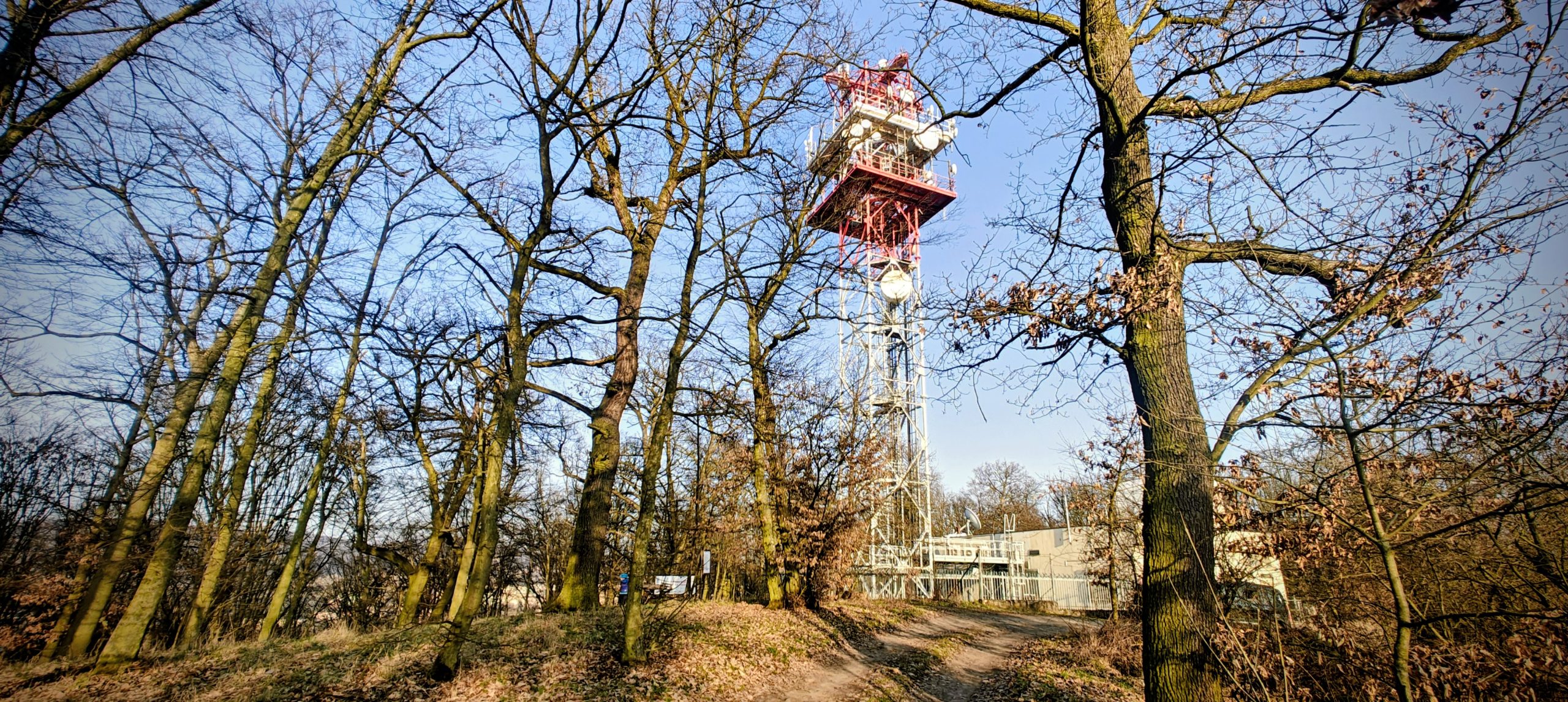
Střížovický vrch was one of the stranger little hills of the day, mainly because the named summit and the peakbagging high point were not quite the same thing. From the west-side parking by the no-entry sign, the route followed an easy paved service road to the antenna area, then continued a little farther east to the broader crest that made more sense as the actual high point. The walking was simple, but the summit identity was just messy enough to keep the visit interesting.
The setting was unusually urban for the day, with local walkers, runners, dog owners, mountain bikers, and infrastructure all sharing the ridge. It was not scenic in the usual summit sense, but it worked very well as a quick, practical P100 stop.

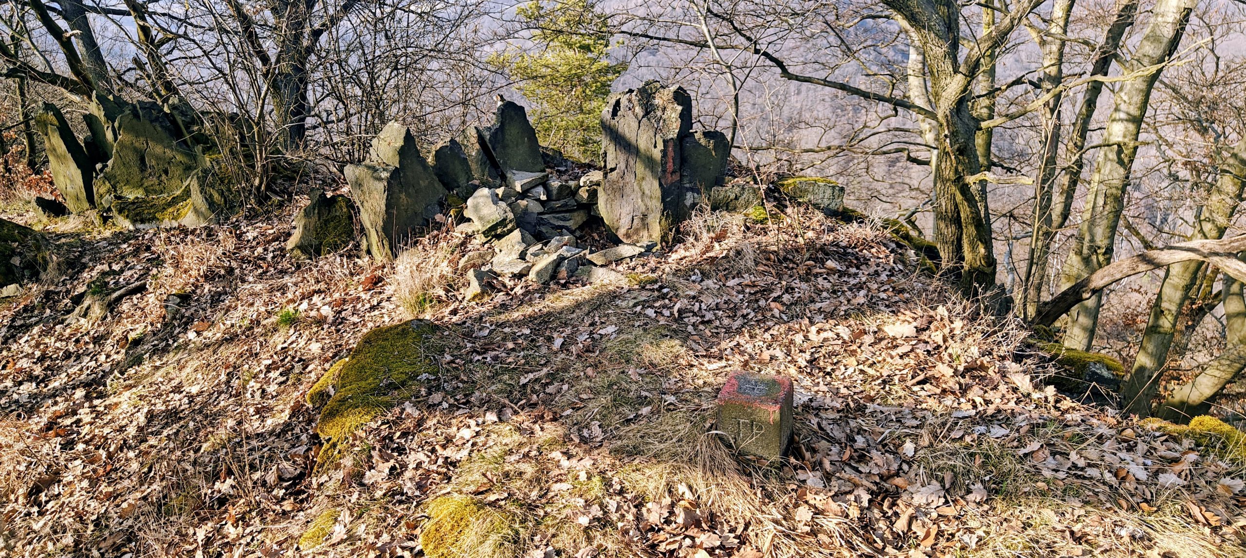
Vaňovský vrch was the last summit of the day and a fitting one. From the west-side forest road above Podlešín, the walk climbed quickly through quiet woodland to a broad, understated summit marked by a modest cairn and a nearby concrete block. The top was not especially scenic, but the hill mattered because of its prominence and position above the Elbe, and it made sense as a short, worthwhile final climb before the drive back.
After a full day of short hills, that calm evening finish worked perfectly. There was no summit theatre, no crowd, and no need for one.
| Peak | Altitude | Prominence ↓ | Isolation | Distance | Elevation Gain | Time |
| Bohemian Ranges | 20.8 km | 974 m | 5h21 | |||
| Vaňovský vrch | 561 m | 235 m | 2.9 km | 1.8 km | 174 m | 0h32 |
| Javorský vrch, | 617 m | 217 m | 6.7 km | 1.6 km | 123 m | 0h32 |
| Chmelník | 508 m | 134 m | 1.5 km | 3.1 km | 221 m | 1h00 |
| Vysoký kámen | 494 m | 132 m | 4.9 km | 1.2 km | 119 m | 0h22 |
| Lotarův vrch | 509 m | 125 m | 3.6 km | 4.0 km | 101 m | 0h55 |
| Děčínský Sněžník | 724 m | 122 m | 23.5 km | 4.5 km | 137 m | 0h59 |
| Střížovický vrch | 346 m | 108 m | 4.6 km | 3.1 km | 29 m | 0h39 |
| Radešín | 550 m | 106 m | 5.5 km | 1.4 km | 70 m | 0h22 |
| 20.8 km hiked and 974 m elevation gained in 5h21 | ||||||
As a single outing, this day was less about one overwhelming summit than about accumulation. Some peaks were scenic, some were practical, some offered little summit puzzles, and some were mainly useful prominence ticks, but together they made a route that stayed varied from start to finish. Around Ústí nad Labem, the hills are close enough together that a day like this can move quickly, yet different enough in terrain and atmosphere that it never collapses into repetition.
That was the real success of the outing. Not one spectacular mountain, but eight distinct short climbs that fitted together into a full and satisfying day.