Skip to content
Menu
p600.org
  • home
  • map
  • trips
  • about
p600.org

Aghouri

hike | 2022-09-01

Our main objective today is the Irhil M’Goun ultra summit. But this is a long hike, and we will be staying overnight in the refuge de Tarkeddite. Before arriving at the refuge, Said and I will take a 2-hour detour to climb bonus p600 peak Aghouri. 

In front of the village, there is a large lot (31.61133, -6.48931). We leave the car there, and early in the morning, we walk five kilometres on a wide path next to the river for about an hour until it gets light. A few backpacks are carried by mules, but in my subjective opinion, mules are more needed to support the local economy than to create great benefits for us. Especially since, while slightly more expensive, the hut provides water and other beverages. On Mount Toubkal, John had blisters, so on this hike on less steep paths, he rides on a mule.

Surrounding mountains

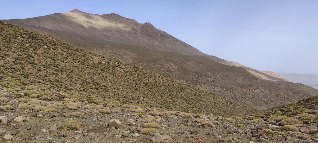
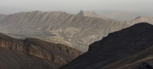
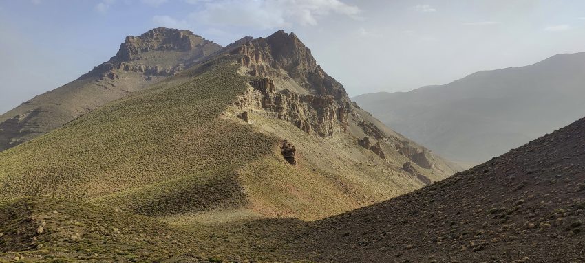
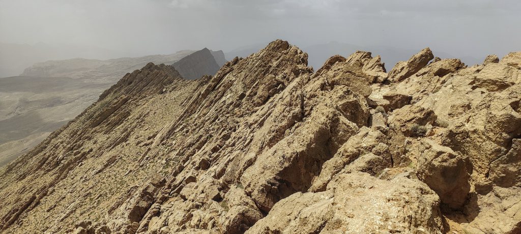
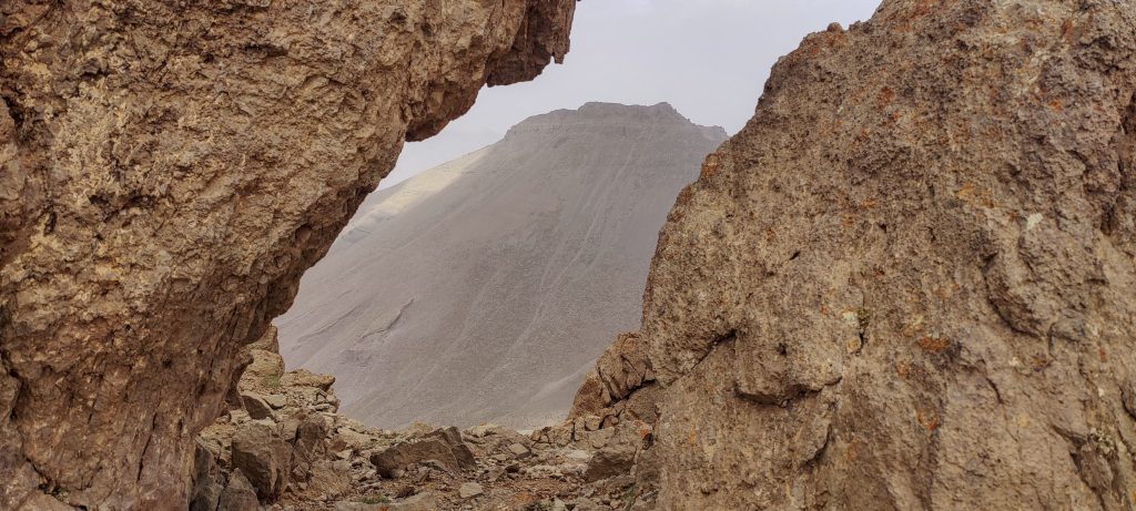
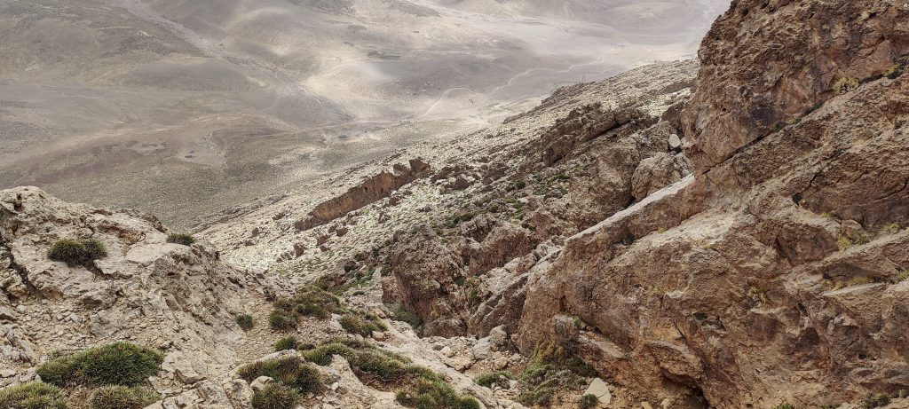
We reach an old settlement, turn in the SW direction, and climb the ridge towards the pass on a narrower path. We will have to climb this ridge and then descend several hundred vertical metres to the valley where the refuge is located. I check the map near the pass. Waw.. About two kilometres away, in the SSW direction, there is an unreported peak, Aghouri 3565m P624.

Climbing to Aghouri ridge
Looking back

Since it’s not even noon yet, I’m pretty sure what I’m going to do next. But the guide has a completely different opinion. Said is a very good and professional guide, and I think he is doing the right thing by not letting me deviate from the plan, but the thought of sitting in the refuge for the next nine hours and doing nothing is killing me. Beautiful weather with no wind or clouds. I offered to go to the refuge, and then his responsibility as a guide would be over. My free time begins… However, Said decided to accompany me along the top of the ridge to the summit of Aghouri. Thanks, rational, and a friendly solution John on a mule, with muleteers moving closer to the shelter, and Said and I climbing Aghouri. 

Views from the ridge
A few exposed steps on the way to the summit

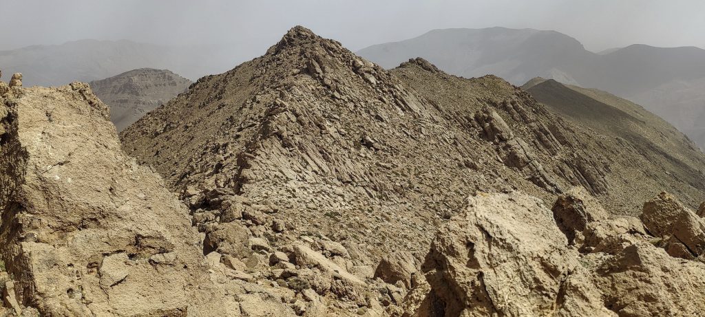
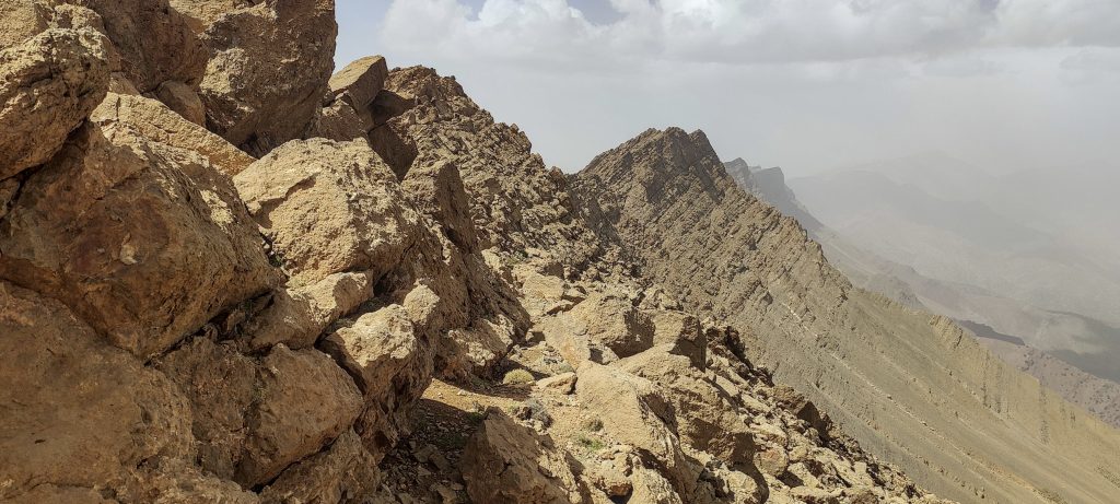
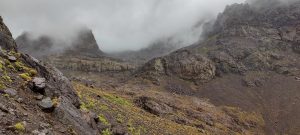
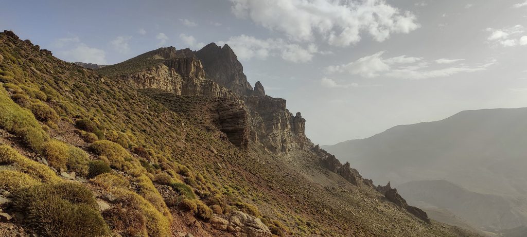
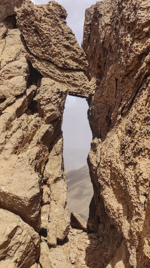
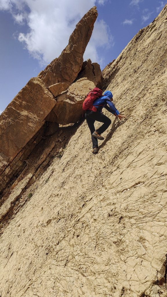
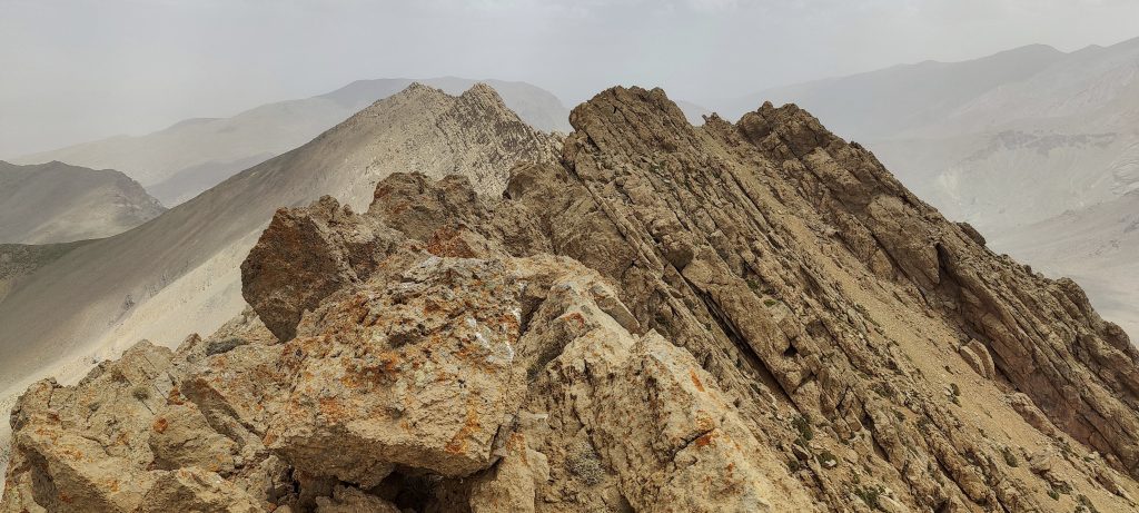
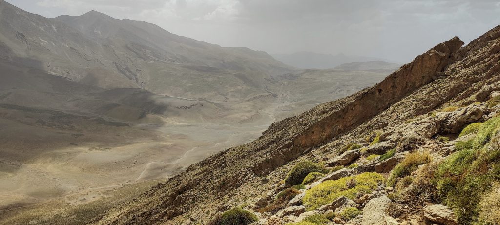
An easy ridge walk at the beginning. Half a kilometre before the destination, any kind of trail disappears, and we scramble up. Easy and technically simple; however, several steps are quite exposed, and a mistake would be costly. Perhaps going a little lower, on the S side of the ridge, would avoid the exposed steps. First we climb to a false peak, just to see that the highpoint is 120 metres away.

At least a few window-like formations are on the way
Ridge, close to the summit
Looking down to the valley where the Refuge de Tarkeddite is located
One more window
Said is climbing an exposed section
I’m going through a “window.”
Said is climbing a steep, exposed wall
Another large window, this time with Said behind it

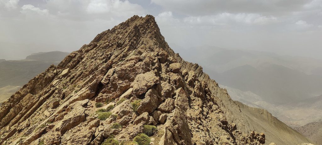
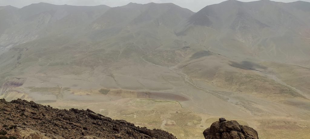
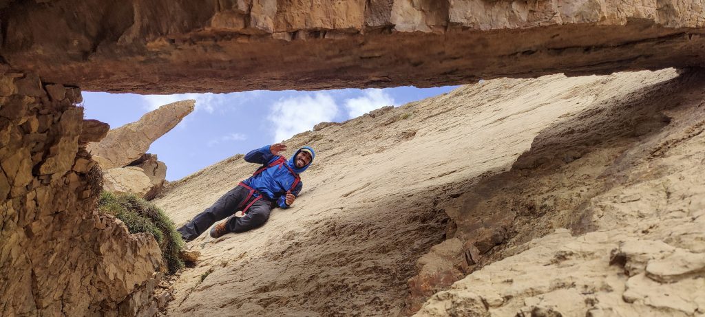
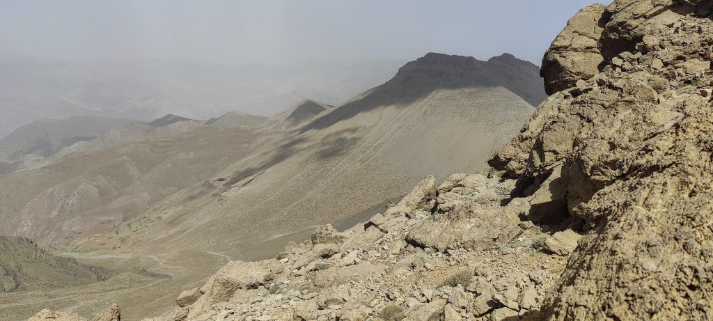
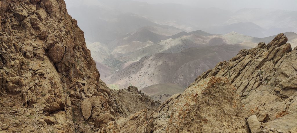
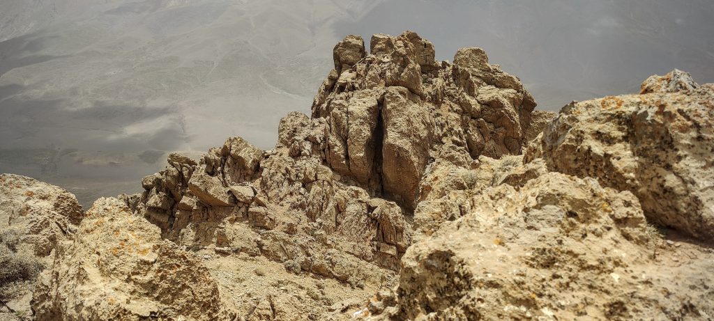
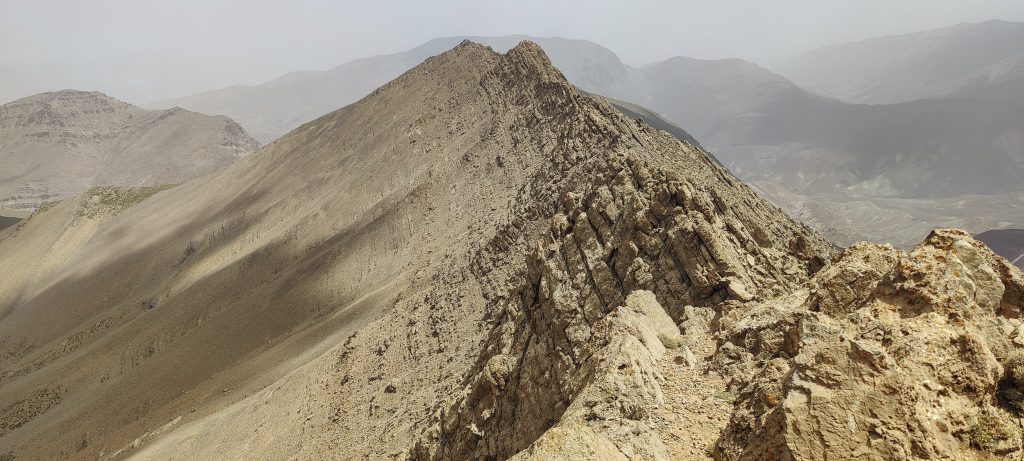
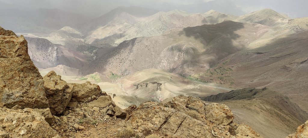
A few minutes later, I see a smiling Said sitting next to the highest rock on the summit. The top is a steep rock, not marked in any way, but with great views all around. The valley we came from, the valley we’re going to, and Irhil M’Goun

The ridge and true summit are in front
Views close to the summit
Sharp ridge
A view from the summit

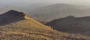
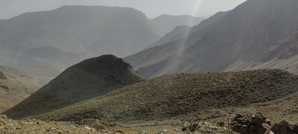
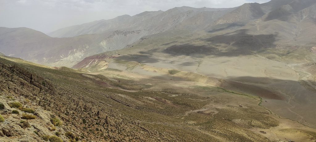
On the descent, we go straight down the slope to the refuge and do not return to the pass. Said has walked this way many times. steep gravel slopes with a few animal tracks.

View down to the valley
On our descent, we went straight to the refuge

In the refuge, as expected, we find John. Detouring to the bonus peak took a couple of hours. Only 2 p.m. is a long time before nightfall. I’m thinking about another P200-P300 peak nearby. But I no longer pronounce these minds to Said ;). A little rest won’t hurt. A couple hundred metres north of the refuge there is a “social point” with a weak internet signal. I can hear Berber music and dances emerging in the camp near our refuge. We have tea, lunch, and dinner and agree to move on at 2 a.m., towards Irhil M’Goun. Great day and another great unplanted P600 peak; at the time of the climb, no one reported it. 

Euphorbia nicaeensis ??

Aghouri3565 m altitude
624 m prominence
4.40 km isolation
RangesAtlas Mountains - High Atlas
Countries/regionsMorocco - Béni Mellal-Khénifra
Distance14.70 km up3.00 km down
Elevation1639 m gain615 m loss
Time
7h10 up
0h05 other
2h00 down
9h15 total
Trailhead1925 m altitude31.6113333, -6.4893056
Route<p style="color: #252525;">We started in the northeast at Arrouss village. walking a wide farmers' trail for an hour. Then a gradual trail through pastures leads to the southwest. Then follow the well-visible trail to the pass on the ridge. Just before the pass, we hike a couple kilometres off trail on the ridge, in a SW direction, towards the summit. The last half-kilometer is scrambling at various levels, with a few exposed steps. On the way down, we take a less exposed off-trail path directly to the hut in the southeast.</p>
Difficulties<p style="color: #252525;">Exposed scrambling near the summit can likely be avoided if the ridge is walked a little lower</p>
LinksGPX trail
  • Atlas Mountains 2022
  • « Jebel Toubkal
  • Irhil M'Goun »

Mountain Ranges

Anatolia
Central Anatolia
Pontic Mountains
Southeast Anatolia
Taurus Mountains
Western Anatolia
Andes
Puna de Atacama
Atlas Mountains
High Atlas
Northwestern Atlas
Central America Ranges
Costa Rica-Panama Ranges
Central Central America
East China
Taiwan
Eastern Europe Ranges
Southeast Baltic Plains
Iberian Peninsula
Cordillera Cantabrica
Castile Ranges
Portugal-Galicia
Pyrenees
Intermountain West
Great Basin Ranges
Korea-Amur Area
Taebaek Sanmae
Malay Archipelago
Java
Nusa Tengarra
Sulawesi
Sumatra
Mid-Atlantic Islands
North Atlantic Islands
Mongolia Ranges
Altai
Gobi Desert Ranges
Hangay Mountains
Northwest Europe
Great Britain
North France-West Rhine Area
Pacific Ranges
Cascade Range
Northwest U.S. Coast Ranges
Sierra Nevada
Central and Southern California Ranges
Philippines
Central Philippines
Luzon
Mindanao
Southeast Asia
Malay Peninsula
Southeast South America
Pampas
Sierras de Cordoba
Southern Africa
Malawi Highlands
West Africa Mountains
Bight of Benin
Cameroon Mountains
Guinea Highlands

Countries / regions

Algeria
Ain Guezzam
Ain Salah
Aïn Témouchent
El Bayadh
Ghardaïa
Oran
Ouargla
Saïda
Sidi Bel Abbès
Tamanrasset
Argentina
Catamarca
Ciudad Autónoma de Buenos Aires
Córdoba
Jujuy
Salta
Tucumán
Belgium
Brussels Capital Region
Flemish Region
Cameroon
Southwest
China
Taiwan
Costa Rica
Alajuela
Cartago
Guanacaste
Heredia
Limón
San José
Czechia
Prague
Denmark
Greenland
France
Hauts-de-France
Occitania
Germany
Berlin
Niedersachsen
Indonesia
Bali
Jambi
Jawa Tengah
Jawa Timur
Nusa Tenggara Barat
Sulawesi Tengah
Sulawesi Utara
Sumatera Barat
Lithuania
Vilnius County
Mongolia
Bayankhongor
Govi-Altai
Khovd
Omnogovi
Ovorkhangai
Ulan Bator
Zavkhan
Morocco
Béni Mellal-Khénifra
Drâa-Tafilalet
Fez-Meknes
Marrakesh-Safi
Souss-Massa
Tangier-Tetouan-Al Hoceima
Mozambique
Zambezia
Netherlands
Gelderland
Noord-Holland
Zeeland
Nicaragua
Chinandega
Managua
Masaya
Rivas
Philippines
Bicol Region (V)
Cagayan Valley (II)
Calabarzon (IV-A)
Central Luzon (III)
Cordillera Administrative Region
Davao Region
Metro Manila
Soccsksargen (XII)
Western Visayas (VI)
Poland
Greater Poland Voivodeship
Masovian Voivodeship
Portugal
Castelo Branco
Leiria
Lisbon
Madeira
Santarém
Qatar
Ad-Dawhah
São Tomé and Príncipe
São Tomé Province
Sierra Leone
Northern Province
Western Area
Singapore
South Korea
Gyeongsangnam-do
Seoul
Spain
Aragón
Asturias
Castilla-La Mancha
Castilla y León
Catalonia
Islas Canarias
Switzerland
Zürich
Turkey
Antalya
Bitlis
Erzincan
Hakkâri
Igdir
Isparta
Kahraman Maras
Muğla
United Kingdom
England
Scotland
United States
California
Delaware
Florida
Maryland
Nevada
New Jersey
New York
Pennsylvania
South Carolina
Utah

TRIPS

2024
Southern Africa 2024
Mid-Atlantic Islands 2024
North America 2024
Anatolia 2024
Korea-Amur Area 2024
East China 2024
2023
Mongolia Ranges 2023
Philippines 2023
West Africa III 2023
West Africa II 2023
Iberian Peninsula 2023
West Africa 2023
Central America 2023
2022
Andes 2022
Northwest Europe 2022
Malay Archipelago III 2022
Malay Archipelago II 2022
Anatolia Mountains 2022
Iberian Peninsula 2022
Atlas Mountains 2022
North France-West Rhine Area 2022

archaeology (3) climb (157) food (2) hike (155) p30 (17) p50 (4) p100 (24) p300 (12) p600 (17) p1000 (11) p1500 (76) ribu (10) sight (46) summary (16) trig (44) ultra (76)

1 591 km walked, 121 298 m climbed

©2025 p600.org | WordPress Theme by Superbthemes.com