Skip to content
Menu
p600.org
  • home
  • map
  • trips
  • about
p600.org

Irhil M’Goun

hike | 2022-09-02

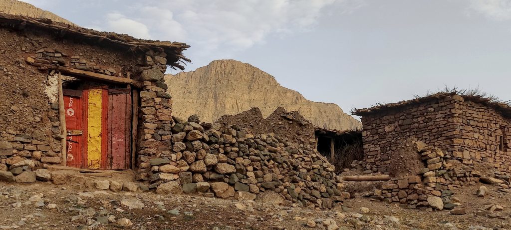
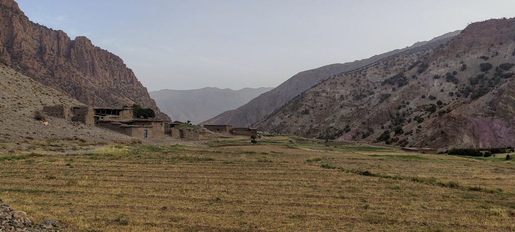
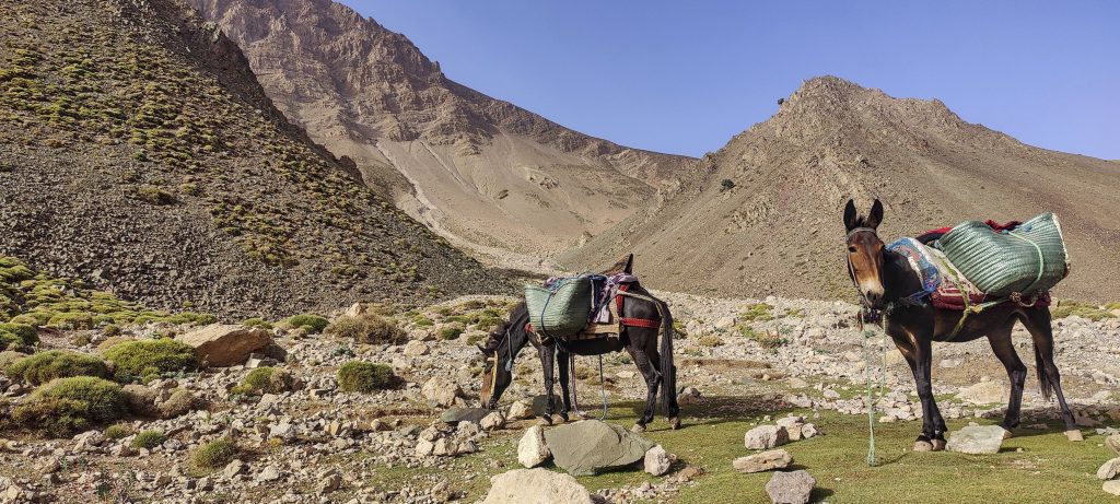
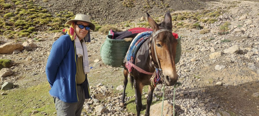
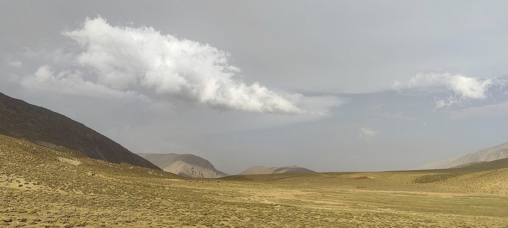
We start in Said’s home valley, in the village of Arousse. Said, his brother, and a helper with two mules, John and myself, all walk up a rough road next to a river. The road is rising gradually and passing through a few farms. The valley turns into a canyon, and at some point we turn onto a trail heading southwest.

  • Day 1. Begin at Arousse village at 1915m, then 1020m 16.5km 8h15 climb to Refuge Tarkddite at 2935m. This is including detour to Aghouri summit and a few hundred meter re-ascend. 
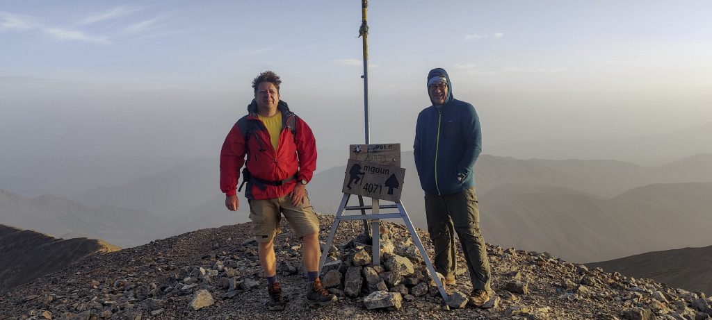
  • Day 2. Night 1136m 10.5 km 4h30 climb to summit at 4071m. Then 2156m 18,5km 7h00 descent to Arousse village
The first few kilometres of dirt road 
Passing several buildings
Mountain village
Valley
Livestock
A valley turns into a canyon
Ighil n-Ikkis 3207m

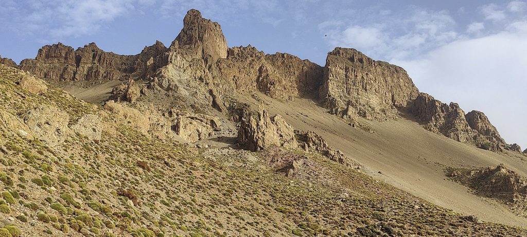
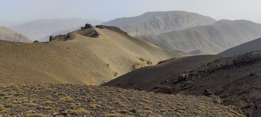
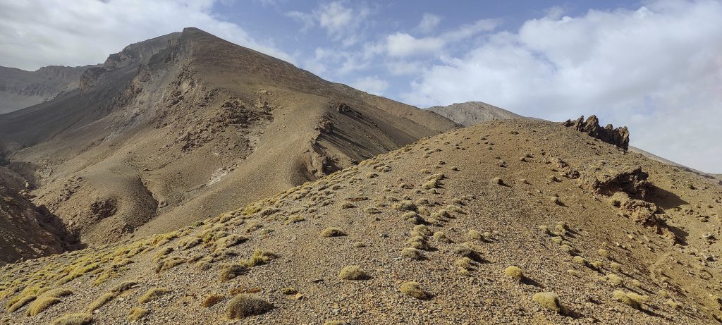
We soon reach the ridge of mount Aghouri. We have to cross it, which means going up and down a few hundred meters. Not far from the pass, I realise that I have enough time to visit the summit of Aghouri, which is a P600 and has no Peakbagger records so far. My motivation is high, so after a small discussion with Said, the two of us leave everyone to head towards the hut and climb towards the summit.

John (left) 😉
Said
John takes care of blisters on the feet
Neighbouring campsite a few hundred metres away
Somewhere on that side, the summit

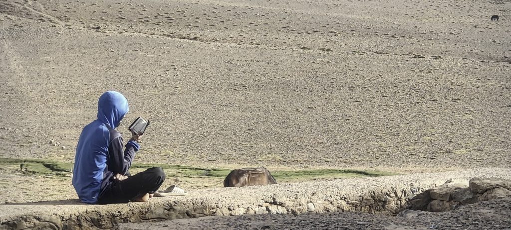
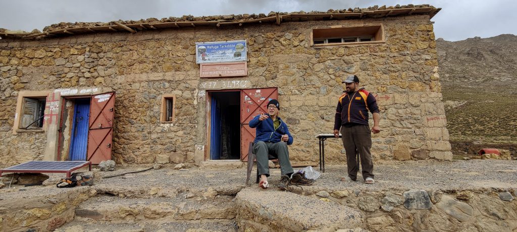
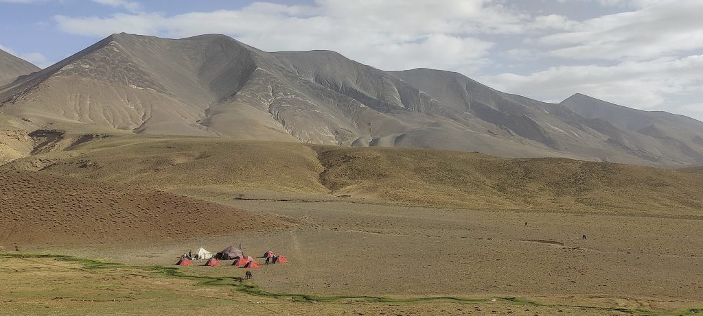
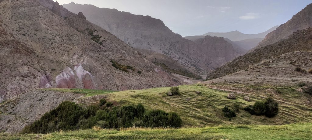
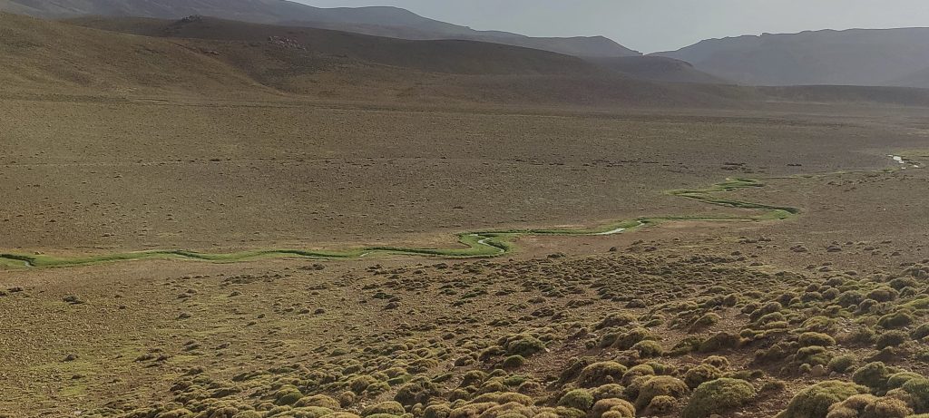
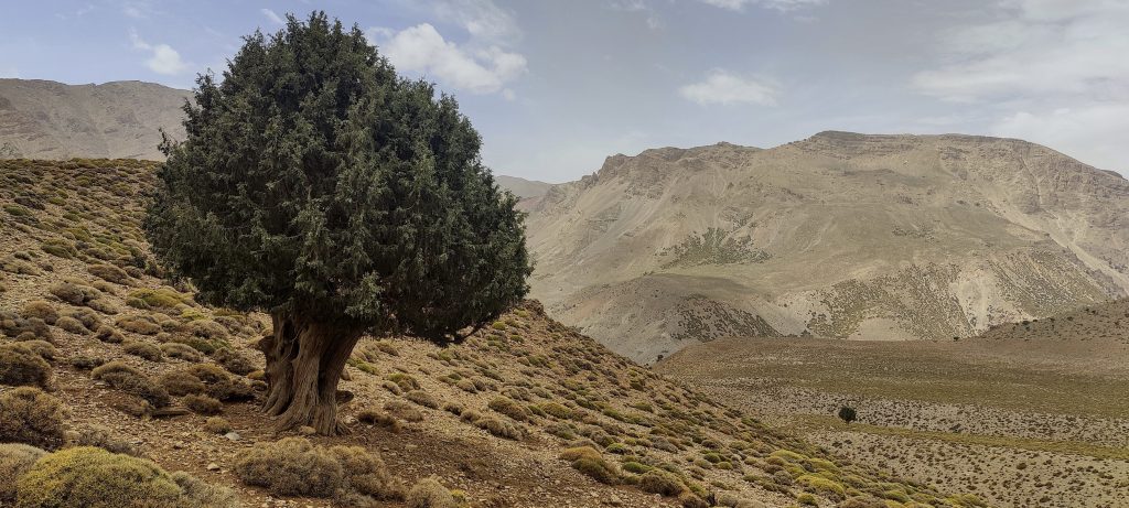
Said and I get to the hut around 3 o’clock, which is still plenty of time. The hut is situated in a beautiful valley, next to a stream, and surrounded by mountains. Near the hut, a camp with ten or more tents is set up. Berber music is playing, and people can be seen dancing. Although it’s a bit of entertainment, it’s not that boring, so I count it as rest time.

A stream runs through the valley
Oumassine 3890m
Locals appear out of nowhere and disappear again
We climb up on the ridge, and from here we can see the top
Sun rises

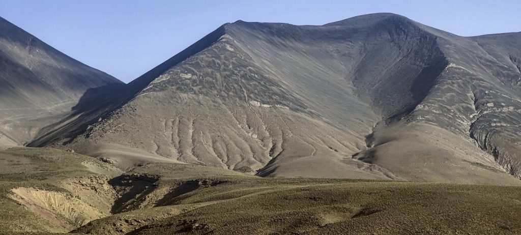
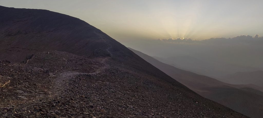
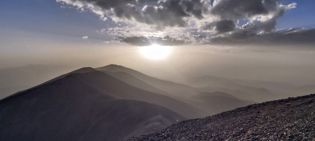
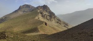
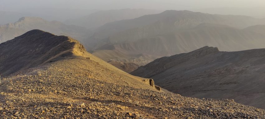
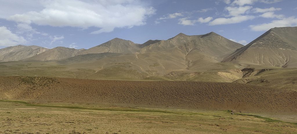
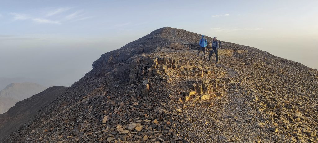
Due to John blisters on the feet, we are a bit worried that we will move slowly, so we get up early, around 2 a.m., cross a stream and a valley, and ascend gentle slopes. It’s not difficult; little by little, we approach the summit. We reach the ridge with the first rays of the sun, and the surrounding views are magnificent. The ridge is easy to follow; it is quite wide and flat. Soon we reach the summit, where there is a small marker.

Close to the summit
John (right) and me at the summit
Yesterday I climbed Aghouri

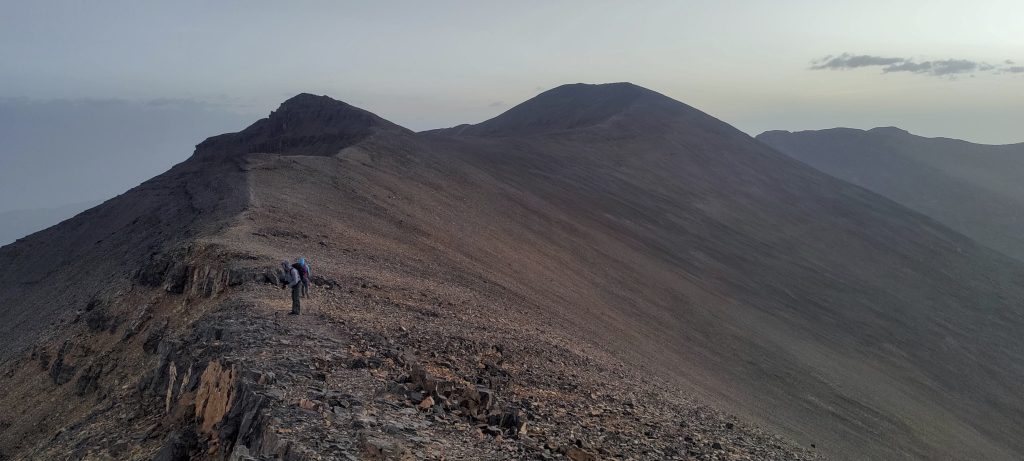
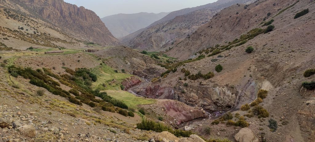
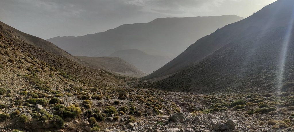
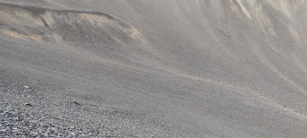
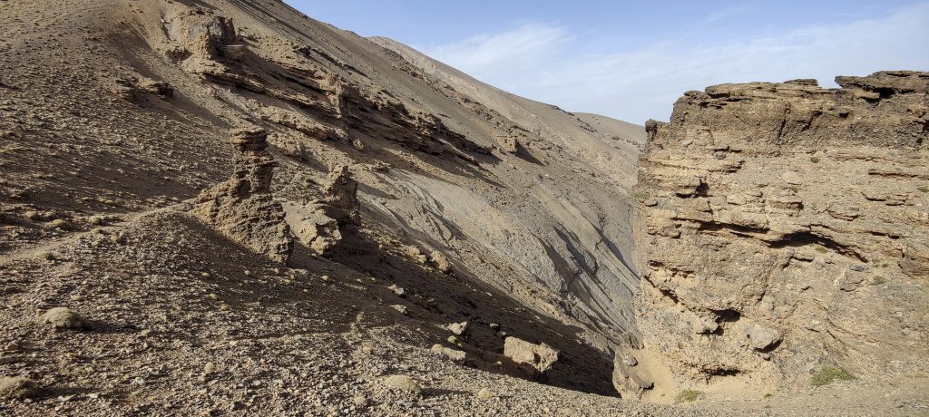
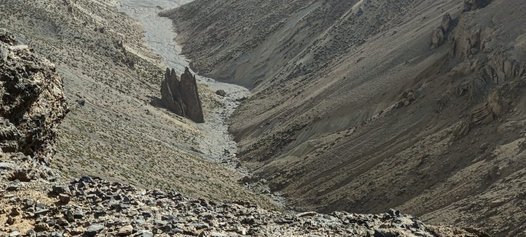
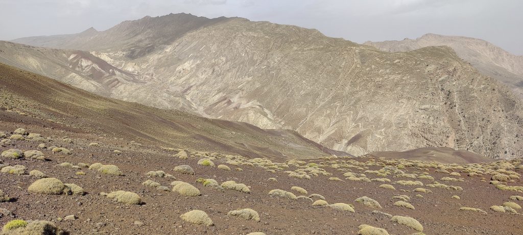
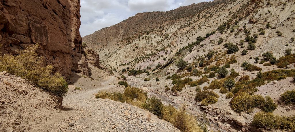
We rest, admire the surrounding views, and descend. For descent, we take the other, northern trail. It is a long way, about 22 kilometres, and we have to descend about 2200 metres, with a few hundred metres of ascent and descent along the way. At the beginning, there were a couple hundred metres of steep, rocky scree. It is slippery, with gravel rolling out from underfoot, but one can descend slowly. Later, the trail is less steep.

We descend the steep scree slope
A very large stone field surrounds us
We descend down this valley

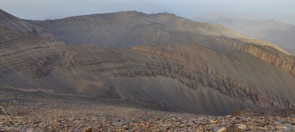
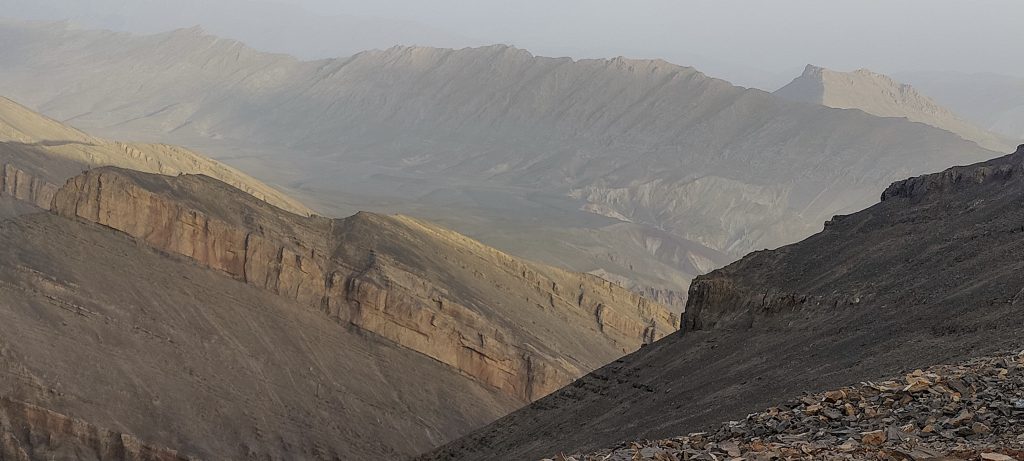
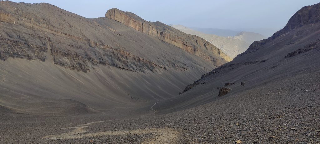
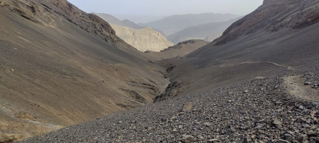
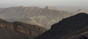
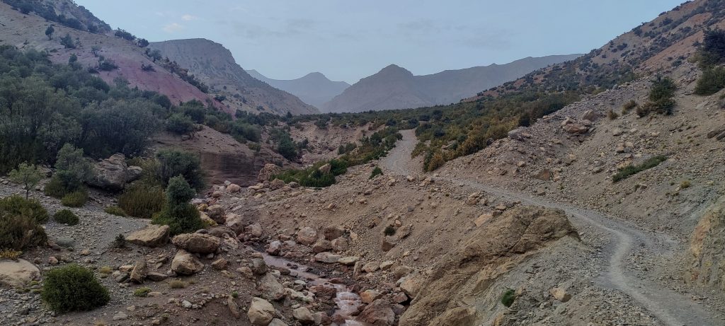
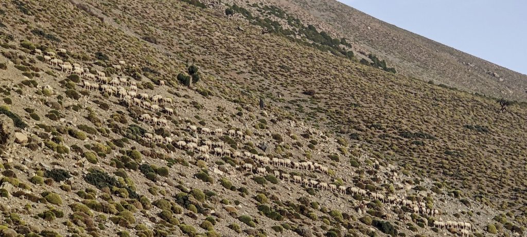
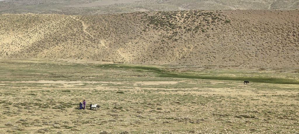
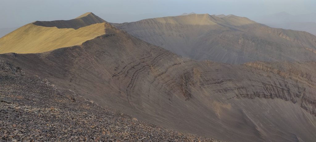
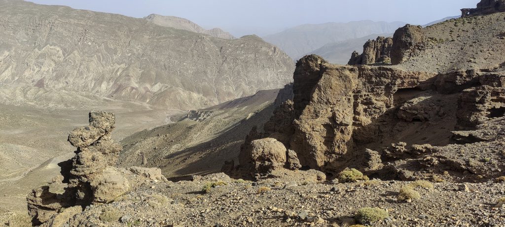
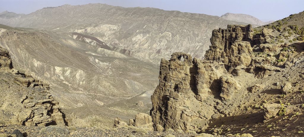
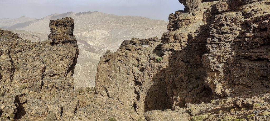
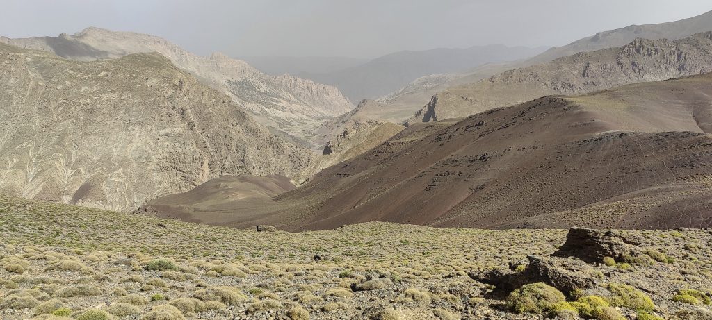
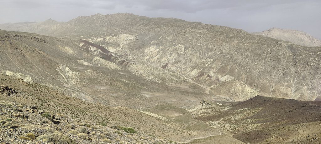
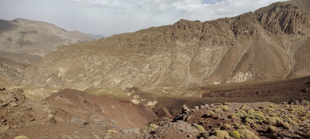
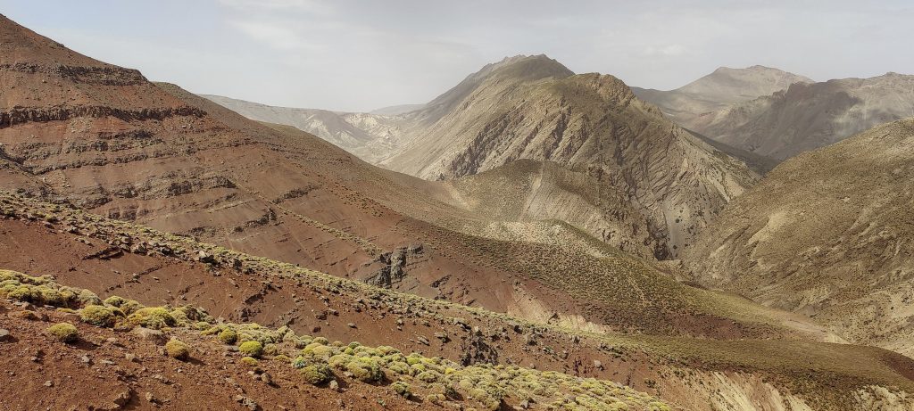
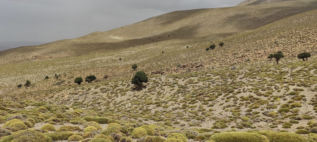
After crossing the canyon, we are back on a small ridge. The views around us are magnificent, with the valley where we spent the night, yesterday’s peak of Aghouri, and the spectacular rock formations surrounding us. The way down does not take long. In one of the saddles, the mules are waiting for us again, or rather, they are waiting for John. It’s very hot, and unlike at the summit, there is little wind here. Anyway, the trail is neither difficult nor steep. It’s just a matter of walking a dozen or so kilometres.

The way back is through this ridge
Looking back
Interesting rock formations on the way down
One of the valleys below
Local farms
Yesterday’s Aghouri summit
A couple of hundred metres up and then down to get over this ridge
Colourful views
Near the bottom, impressive old trees grow
Back on the road

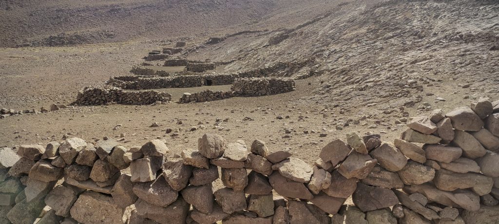
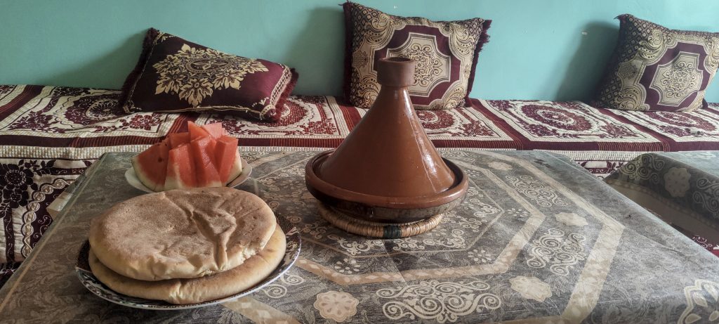
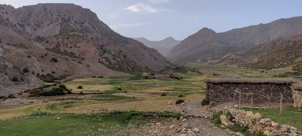
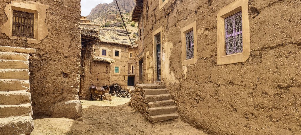
Around noon, we reach the first buildings and a dirty road at the bottom of the canyon. A few more kilometers, and we are at the car. Said calls us to his parents’ house. We don’t refuse; a cold shower is much needed. His mother has prepared for us a homemade Tajine Kefta (Moroccan meatball tagine). This is most delectable dish of the trip. Thank you!

Village of Aarrouss

After a successful day, we climbed the third of the five planned ultrapeaks. It’s subjective, but I think this hike was the most interesting and memorable of the trip. After a rest and a delicious meal at Said’s house, we drive a few hundred kilometres to the next ultra-peak, Adrar Bou Nasser.

The lunch prepared by Said’s mother was very, very tasty

+-
2 km
1 mi
'CyclOSM | Map data: ©, OpenStreetMap contributors'
Irhil M'Goun4071 m altitude
1904 m prominence
148.49 km isolation
RangesAtlas Mountains - High Atlas
Countries/regionsMorocco - Drâa-Tafilalet
Distance11.50 km up21.50 km down
Elevation1312 m gain2339 m loss
Time
3h30 up
0h10 other
9h10 down
12h50 total
Trailhead2949 m altitude31.5315556, -6.5157500
Route<p style="color: #252525;">We begin NW in a Refuge Tarkddite. A gentle path through grassy slopes, then stepper slopes, but always a clear path. We move E on the ridge, again, on a good-quality, safe surface. We descend W via steep scree from the summit, then follow the good trail N through a canyon, then through a ridge descending to a stream, then crossing and ascending another ridge. Then we walk in the NE direction on a reasonably good trail, and we are rejoining the wide farmer's path that we walked the day before.</p>
Difficulties<p style="color: #252525;">Steep scree W from the summit can be fun or painful, based on personal experience</p>
LinksGPX trail
  • Atlas Mountains 2022
  • « Aghouri
  • Adrar Bou Nasser »

Mountain Ranges

Anatolia
Central Anatolia
Pontic Mountains
Southeast Anatolia
Taurus Mountains
Western Anatolia
Andes
Puna de Atacama
Atlas Mountains
High Atlas
Northwestern Atlas
Central America Ranges
Costa Rica-Panama Ranges
Central Central America
East China
Taiwan
Eastern Europe Ranges
Southeast Baltic Plains
Iberian Peninsula
Cordillera Cantabrica
Castile Ranges
Portugal-Galicia
Pyrenees
Intermountain West
Great Basin Ranges
Korea-Amur Area
Taebaek Sanmae
Malay Archipelago
Java
Nusa Tengarra
Sulawesi
Sumatra
Mid-Atlantic Islands
North Atlantic Islands
Mongolia Ranges
Altai
Gobi Desert Ranges
Hangay Mountains
Northwest Europe
Great Britain
North France-West Rhine Area
Pacific Ranges
Cascade Range
Northwest U.S. Coast Ranges
Sierra Nevada
Central and Southern California Ranges
Philippines
Central Philippines
Luzon
Mindanao
Southeast Asia
Malay Peninsula
Southeast South America
Pampas
Sierras de Cordoba
Southern Africa
Malawi Highlands
West Africa Mountains
Bight of Benin
Cameroon Mountains
Guinea Highlands

Countries / regions

Algeria
Ain Guezzam
Ain Salah
Aïn Témouchent
El Bayadh
Ghardaïa
Oran
Ouargla
Saïda
Sidi Bel Abbès
Tamanrasset
Argentina
Catamarca
Ciudad Autónoma de Buenos Aires
Córdoba
Jujuy
Salta
Tucumán
Belgium
Brussels Capital Region
Flemish Region
Cameroon
Southwest
China
Taiwan
Costa Rica
Alajuela
Cartago
Guanacaste
Heredia
Limón
San José
Czechia
Prague
Denmark
Greenland
France
Hauts-de-France
Occitania
Germany
Berlin
Niedersachsen
Indonesia
Bali
Jambi
Jawa Tengah
Jawa Timur
Nusa Tenggara Barat
Sulawesi Tengah
Sulawesi Utara
Sumatera Barat
Lithuania
Vilnius County
Mongolia
Bayankhongor
Govi-Altai
Khovd
Omnogovi
Ovorkhangai
Ulan Bator
Zavkhan
Morocco
Béni Mellal-Khénifra
Drâa-Tafilalet
Fez-Meknes
Marrakesh-Safi
Souss-Massa
Tangier-Tetouan-Al Hoceima
Mozambique
Zambezia
Netherlands
Gelderland
Noord-Holland
Zeeland
Nicaragua
Chinandega
Managua
Masaya
Rivas
Philippines
Bicol Region (V)
Cagayan Valley (II)
Calabarzon (IV-A)
Central Luzon (III)
Cordillera Administrative Region
Davao Region
Metro Manila
Soccsksargen (XII)
Western Visayas (VI)
Poland
Greater Poland Voivodeship
Masovian Voivodeship
Portugal
Castelo Branco
Leiria
Lisbon
Madeira
Santarém
Qatar
Ad-Dawhah
São Tomé and Príncipe
São Tomé Province
Sierra Leone
Northern Province
Western Area
Singapore
South Korea
Gyeongsangnam-do
Seoul
Spain
Aragón
Asturias
Castilla-La Mancha
Castilla y León
Catalonia
Islas Canarias
Switzerland
Zürich
Turkey
Antalya
Bitlis
Erzincan
Hakkâri
Igdir
Isparta
Kahraman Maras
Muğla
United Kingdom
England
Scotland
United States
California
Delaware
Florida
Maryland
Nevada
New Jersey
New York
Pennsylvania
South Carolina
Utah

TRIPS

2024
Southern Africa 2024
Mid-Atlantic Islands 2024
North America 2024
Anatolia 2024
Korea-Amur Area 2024
East China 2024
2023
Mongolia Ranges 2023
Philippines 2023
West Africa III 2023
West Africa II 2023
Iberian Peninsula 2023
West Africa 2023
Central America 2023
2022
Andes 2022
Northwest Europe 2022
Malay Archipelago III 2022
Malay Archipelago II 2022
Anatolia Mountains 2022
Iberian Peninsula 2022
Atlas Mountains 2022
North France-West Rhine Area 2022

archaeology (3) climb (157) food (2) hike (155) p30 (17) p50 (4) p100 (24) p300 (12) p600 (17) p1000 (11) p1500 (76) ribu (10) sight (46) summary (16) trig (44) ultra (76)

1 591 km walked, 121 298 m climbed

©2025 p600.org | WordPress Theme by Superbthemes.com
Menu
p600.org
  • home
  • map
  • trips
  • about