Skip to content
Menu
p600.org
  • home
  • map
  • trips
  • about
p600.org

Gunung Marapi

hike | 2022-10-24

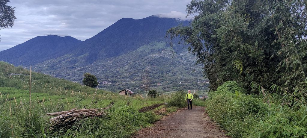
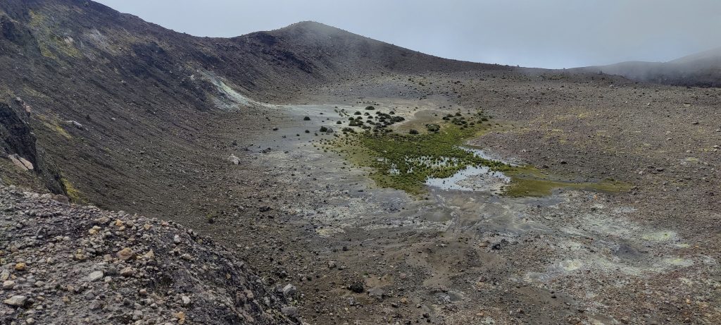
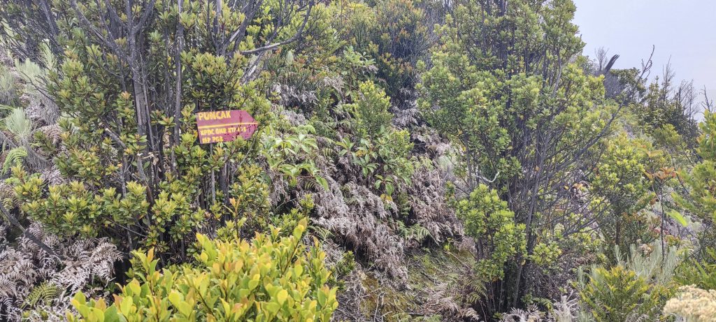
Today’s hike is intimidating because we don’t know for sure if we will reach the actual high point. We know that there are people who have been there, and we even have some ideas about where to look for the trailhead; we’ve also seen videos of people on the trail, but we haven’t found a single local person who would be willing to accompany us and show us the way. We have even considered buying our own machetes and making the trail. The point is that the vast majority of hikers climb to the top of Puncak Merpati and also take a look around the crater. The path to this place is well marked and not difficult. However, the real summit, Puncak Garuda, is another two kilometers away. and is completely covered with impenetrable jungle. We did, however, find the trail, albeit overgrown and slow-moving, and it was thanks to that trail that we were able to reach the true summit.

Rob and Singgalang in the background
Park entrance
There are few rare views on the trail

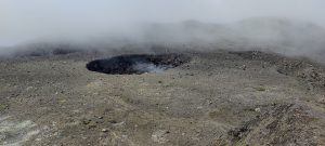
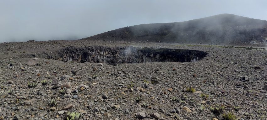
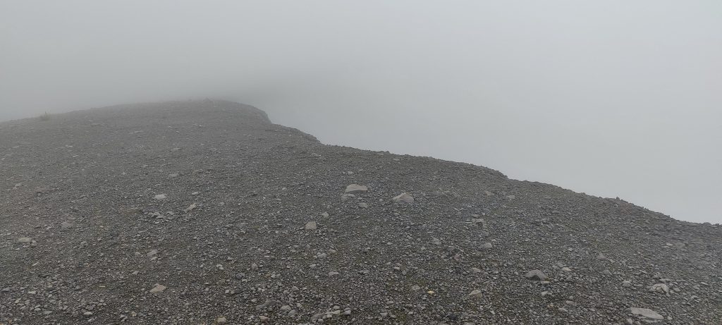
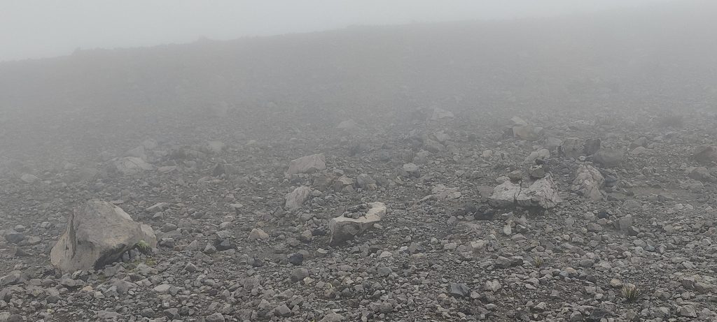
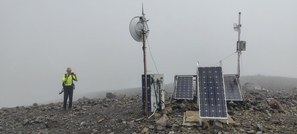
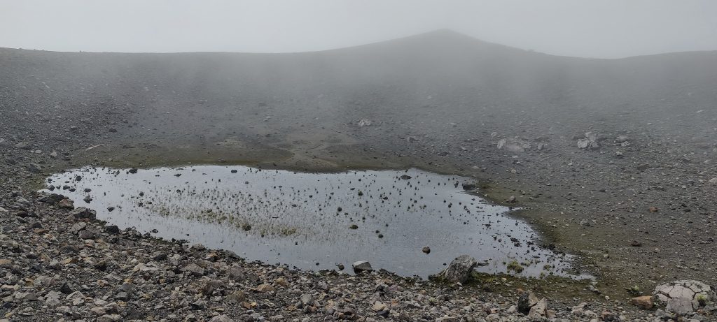
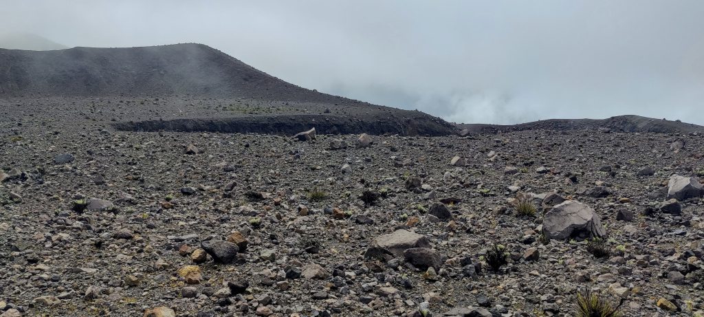
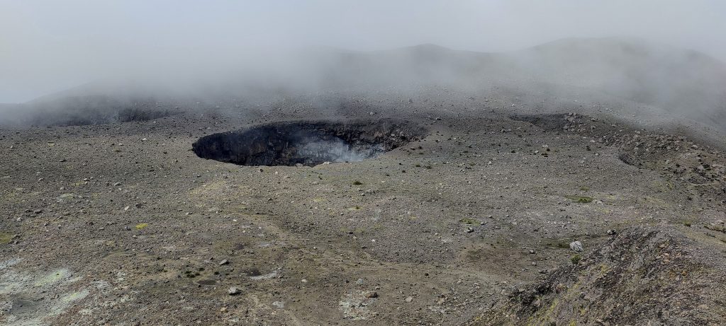
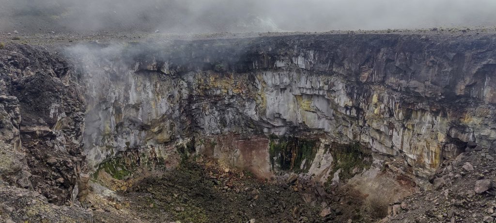
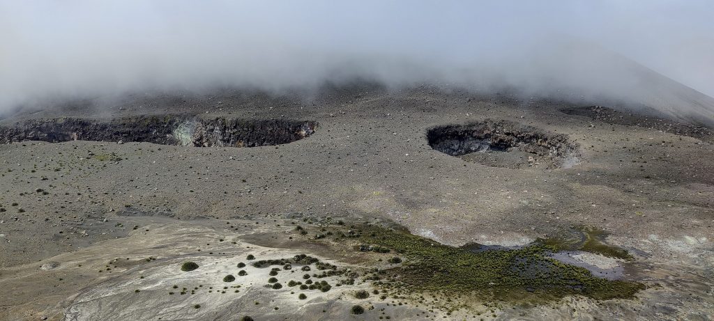
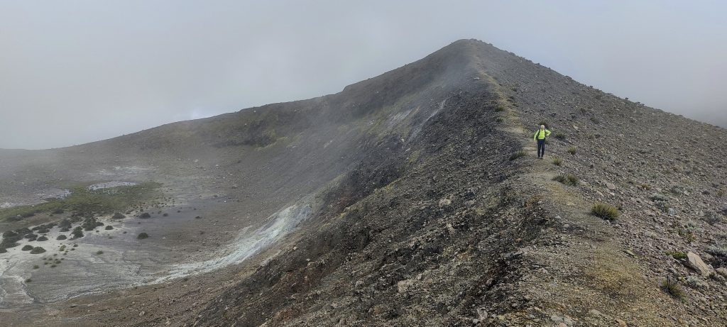
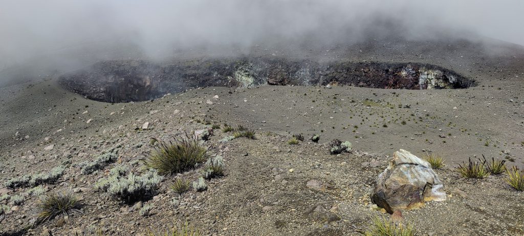
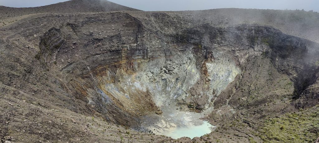
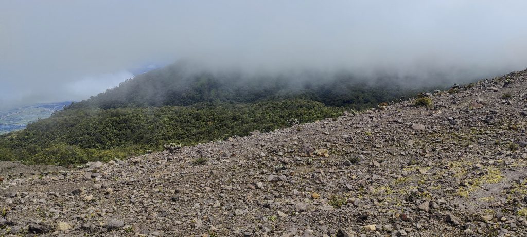
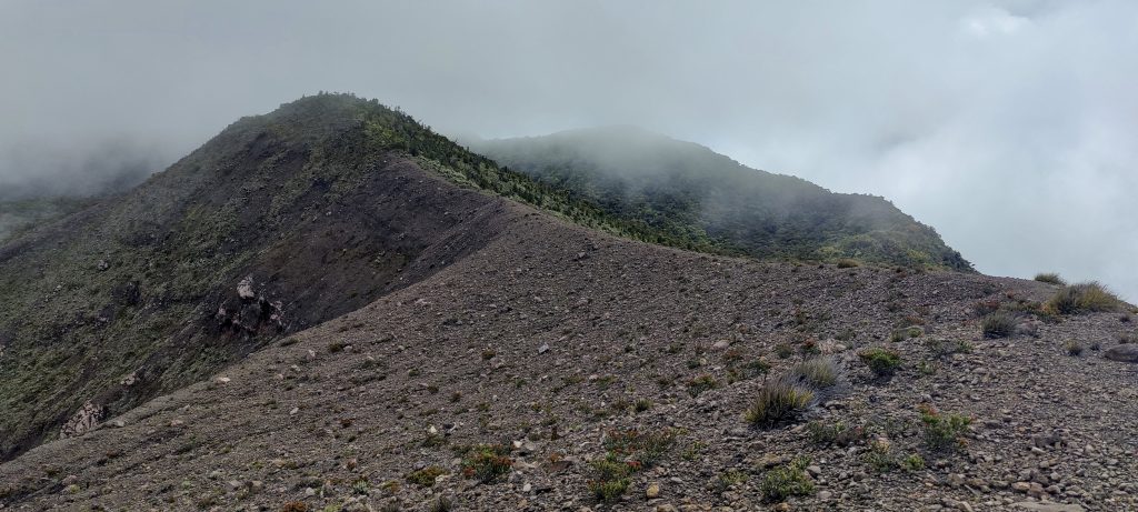
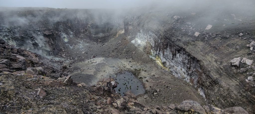
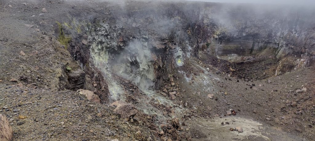
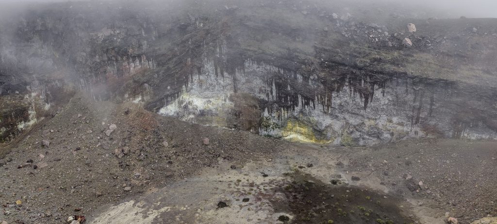
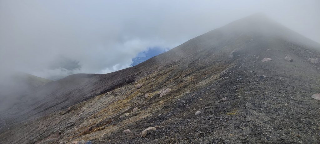
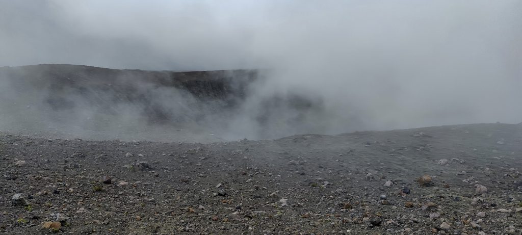
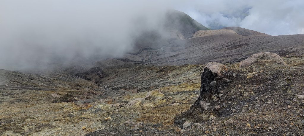
At the bottom, where there are many restaurants, some guy talking about registration asked us to pay something. We gave him 50 000 rupees (3 euros), and he stated that now there are no more obstacles to climb. There are well-marked paths to the crater ridge, and walking along the ridge is easy and quite clear. Although a glance at the satellite photos shows a complex system of 5–6 craters (maybe more). Even in the fog, it was interesting to explore the landscape and observe the smoke coming from the fumaroles.

A crater in the clouds
Assume this is a high camp site
Rob on the lower summit – Tugu Abel Tasman – 2891m
Wet due to the recent rains
Walking on rocky terrain is simple
Circle-shaped smoking crater
Inside of the crater
Land is gradually being reclaimed by vegetation
Natural bridge between the small crater and the gap
Interesting gap forming between two peaks
Rob on one of the smaller rims between craters
Crater holes on a quite flat surface
Looking down the slopes
Crater with an acidic lake

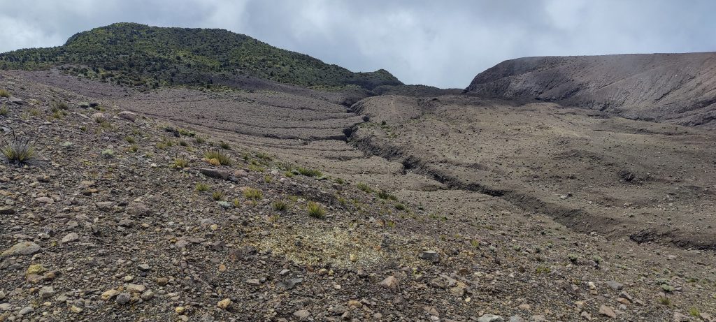
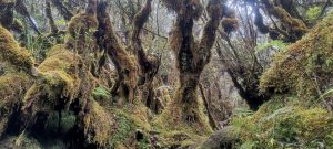
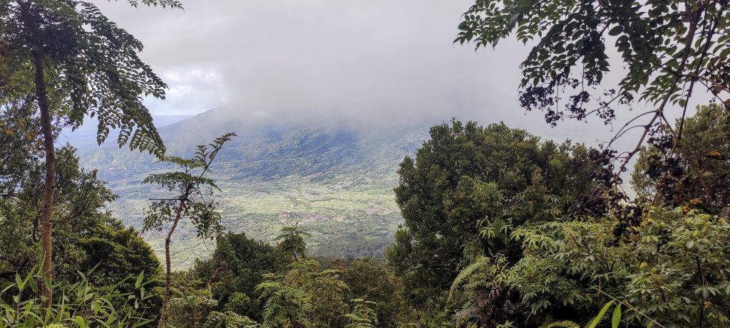
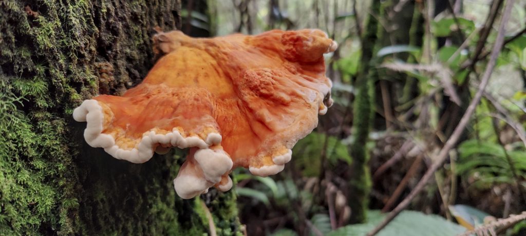
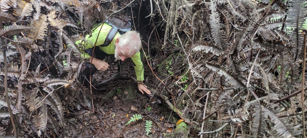
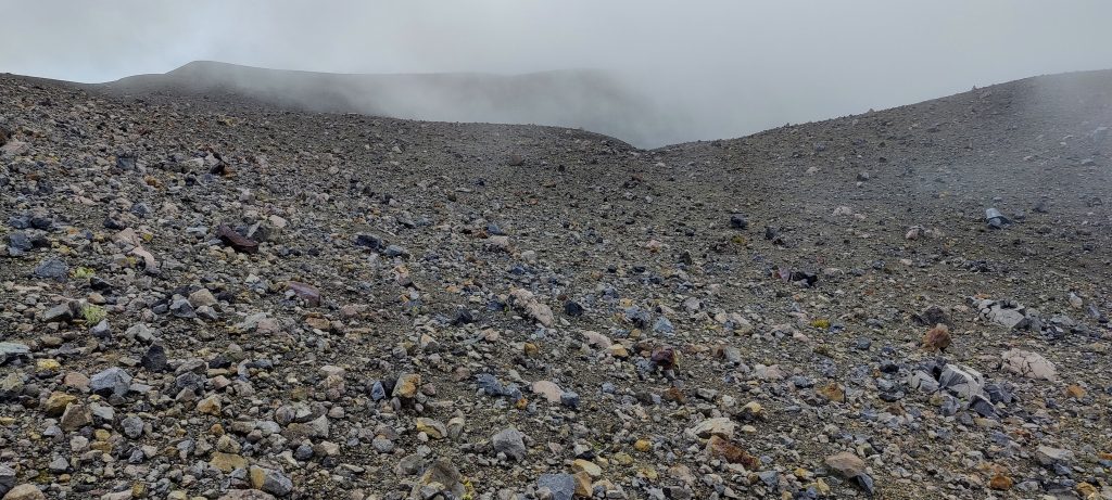
What was very important for today’s hike was that we found the arrow pointing to the trailhead quite quickly, almost on the first try. If we had tried to go without the trail, I think we would have given up after a few hundred meters at most. The trail is overgrown and not often walked, but it is still a trail. We often had to crawl on all fours, climb over logs, and move through dense bushes.

The rocky surface ends and the jungle begins
Puncak Garuda trailhead is close to the top of Puncak Terbakar
Marker pointing to the actual highpoint trail 
Blueberries
Fungus

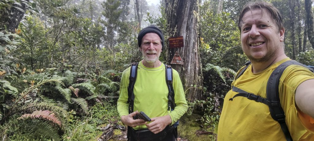
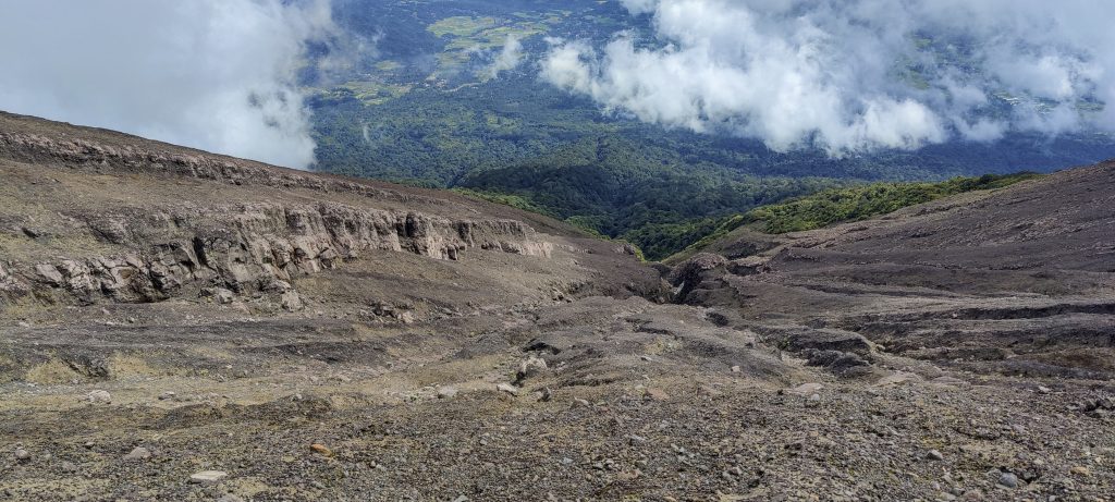
We took nearly two hours to get through the jungle… At first, we visited the possible highest point, but we realized that the actual highest point of the mountain is 100 meters to the southeast. At the top, there is a carved-out platform with a sign indicating that it is Puncak Garuda. Also, looking at the surrounding slopes, there doesn’t appear to be any higher ground. coincides with the contours of the topo lines on the map.

Many sections of the trail resemble this: 
Rob and me at Puncak Garuda
Glimpse inside one of the craters
Fumaroles
I’m guessing Rob is writing a PB trip report.
One more crater
Little wind
Easy terrain

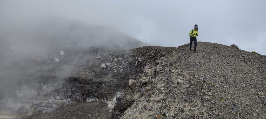
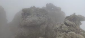
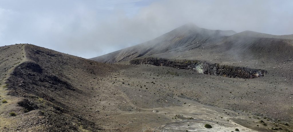
We returned to the rocky ridge of the crater a little faster. Apparently, we are gaining experience in bushwhacking. We walked around the crater from the opposite side as we had in the morning, stopped at Puncak Merpati, and were soon back on the marked trail back to the car. 

Puncak Merpati is the destination for most of the hikers.
Main crater
Looking down the slopes
Mini canyons are forming on the south slopes

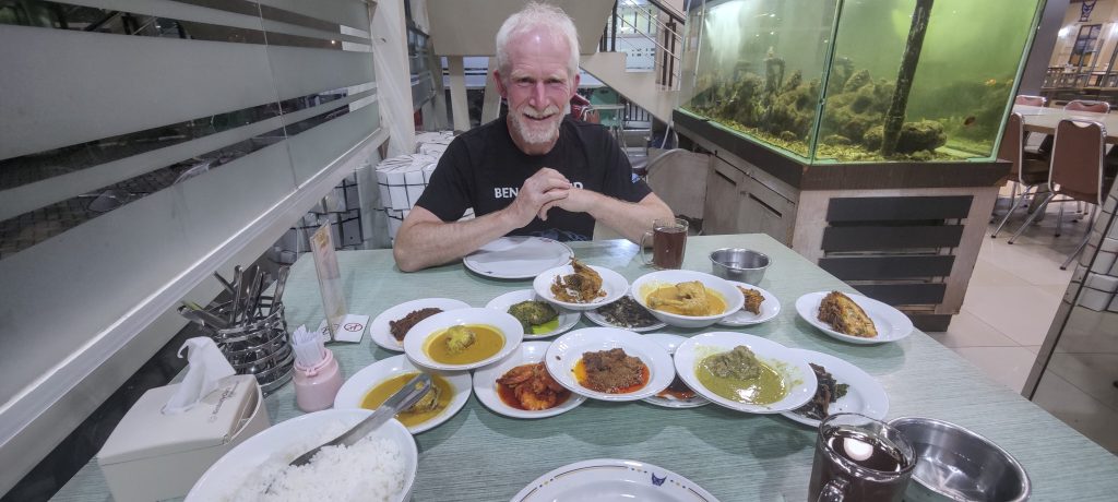
In my mind, this ultra-peak is a cool achievement. Because the true summit is difficult to reach, many hikers skip it. Secondly, we had a good time and saw a lot of interesting views of the craters. Tomorrow, we fly to Madan and then boat to Siau Island. If the volcano’s gods are kind, we will climb Gunung Karangetang.

After a good hike, a good dinner

Gunung Marapi2891 m altitude
2116 m prominence
74.53 km isolation
RangesAsia – Malay Archipelago – Sumatra
Countries/regionsIndonesia – Sumatera Barat
Distance10.80 km up10.80 km down
Elevation1770 m gain1770 m loss
Time
6h20 up
0h05 other
4h20 down
10h45 total
Trailhead1120 m altitude-0.3936940, 100.4128880
LinksGPX trail
  • Malay Archipelago III 2022
  • « Singgalang
  • Karangetang »

Mountain Ranges

Anatolia
Central Anatolia
Pontic Mountains
Southeast Anatolia
Taurus Mountains
Western Anatolia
Andes
Puna de Atacama
Atlas Mountains
High Atlas
Northwestern Atlas
Central America Ranges
Costa Rica-Panama Ranges
Central Central America
East China
Taiwan
Eastern Europe Ranges
Southeast Baltic Plains
Iberian Peninsula
Cordillera Cantabrica
Castile Ranges
Portugal-Galicia
Pyrenees
Intermountain West
Great Basin Ranges
Korea-Amur Area
Taebaek Sanmae
Malay Archipelago
Java
Nusa Tengarra
Sulawesi
Sumatra
Mid-Atlantic Islands
North Atlantic Islands
Mongolia Ranges
Altai
Gobi Desert Ranges
Hangay Mountains
Northwest Europe
Great Britain
North France-West Rhine Area
Pacific Ranges
Cascade Range
Northwest U.S. Coast Ranges
Sierra Nevada
Central and Southern California Ranges
Philippines
Central Philippines
Luzon
Mindanao
Southeast Asia
Malay Peninsula
Southeast South America
Pampas
Sierras de Cordoba
Southern Africa
Malawi Highlands
West Africa Mountains
Bight of Benin
Cameroon Mountains
Guinea Highlands

Countries / regions

Algeria
Ain Guezzam
Ain Salah
Aïn Témouchent
El Bayadh
Ghardaïa
Oran
Ouargla
Saïda
Sidi Bel Abbès
Tamanrasset
Argentina
Catamarca
Ciudad Autónoma de Buenos Aires
Córdoba
Jujuy
Salta
Tucumán
Belgium
Brussels Capital Region
Flemish Region
Cameroon
Southwest
China
Taiwan
Costa Rica
Alajuela
Cartago
Guanacaste
Heredia
Limón
San José
Czechia
Prague
Denmark
Greenland
France
Hauts-de-France
Occitania
Germany
Berlin
Niedersachsen
Indonesia
Bali
Jambi
Jawa Tengah
Jawa Timur
Nusa Tenggara Barat
Sulawesi Tengah
Sulawesi Utara
Sumatera Barat
Lithuania
Vilnius County
Mongolia
Bayankhongor
Govi-Altai
Khovd
Omnogovi
Ovorkhangai
Ulan Bator
Zavkhan
Morocco
Béni Mellal-Khénifra
Drâa-Tafilalet
Fez-Meknes
Marrakesh-Safi
Souss-Massa
Tangier-Tetouan-Al Hoceima
Mozambique
Zambezia
Netherlands
Gelderland
Noord-Holland
Zeeland
Nicaragua
Chinandega
Managua
Masaya
Rivas
Philippines
Bicol Region (V)
Cagayan Valley (II)
Calabarzon (IV-A)
Central Luzon (III)
Cordillera Administrative Region
Davao Region
Metro Manila
Soccsksargen (XII)
Western Visayas (VI)
Poland
Greater Poland Voivodeship
Masovian Voivodeship
Portugal
Castelo Branco
Leiria
Lisbon
Madeira
Santarém
Qatar
Ad-Dawhah
São Tomé and Príncipe
São Tomé Province
Sierra Leone
Northern Province
Western Area
Singapore
South Korea
Gyeongsangnam-do
Seoul
Spain
Aragón
Asturias
Castilla-La Mancha
Castilla y León
Catalonia
Islas Canarias
Switzerland
Zürich
Turkey
Antalya
Bitlis
Erzincan
Hakkâri
Igdir
Isparta
Kahraman Maras
Muğla
United Kingdom
England
Scotland
United States
California
Delaware
Florida
Maryland
Nevada
New Jersey
New York
Pennsylvania
South Carolina
Utah

TRIPS

2024
Southern Africa 2024
Mid-Atlantic Islands 2024
North America 2024
Anatolia 2024
Korea-Amur Area 2024
East China 2024
2023
Mongolia Ranges 2023
Philippines 2023
West Africa III 2023
West Africa II 2023
Iberian Peninsula 2023
West Africa 2023
Central America 2023
2022
Andes 2022
Northwest Europe 2022
Malay Archipelago III 2022
Malay Archipelago II 2022
Anatolia Mountains 2022
Iberian Peninsula 2022
Atlas Mountains 2022
North France-West Rhine Area 2022

archaeology (3) climb (157) food (2) hike (155) p30 (17) p50 (4) p100 (24) p300 (12) p600 (17) p1000 (11) p1500 (76) ribu (10) sight (46) summary (16) trig (44) ultra (76)

1 591 km walked, 121 298 m climbed

©2025 p600.org | WordPress Theme by Superbthemes.com