Skip to content
Menu
p600.org
  • home
  • map
  • trips
  • about
p600.org

Talang

hike | 2022-10-22

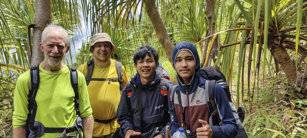
I said goodbye to Dave in the morning; he flew home, and a few minutes later we met up with Rob, who had just arrived here after hiking on the island of Java. Dave and Rob nearly met, but they only missed each other by a few minutes. Next time. It was quite a late morning, with not much to do, so we chose Ribu Talang. Mountain is approximately an hour and a half’s drive from Padang.

Typical “sweet roll,” filled with sweet rice and cane sugar. 
Trailhead in the farm fields
Bamboo
Fern
Rob is balancing on the log

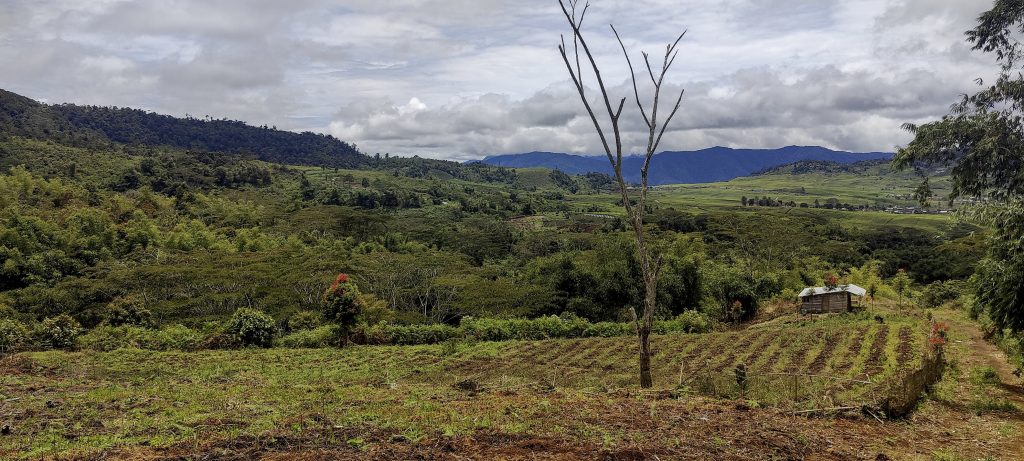
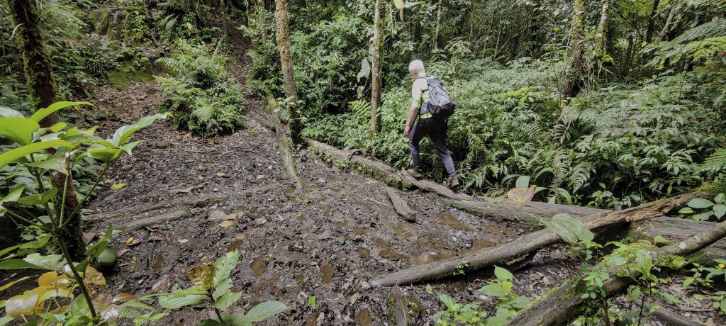
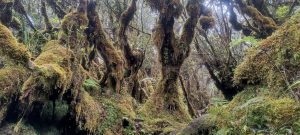
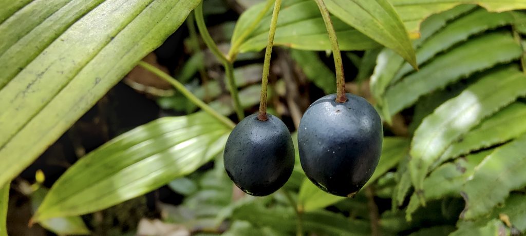
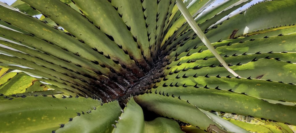
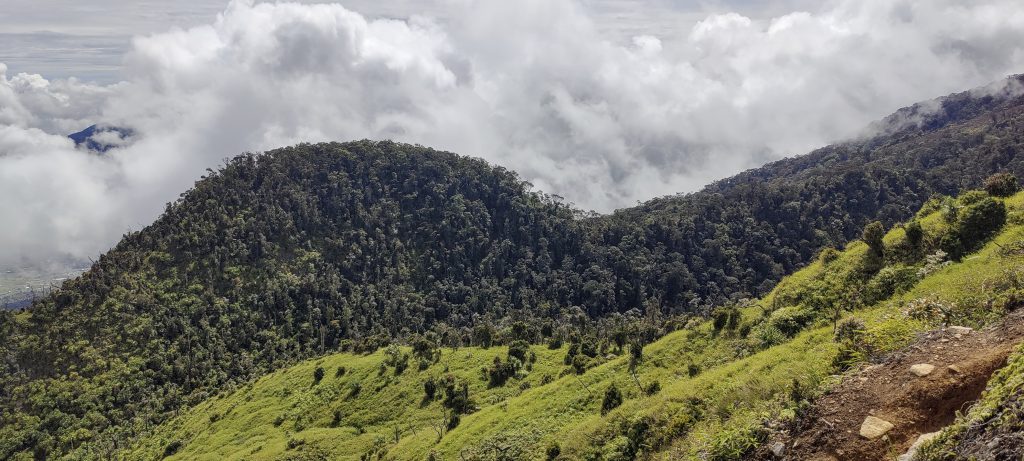
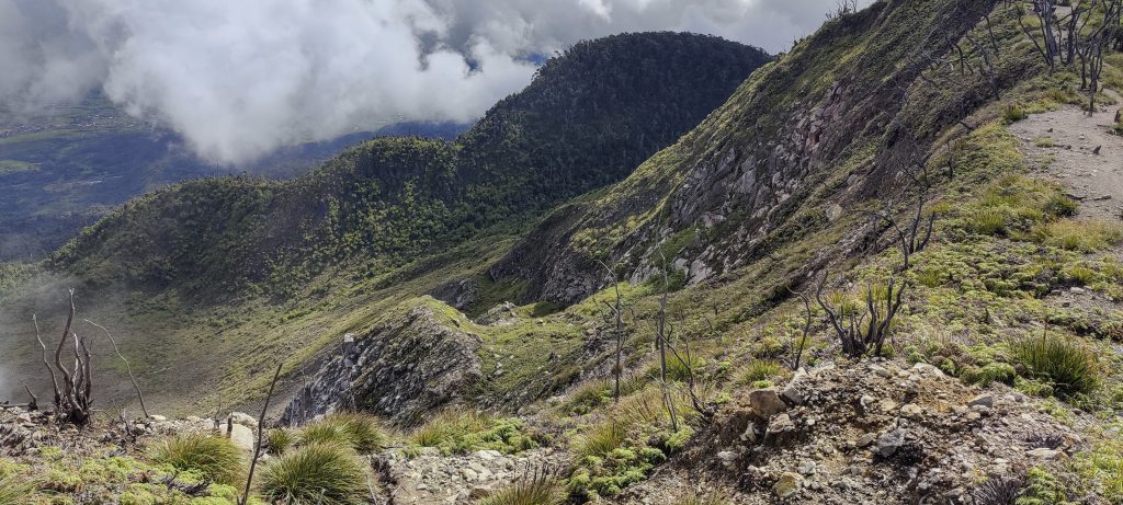
At the beginning, we hit a completely slippery clay path; I even wondered how we were going to climb down. But within a few hours, the trail dries out and is not as slippery on the way down. The first part of the hike was through a typical jungle. But once you get higher up, the jungle changes. more open areas and palm trees.

Fungus
Have no idea… ??

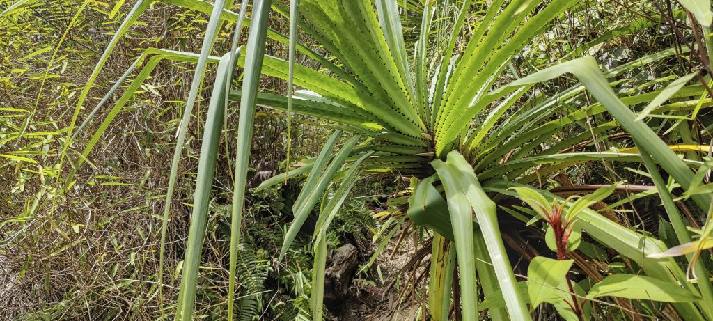
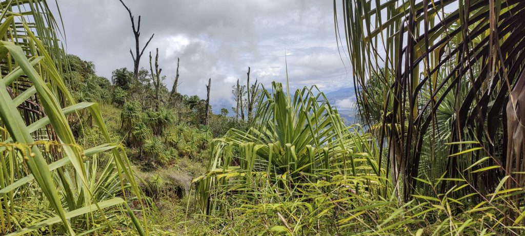
A different, light green jungle with a lot of palm trees

Trail goes through palms and bushes
First glimpse of the fumaroles close to the summit
Rob
Walking palm (Socratea exorrhiza ??)
Local hikers stopped us for a group photo
Palm leaves

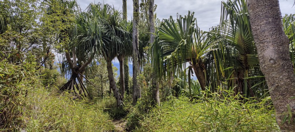
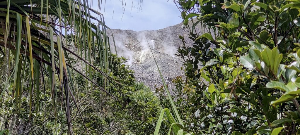
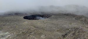
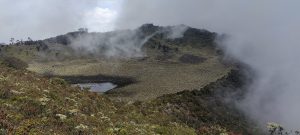
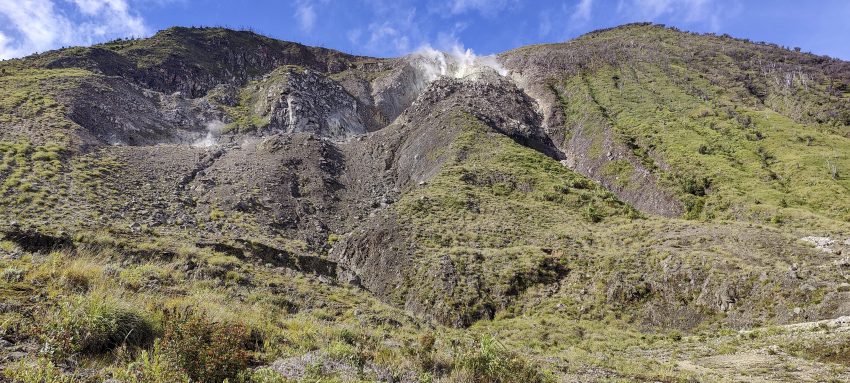
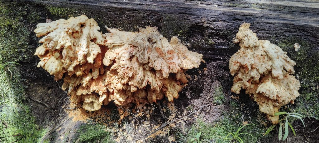
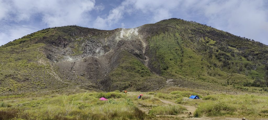
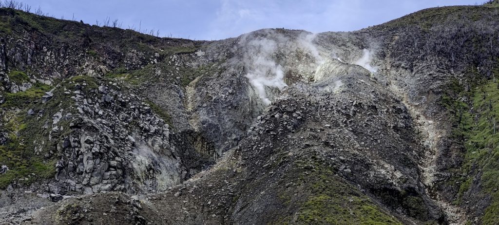
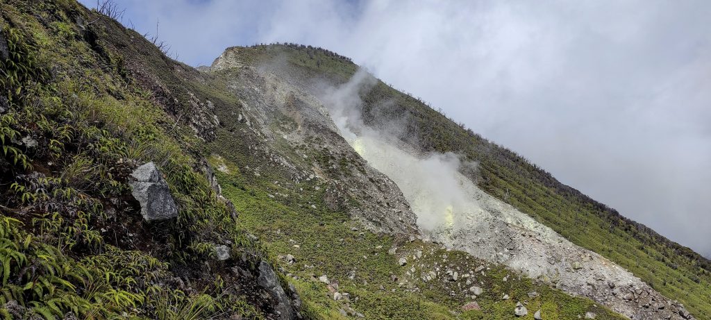
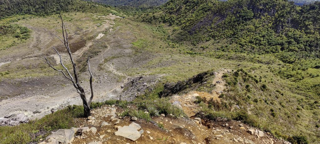
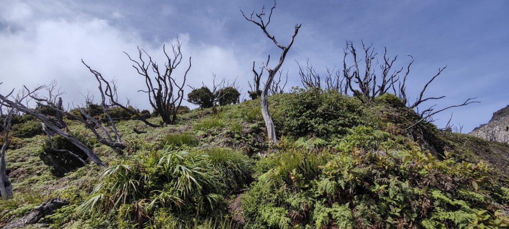
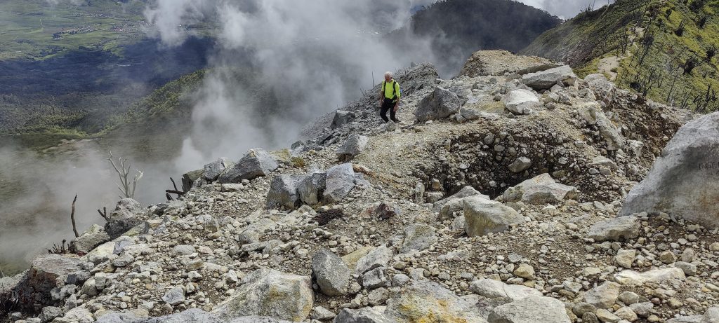
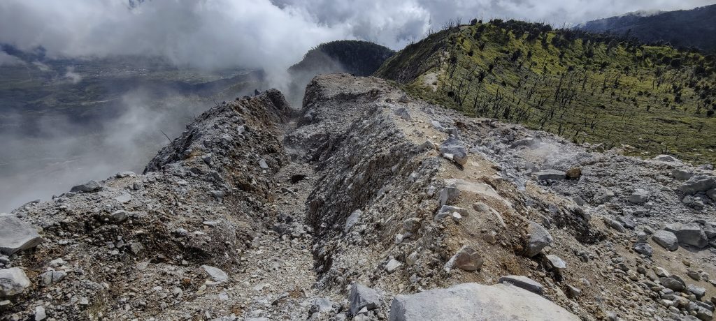
A few hundred meters from the top, we enter a flat plateau. Apparently, there was once a crater here; now it is a campsite with several tents. We say hello and continue climbing. There is a lot of fumarole smoking on the slope and a slight smell of sulfur. The vegetation on the ridge is even different, with many dry trees. I guess it’s the result of volcanic activity.

Danau Talang and Danau Dibaruh lakes
Summit and fumaroles nearby
Looking back
A slight sulphur odor 
Looking back to the steep slope
There are a lot of dead or dry trees on the ridge
Local “raspberry”
Interesting red bush
Summit view

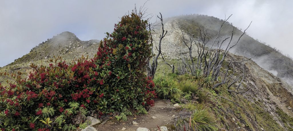
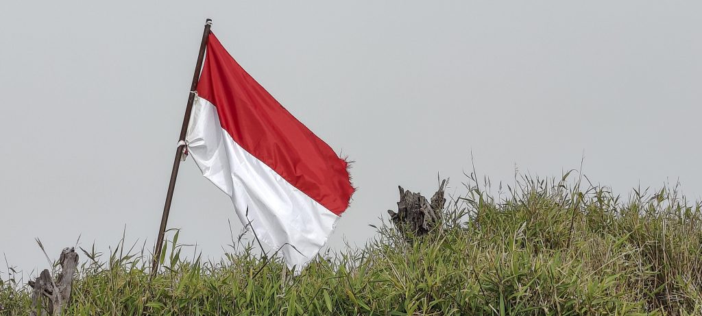
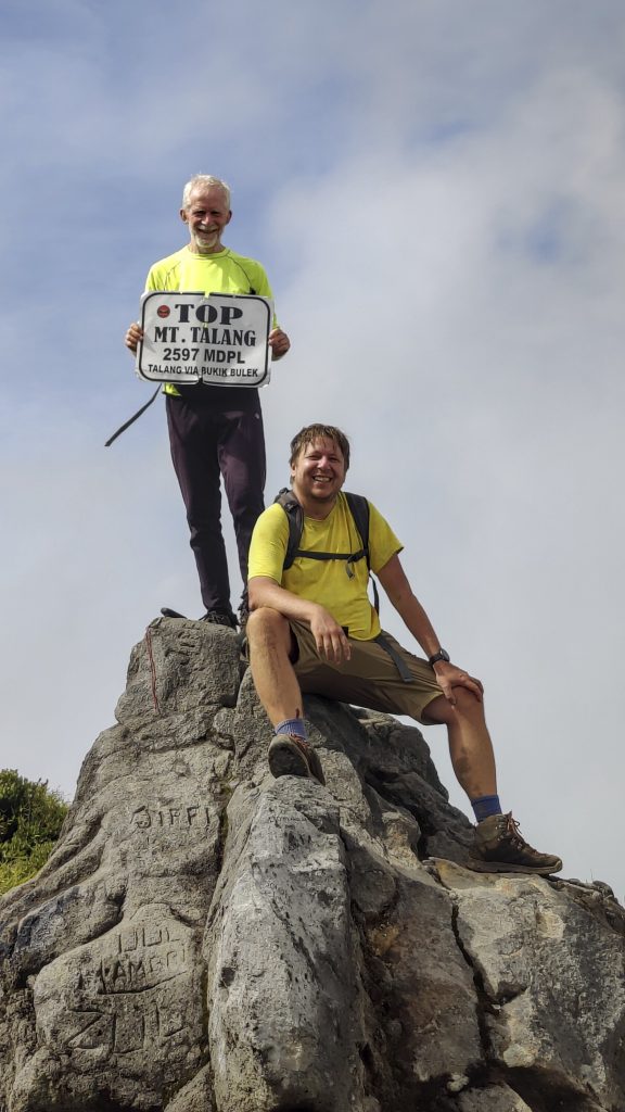
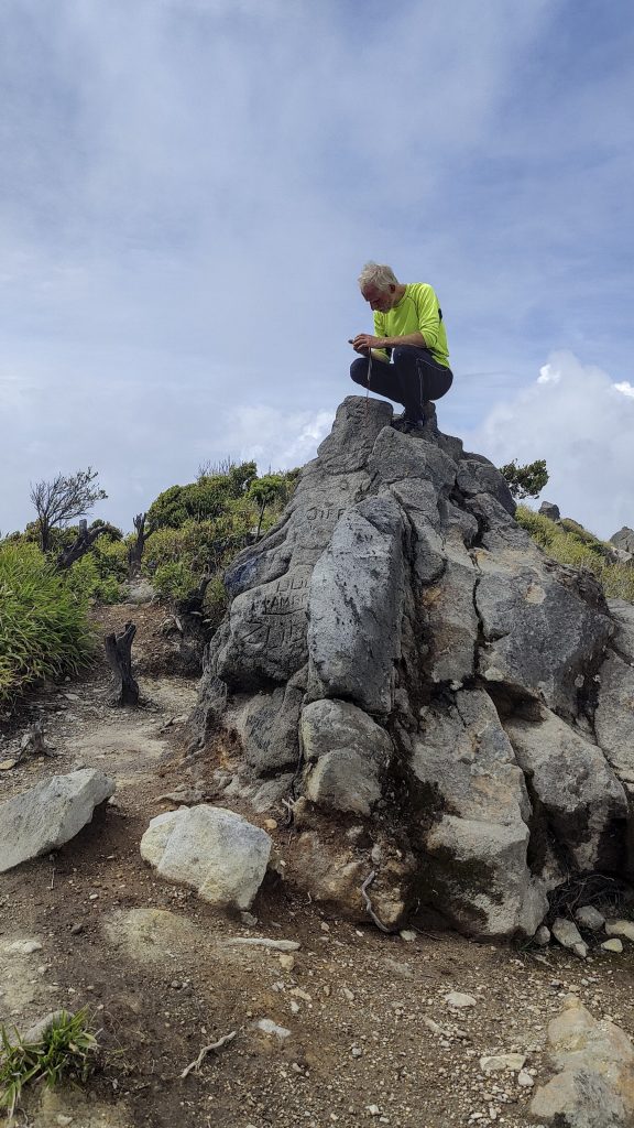
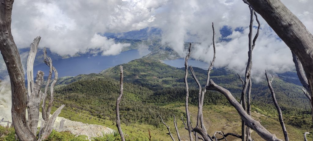
Half an hour later, we reach the ridge; ten minutes later, we reach the summit. The Indonesian flag flies at the top. And we have to figure out which of the larger rocks has the highest point. At least two are certainly very similar in height. With the help of a handlevel, Rob finds that the rock to the south is slightly higher. Peabagger’s highest point is in the same place.

Rob is approaching the summit
Indonesian flag at the top
Rob and myself at the highest outcrop
Rob identifying the highpoint
The slope is slowly “splitting” from the ridge
View down from the ridge
Danau Talang and Danau Dibaruh from the ridge
Prehistoric jungles
Road to the trailhead
Tea plantation everywhere at the bottom
A tea plantation enhances the beauty of the landscape. 

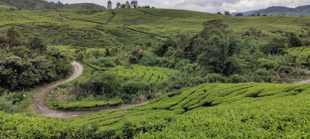
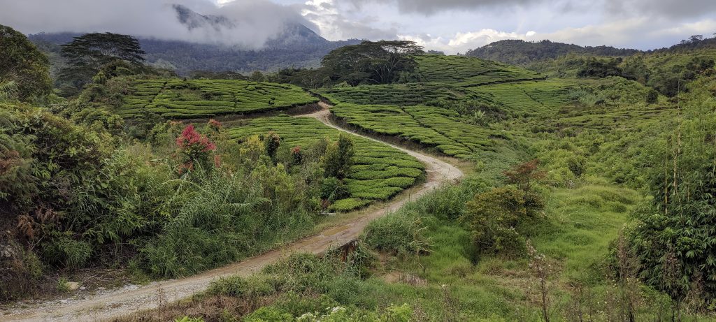
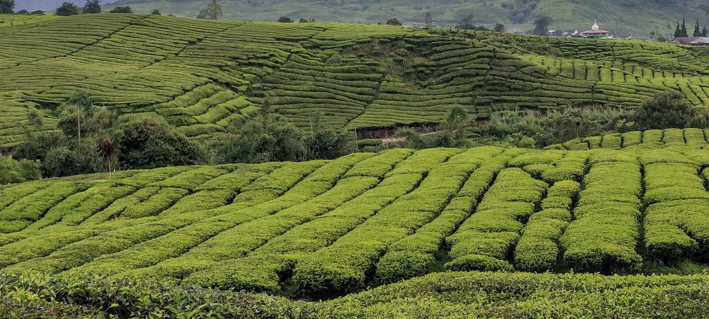
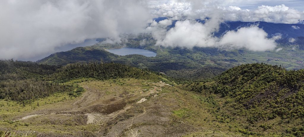
We’re going down the same path; the time flew by, and I didn’t even notice how we ended up back on the tea plantations. Tomorrow we have different plans: Rob will climb the Ribu Malintang and I will climb the Ultra Singgalang (Rob has already climbed it). It was a great day with beautiful views, and moreover, we avoided the rain.


Talang2597 m altitude
1047 m prominence
35.10 km isolation
RangesAsia – Malay Archipelago – Sumatra
Countries/regionsIndonesia – Sumatera Barat
Distance5.60 km up5.60 km down
Elevation1086 m gain1086 m loss
Time
3h00 up
0h15 other
2h15 down
5h30 total
Trailhead1509 m altitude-1.0211380, 100.6795830
Difficulties<p>muddy and rough road leading to the trailhead, but short enough to walk</p>
LinksGPX trail
  • Malay Archipelago III 2022
  • « Malay Archipelago II 2022
  • Singgalang »

Mountain Ranges

Anatolia
Central Anatolia
Pontic Mountains
Southeast Anatolia
Taurus Mountains
Western Anatolia
Andes
Puna de Atacama
Atlas Mountains
High Atlas
Northwestern Atlas
Central America Ranges
Costa Rica-Panama Ranges
Central Central America
East China
Taiwan
Eastern Europe Ranges
Southeast Baltic Plains
Iberian Peninsula
Cordillera Cantabrica
Castile Ranges
Portugal-Galicia
Pyrenees
Intermountain West
Great Basin Ranges
Korea-Amur Area
Taebaek Sanmae
Malay Archipelago
Java
Nusa Tengarra
Sulawesi
Sumatra
Mid-Atlantic Islands
North Atlantic Islands
Mongolia Ranges
Altai
Gobi Desert Ranges
Hangay Mountains
Northwest Europe
Great Britain
North France-West Rhine Area
Pacific Ranges
Cascade Range
Northwest U.S. Coast Ranges
Sierra Nevada
Central and Southern California Ranges
Philippines
Central Philippines
Luzon
Mindanao
Southeast Asia
Malay Peninsula
Southeast South America
Pampas
Sierras de Cordoba
Southern Africa
Malawi Highlands
West Africa Mountains
Bight of Benin
Cameroon Mountains
Guinea Highlands

Countries / regions

Algeria
Ain Guezzam
Ain Salah
Aïn Témouchent
El Bayadh
Ghardaïa
Oran
Ouargla
Saïda
Sidi Bel Abbès
Tamanrasset
Argentina
Catamarca
Ciudad Autónoma de Buenos Aires
Córdoba
Jujuy
Salta
Tucumán
Belgium
Brussels Capital Region
Flemish Region
Cameroon
Southwest
China
Taiwan
Costa Rica
Alajuela
Cartago
Guanacaste
Heredia
Limón
San José
Czechia
Prague
Denmark
Greenland
France
Hauts-de-France
Occitania
Germany
Berlin
Niedersachsen
Indonesia
Bali
Jambi
Jawa Tengah
Jawa Timur
Nusa Tenggara Barat
Sulawesi Tengah
Sulawesi Utara
Sumatera Barat
Lithuania
Vilnius County
Mongolia
Bayankhongor
Govi-Altai
Khovd
Omnogovi
Ovorkhangai
Ulan Bator
Zavkhan
Morocco
Béni Mellal-Khénifra
Drâa-Tafilalet
Fez-Meknes
Marrakesh-Safi
Souss-Massa
Tangier-Tetouan-Al Hoceima
Mozambique
Zambezia
Netherlands
Gelderland
Noord-Holland
Zeeland
Nicaragua
Chinandega
Managua
Masaya
Rivas
Philippines
Bicol Region (V)
Cagayan Valley (II)
Calabarzon (IV-A)
Central Luzon (III)
Cordillera Administrative Region
Davao Region
Metro Manila
Soccsksargen (XII)
Western Visayas (VI)
Poland
Greater Poland Voivodeship
Masovian Voivodeship
Portugal
Castelo Branco
Leiria
Lisbon
Madeira
Santarém
Qatar
Ad-Dawhah
São Tomé and Príncipe
São Tomé Province
Sierra Leone
Northern Province
Western Area
Singapore
South Korea
Gyeongsangnam-do
Seoul
Spain
Aragón
Asturias
Castilla-La Mancha
Castilla y León
Catalonia
Islas Canarias
Switzerland
Zürich
Turkey
Antalya
Bitlis
Erzincan
Hakkâri
Igdir
Isparta
Kahraman Maras
Muğla
United Kingdom
England
Scotland
United States
California
Delaware
Florida
Maryland
Nevada
New Jersey
New York
Pennsylvania
South Carolina
Utah

TRIPS

2024
Southern Africa 2024
Mid-Atlantic Islands 2024
North America 2024
Anatolia 2024
Korea-Amur Area 2024
East China 2024
2023
Mongolia Ranges 2023
Philippines 2023
West Africa III 2023
West Africa II 2023
Iberian Peninsula 2023
West Africa 2023
Central America 2023
2022
Andes 2022
Northwest Europe 2022
Malay Archipelago III 2022
Malay Archipelago II 2022
Anatolia Mountains 2022
Iberian Peninsula 2022
Atlas Mountains 2022
North France-West Rhine Area 2022

archaeology (3) climb (157) food (2) hike (155) p30 (17) p50 (4) p100 (24) p300 (12) p600 (17) p1000 (11) p1500 (76) ribu (10) sight (46) summary (16) trig (44) ultra (76)

1 591 km walked, 121 298 m climbed

©2025 p600.org | WordPress Theme by Superbthemes.com