Skip to content
Menu
p600.org
  • home
  • map
  • trips
  • about
p600.org

Ben Vorlich

hike | 2022-11-22
943 m altitude, 632 m prominence, 5.54 km isolation

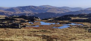
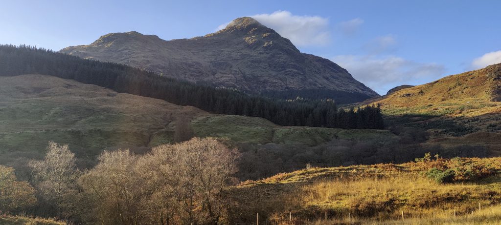
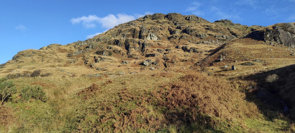
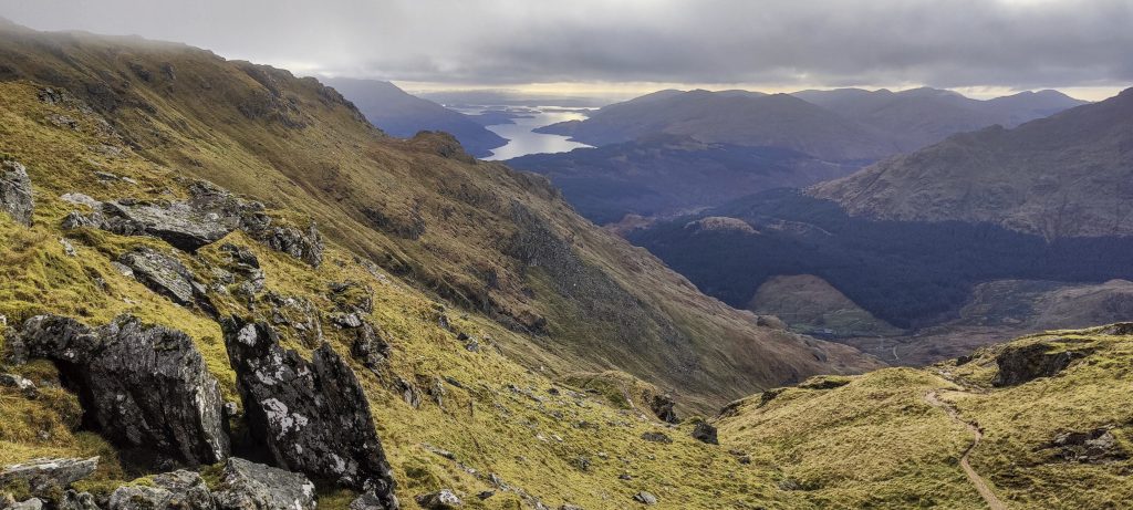
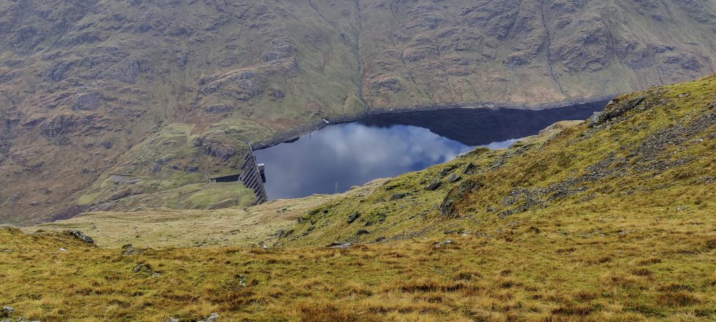
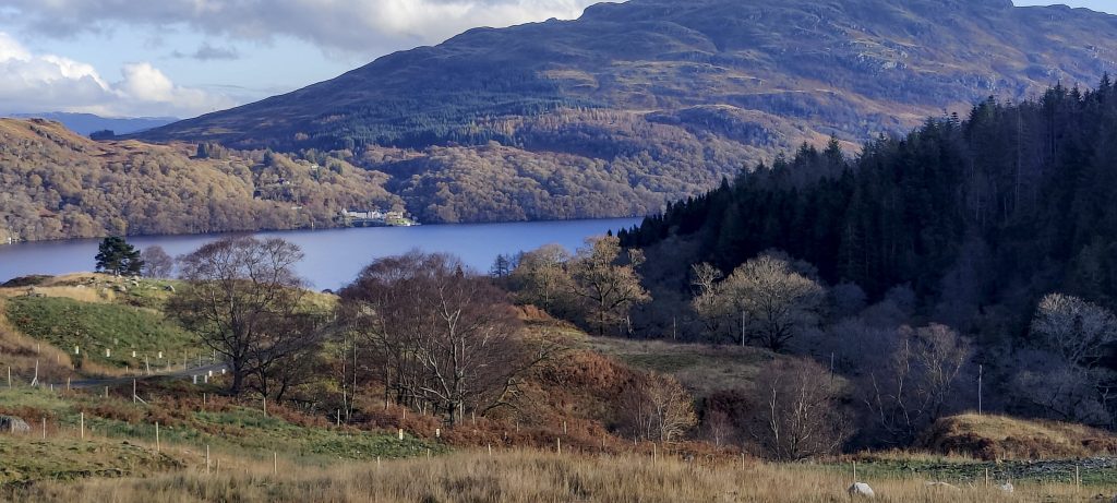
On this trip, this is the last of Scotland’s four p600’s peaks. Arūnas decides to walk along Loch Lomond, so I get out of the car at the closed gate and walk about three kilometres to the trailhead on the tarmac road. A first-class walk with spectacular views illuminated by the morning sun.

Ben Vane 915 m p424 (??), in a bright morning light
A’ Chrois 848m p106 (??)
South Slope of Ben Vorlich
Nice valleys

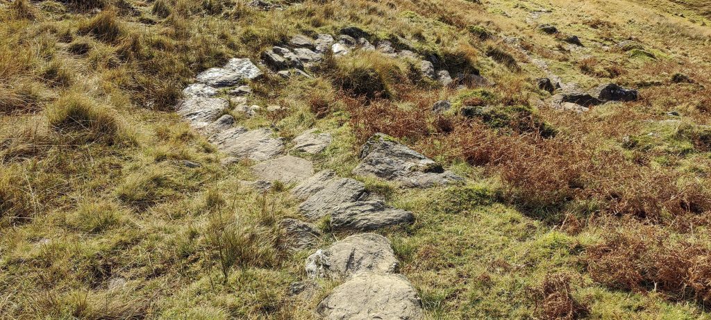
It is pleasantly surprising that the path is paved at the beginning. This makes climbing steep slopes much easier. Later on, the path turns into a regular one, but I still see stones laid in steeper places to make it easier to climb. Thanks!

Respect for stone stairs
Three deers (??)
Looking back from the ridge
The snow line starts at the ridge
More snow higher up

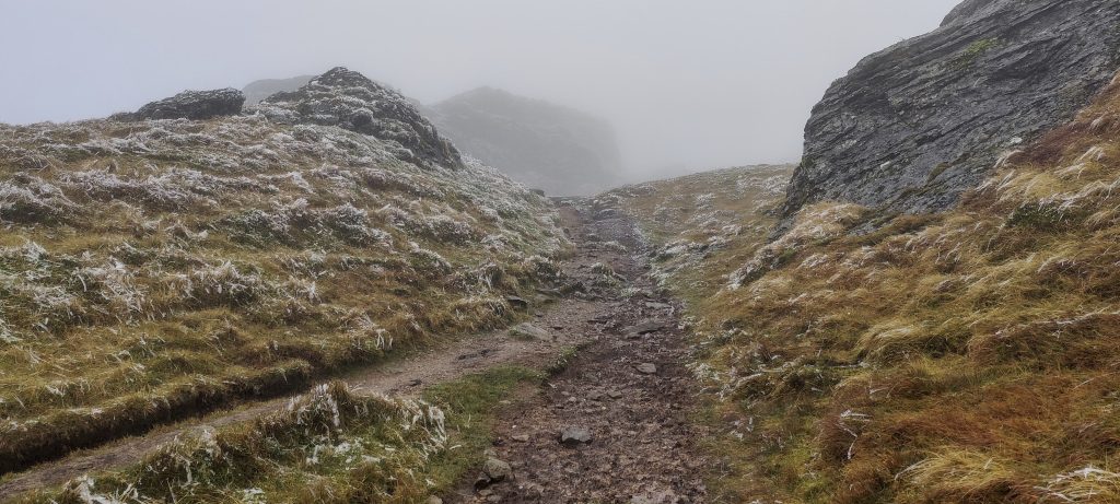
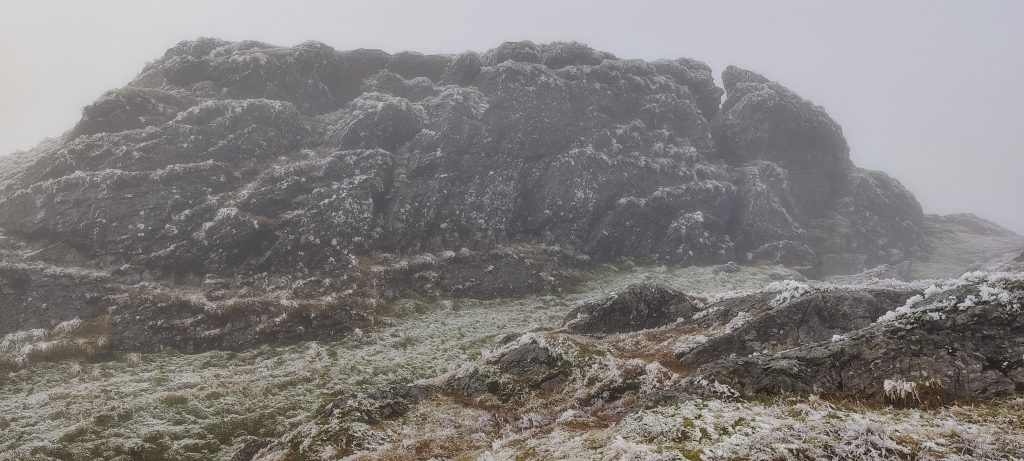
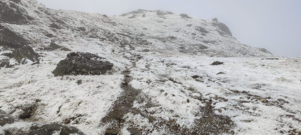
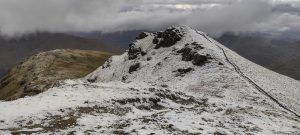
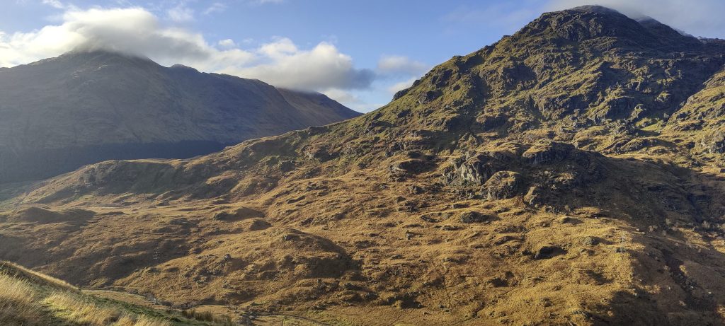
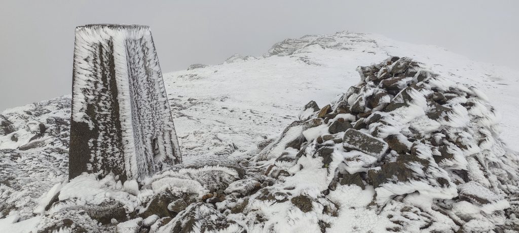
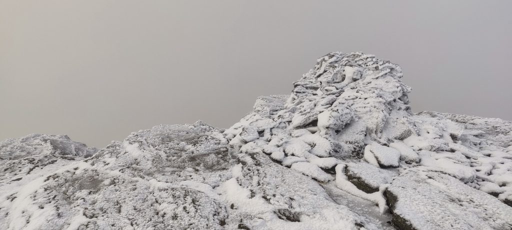
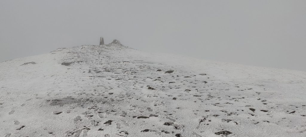
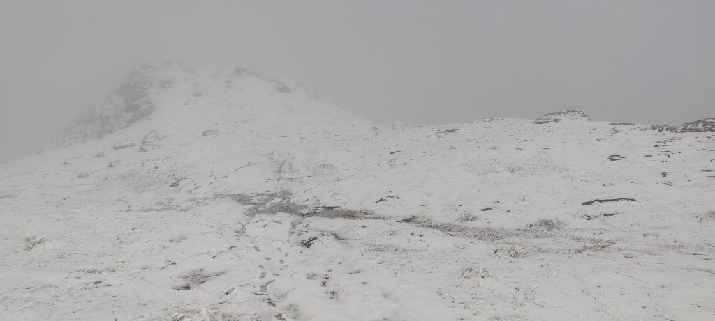
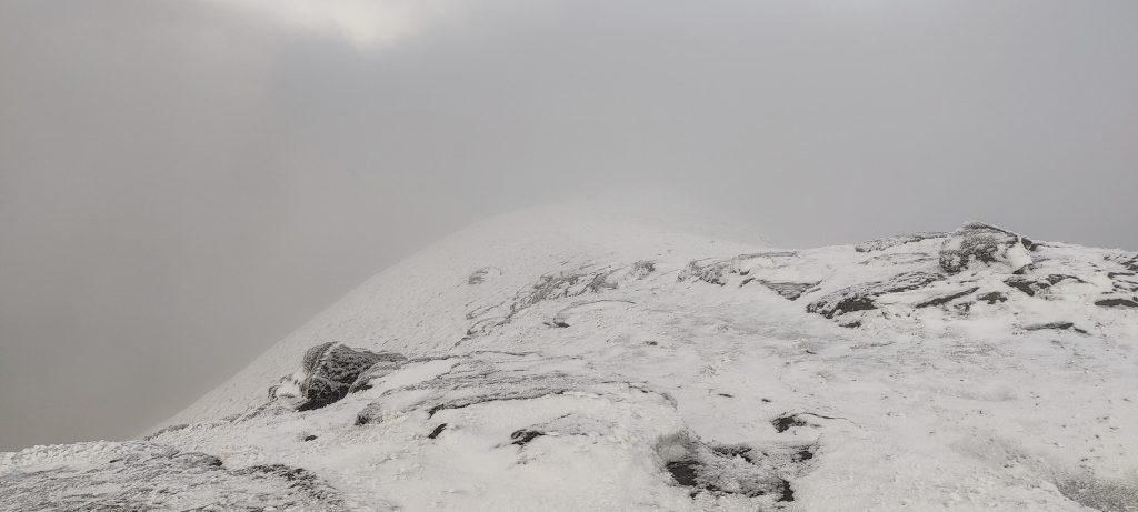
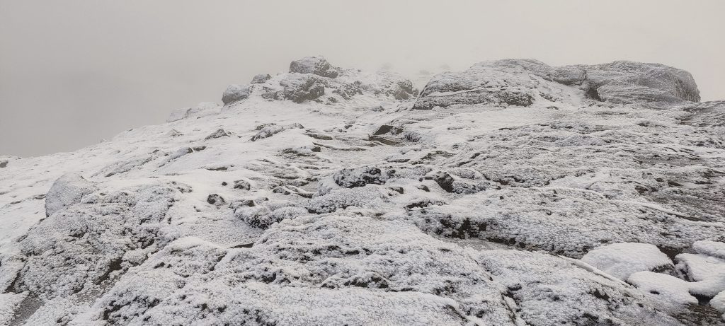
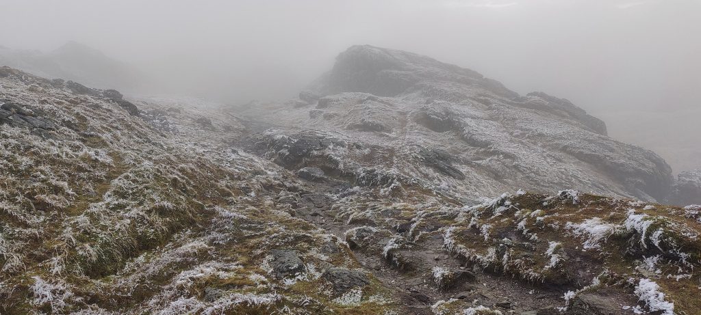
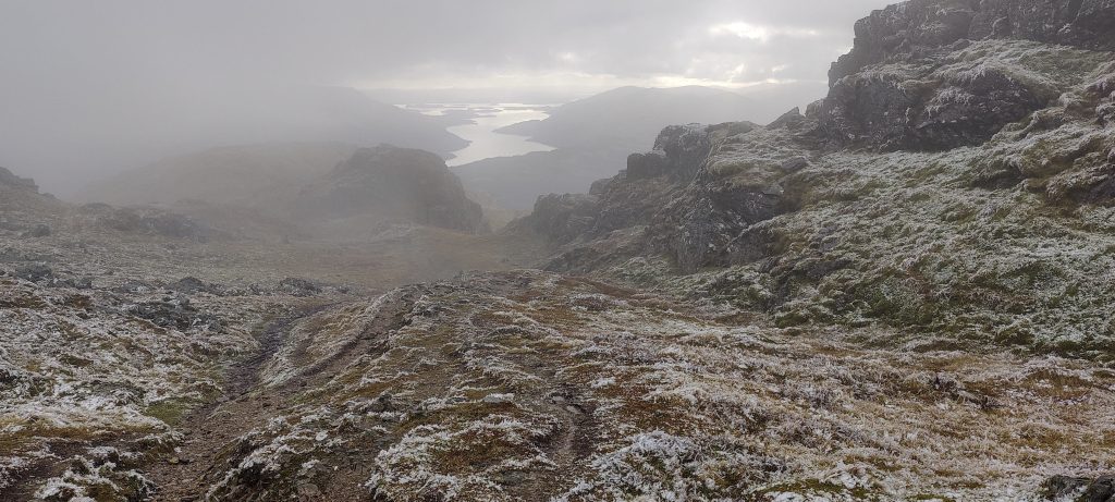
There were a few centimetres of snow starting a couple hundred metres before the summit. I reach the triangulation point, and it’s a good thing that I did a little homework before climbing. Now I know that the true summit is two hundred metres away. Otherwise, I wouldn’t notice the peak in the clouds, and I would assume that the peak is where the triangulation pillar is. So I walked to the high point, and minutes later I descended the same path.

Trig pillar at the lower summit
A cairn marks the true summit
Low clouds obscure views, but anyway, the terrain looks nice
Loch Lomond is in the background
Loch Sloy and the dam
In the distance, i can see the Ben Lomond pyramid. 
It’s amusing to see the gates open on the opposite side
Looks healthy
Loch Lomond on the way down

In less than two hours, I’m back in the car, and we’re rolling towards London. Tomorrow, I have a flight to Madrid, which will be followed by a short stop in Asunción, another stop in Cordoba, and a final stop in Salta, Argentina. At Cordoba, between the flights, we will find the bonus peak, Cerro Pan de Azúcar.


Ben Vorlich 943 m altitude
632 m prominence
5.54 km isolation
Ranges Europe - Northwest Europe - Great Britain
Countries/regions United Kingdom – Scotland
Distance 6.20 km up 6.20 km down
Elevation 903 m gain 903 m loss
Time
1h50 up
0h05 other
1h50 down
3h45 total
Trailhead 39 m altitude 56.2458610, -4.7158330
Links GPX trail
  • Northwest Europe 2022
  • « Beinn an Lochain

Mountain Ranges

Anatolia
Taurus Mountains
Western Anatolia
Andes
Puna de Atacama
Atlas Mountains
High Atlas
Northwestern Atlas
Central America Ranges
Costa Rica-Panama Ranges
Central Central America
Eastern Europe Ranges
Southeast Baltic Plains
Iberian Peninsula
Cordillera Cantabrica
Castile Ranges
Portugal-Galicia
Pyrenees
Malay Archipelago
Java
Nusa Tengarra
Sulawesi
Sumatra
Northwest Europe
Great Britain
North France-West Rhine Area
Southeast South America
Pampas
Sierras de Cordoba
West Africa Mountains
Bight of Benin
Cameroon Mountains

Countries / regions

Algeria
Ain Guezzam
Ain Salah
Aïn Témouchent
El Bayadh
Ghardaïa
Oran
Ouargla
Saïda
Sidi Bel Abbès
Tamanrasset
Argentina
Catamarca
Ciudad Autónoma de Buenos Aires
Córdoba
Jujuy
Salta
Tucumán
Belgium
Flemish Region
Brussels Capital Region
Cameroon
Southwest
Costa Rica
Alajuela
Cartago
Guanacaste
Heredia
Limón
San José
Czechia
Prague
Denmark
Greenland
France
Hauts-de-France
Germany
Berlin
Niedersachsen
Indonesia
Bali
Jambi
Jawa Tengah
Jawa Timur
Nusa Tenggara Barat
Sulawesi Tengah
Sulawesi Utara
Sumatera Barat
Lithuania
Vilnius County
Morocco
Béni Mellal-Khénifra
Drâa-Tafilalet
Fez-Meknes
Marrakesh-Safi
Souss-Massa
Tangier-Tetouan-Al Hoceima
Netherlands
Gelderland
Noord-Holland
Nicaragua
Chinandega
Managua
Masaya
Rivas
Poland
Greater Poland Voivodeship
Masovian Voivodeship
Portugal
Castelo Branco
Leiria
Lisbon
Santarém
São Tomé and Príncipe
São Tomé Province
Spain
Aragón
Asturias
Castilla-La Mancha
Castilla y León
Switzerland
Zürich
Turkey
Antalya
Isparta
Muğla
United Kingdom
England
Scotland
United States
Delaware
Florida
Georgia
Maryland
New Jersey
New York
North Carolina
South Carolina
Pennsylvania
Virginia

TRIPS

2023
West Africa 2023 II
Iberian Peninsula 2023
West Africa 2023
Central America 2023
2022
Andes 2022
Northwest Europe 2022
Malay Archipelago III 2022
Malay Archipelago II 2022
Anatolia Mountains 2022
Iberian Peninsula 2022
Atlas Mountains 2022

archaeology (3) climb (69) food (2) hike (68) p30 (3) p100 (9) p300 (8) p600 (13) p1000 (5) p1500 (34) ribu (4) sight (34) summary (11) ultra (34)

839 km walked, 65 247 m climbed

©2023 p600.org | WordPress Theme by Superbthemes.com