Skip to content
Menu
p600.org
  • home
  • map
  • trips
  • about
p600.org

Cerro Malcante

hike | 2022-11-29

The forbidden fruit is sweeter, and Cerro Malcante also intrigues us more than the other mountains. We arrive early in the morning, park the car on the side of the road, and a few minutes later we are climbing up the steep slope. So far, no one has stopped us, but a few hundred metres up, we look down and see another car pass by. But here again, luck is with us, and the car drives on and off.

As we approach the mountain at dawn, we see that the top and higher slopes are covered in snow
Like other mountains, it is home to yareta (Azorella compacta ???)
The perfect morning colour play
We park on the side of the road and climb without waiting for anything
Spectacular, colourful ornaments created by nature

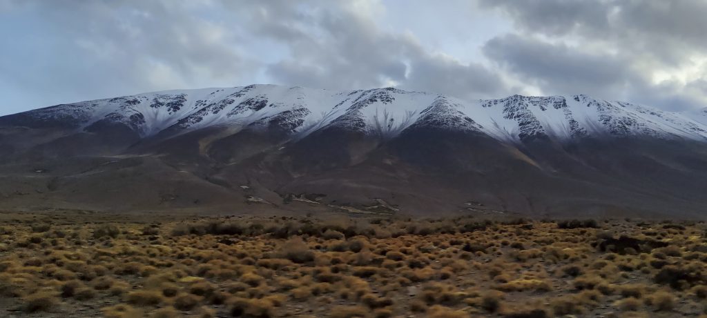
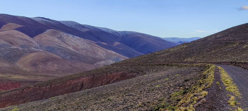
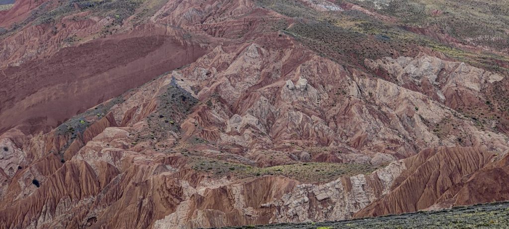
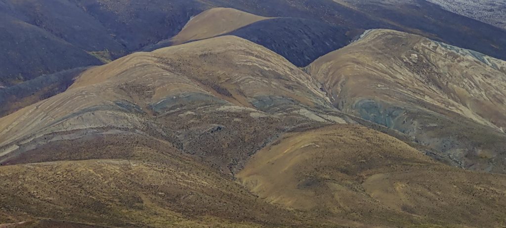
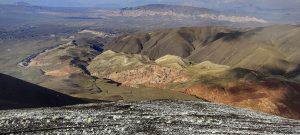
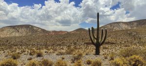
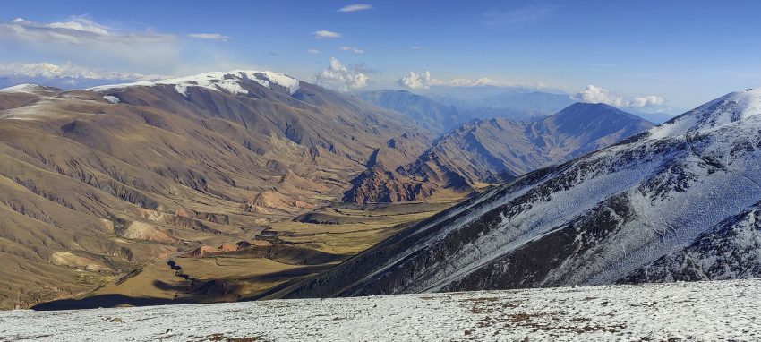
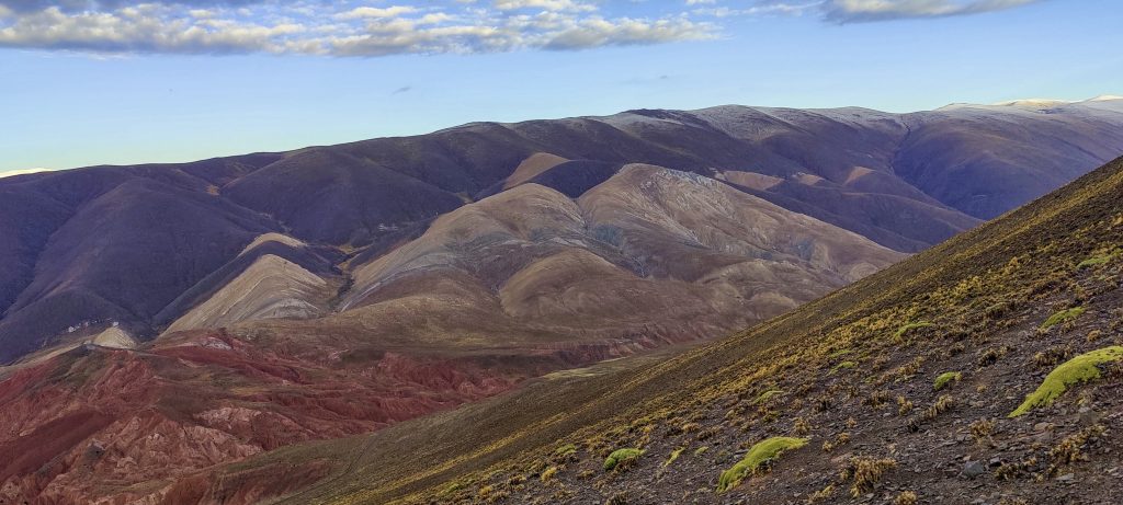
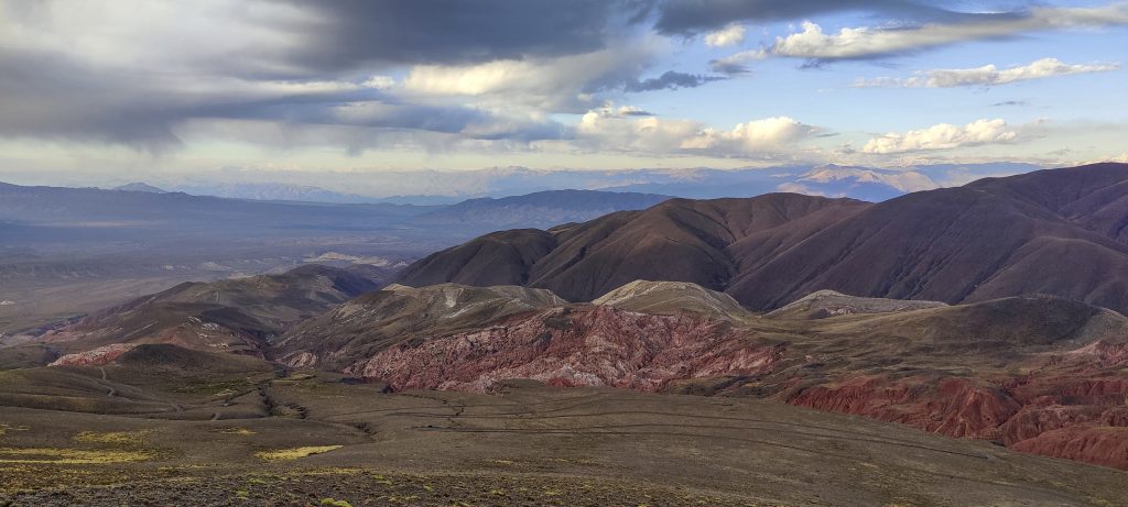
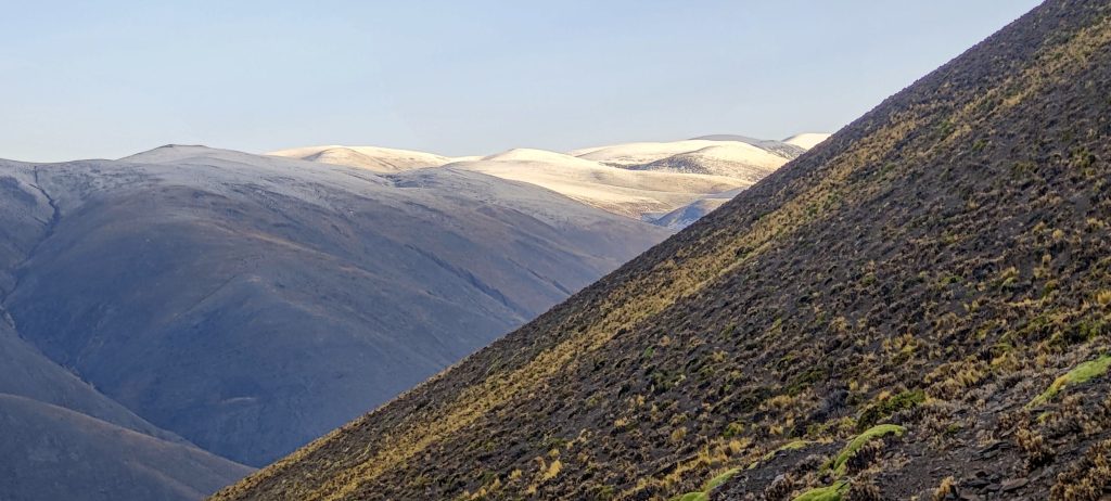
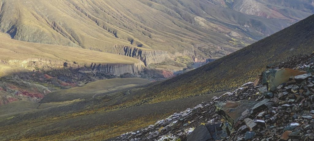
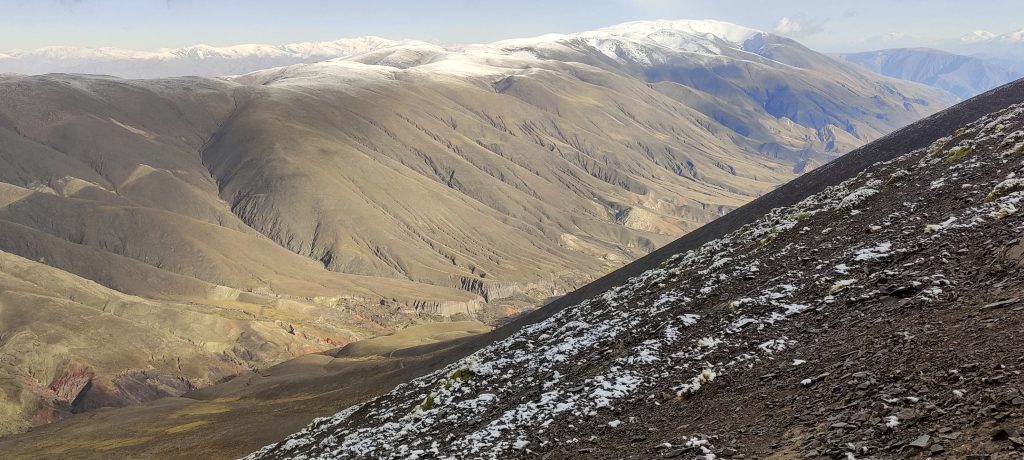
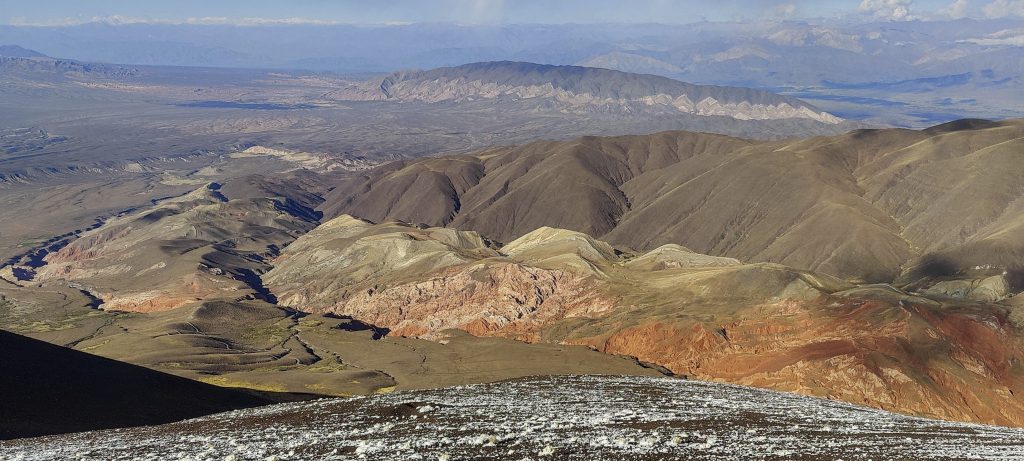
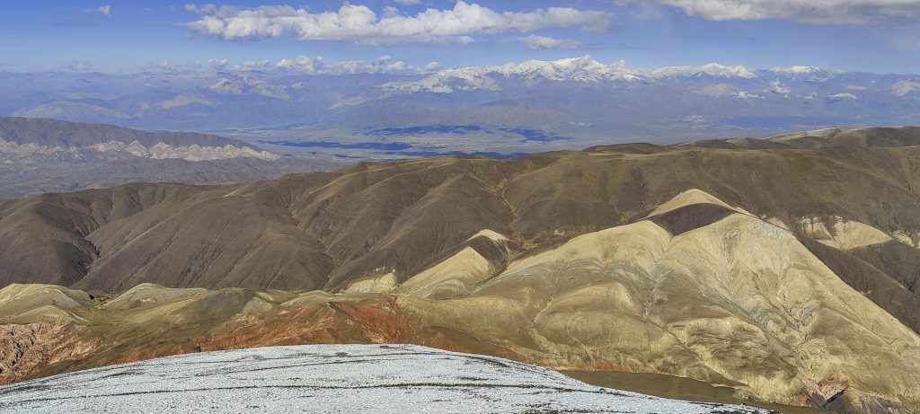
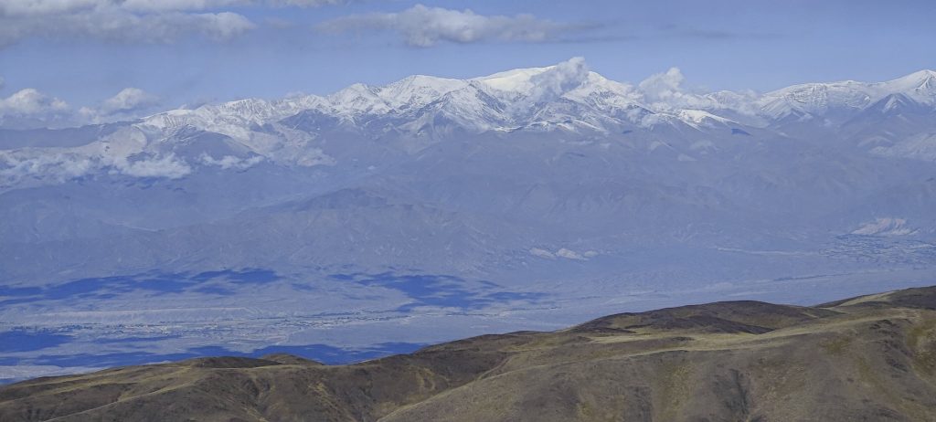
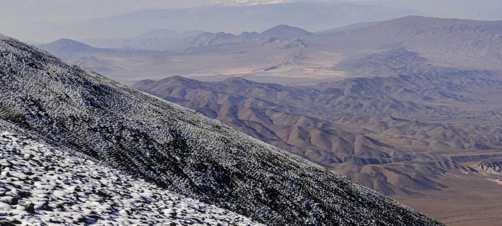
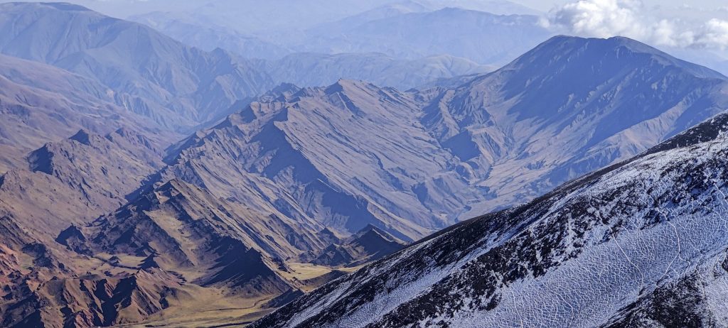
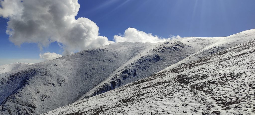
Admittedly, climbing the same slope over and over again would be rather boring if the surrounding views weren’t killing you. Los Cardones National Park is a must-see for anyone who enjoys spectacular, colourful scenery… and cacti. The views make this climb top-rated and memorable.

Climbing the slope and admiring the views
Looking back
Other snowy peaks in the distance
It would be interesting to take a walk through the canyon. Next time…
Cerro Rio Blanco – ~4200m
Rob approaching 5000m line
John climbing up the slope

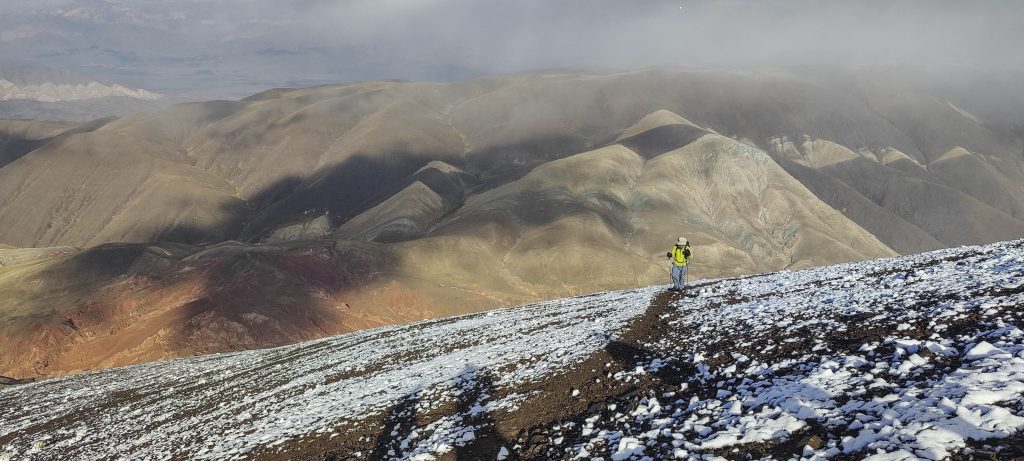
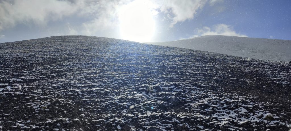
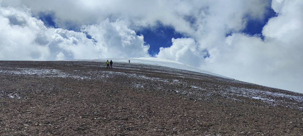
We zigzagged up the steep slopes. Somewhere around two kilometers’ altitude, this would be the equivalent of an easy stroll; here it’s a bit harder… Soon I reach 4807 metres and 81 centimetres above sea level, and with one more step, I have improved my personal altitude record (up to this point, it had been the top of Mont Blanc). I stop for a moment to celebrate and continue climbing, each step now a new personal record.

“Valley of colours”
Nevado de Cachi – 6380m
Looking down the slope
Spectacular valleys
Ornaments created by snow and ice
The top is just around the corner, but we are moving quite slowly due to the altitude

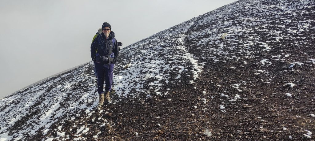
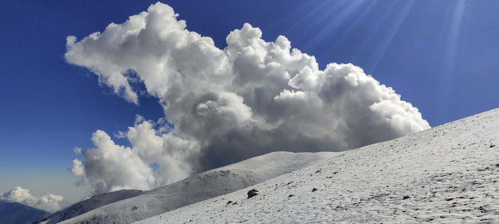
A couple of hundred metres before the summit, clouds start to gather on the other side of the ridge. Franco shouts that it’s not right, but we all keep climbing. We all know that we have to hurry, but the reality is different; we are climbing as fast as our physiology allows.

Clouds are forming on the other side of the mountain; we need to hurry
Guanaco is also here
The clouds just get bigger and thicker

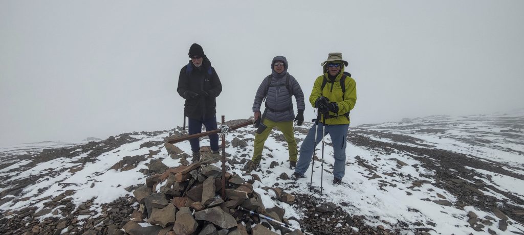
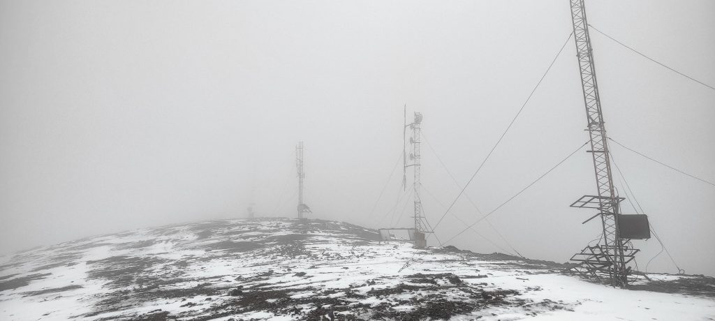
We are approaching something like a peak; unfortunately, this is just another bump on the ridge. A few hundred metres more, and we reach the antennas. I did not expect to find them here. At one of the antennas, Rob takes out a hand-level and compares the height with that of the cairned summit. Low clouds make visibility difficult, and we are in a hurry because of the electrified air, but Rob confirms that the elevation at one of the antennas is a metre higher than the summit marked by the cairn. We hastily take a photo and run away from the epicentre of the electrostatic charge.

Rob (left), John (right), and me (middle) next to a small metal peak marker
I was a bit surprised to see the communication masts at the top; it may be that the highest point is at the third antena
We descend in a straight line, without zigzags
Summer is back below the snow line

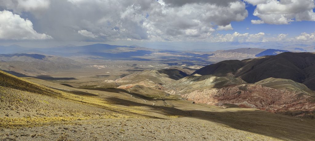
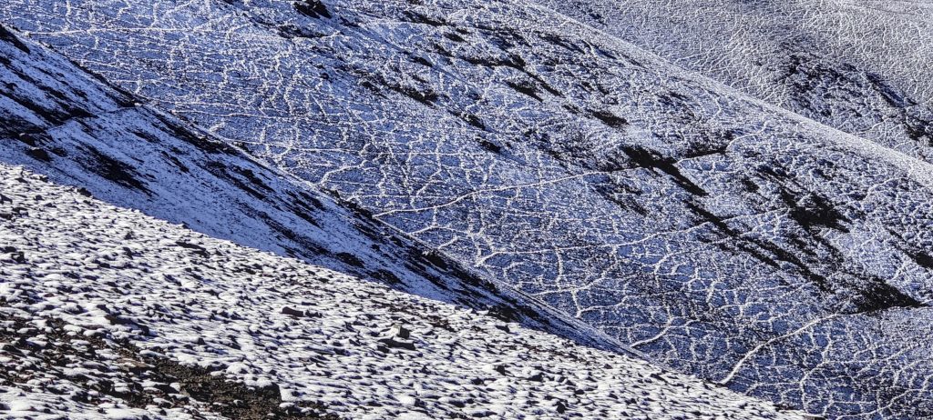
We are climbing down in a straight line instead of zigzagging and going quite fast. The surface is slightly snow-covered and soft as a carpet. If not for the lack of oxygen, one could run like a sprinter, but we can’t. We return to the car and enjoy the impressive views of Los Cardones National Park as we drive. Overnight stop in Cafayate and then mules and the muleteer of Cerro Bolsón de los Cerillos are waiting for us. In a couple of days, we will try our strength and luck on this peak.


Cerro Malcante5100 m altitude
1917 m prominence
56.77 km isolation
RangesSouth America - Andes - Puna de Atacama
Countries/regionsArgentina – Salta
Distance5.00 km up3.80 km down
Elevation1058 m gain1058 m loss
Time
3h45 up
0h05 other
1h45 down
5h35 total
Trailhead4041 m altitude-25.0709720, -65.8750000
Difficultieshigh electrostatic charge at the top
LinksGPX trail
  • Andes 2022
  • « Cerro Altar
  • Los Cardones National Park »

Mountain Ranges

Anatolia
Central Anatolia
Pontic Mountains
Southeast Anatolia
Taurus Mountains
Western Anatolia
Andes
Puna de Atacama
Atlas Mountains
High Atlas
Northwestern Atlas
Central America Ranges
Costa Rica-Panama Ranges
Central Central America
East China
Taiwan
Eastern Europe Ranges
Southeast Baltic Plains
Iberian Peninsula
Cordillera Cantabrica
Castile Ranges
Portugal-Galicia
Pyrenees
Intermountain West
Great Basin Ranges
Korea-Amur Area
Taebaek Sanmae
Malay Archipelago
Java
Nusa Tengarra
Sulawesi
Sumatra
Mid-Atlantic Islands
North Atlantic Islands
Mongolia Ranges
Altai
Gobi Desert Ranges
Hangay Mountains
Northwest Europe
Great Britain
North France-West Rhine Area
Pacific Ranges
Cascade Range
Northwest U.S. Coast Ranges
Sierra Nevada
Central and Southern California Ranges
Philippines
Central Philippines
Luzon
Mindanao
Southeast Asia
Malay Peninsula
Southeast South America
Pampas
Sierras de Cordoba
Southern Africa
Malawi Highlands
West Africa Mountains
Bight of Benin
Cameroon Mountains
Guinea Highlands

Countries / regions

Algeria
Ain Guezzam
Ain Salah
Aïn Témouchent
El Bayadh
Ghardaïa
Oran
Ouargla
Saïda
Sidi Bel Abbès
Tamanrasset
Argentina
Catamarca
Ciudad Autónoma de Buenos Aires
Córdoba
Jujuy
Salta
Tucumán
Belgium
Brussels Capital Region
Flemish Region
Cameroon
Southwest
China
Taiwan
Costa Rica
Alajuela
Cartago
Guanacaste
Heredia
Limón
San José
Czechia
Prague
Denmark
Greenland
France
Hauts-de-France
Occitania
Germany
Berlin
Niedersachsen
Indonesia
Bali
Jambi
Jawa Tengah
Jawa Timur
Nusa Tenggara Barat
Sulawesi Tengah
Sulawesi Utara
Sumatera Barat
Lithuania
Vilnius County
Mongolia
Bayankhongor
Govi-Altai
Khovd
Omnogovi
Ovorkhangai
Ulan Bator
Zavkhan
Morocco
Béni Mellal-Khénifra
Drâa-Tafilalet
Fez-Meknes
Marrakesh-Safi
Souss-Massa
Tangier-Tetouan-Al Hoceima
Mozambique
Zambezia
Netherlands
Gelderland
Noord-Holland
Zeeland
Nicaragua
Chinandega
Managua
Masaya
Rivas
Philippines
Bicol Region (V)
Cagayan Valley (II)
Calabarzon (IV-A)
Central Luzon (III)
Cordillera Administrative Region
Davao Region
Metro Manila
Soccsksargen (XII)
Western Visayas (VI)
Poland
Greater Poland Voivodeship
Masovian Voivodeship
Portugal
Castelo Branco
Leiria
Lisbon
Madeira
Santarém
Qatar
Ad-Dawhah
São Tomé and Príncipe
São Tomé Province
Sierra Leone
Northern Province
Western Area
Singapore
South Korea
Gyeongsangnam-do
Seoul
Spain
Aragón
Asturias
Castilla-La Mancha
Castilla y León
Catalonia
Islas Canarias
Switzerland
Zürich
Turkey
Antalya
Bitlis
Erzincan
Hakkâri
Igdir
Isparta
Kahraman Maras
Muğla
United Kingdom
England
Scotland
United States
California
Delaware
Florida
Maryland
Nevada
New Jersey
New York
Pennsylvania
South Carolina
Utah

TRIPS

2024
Southern Africa 2024
Mid-Atlantic Islands 2024
North America 2024
Anatolia 2024
Korea-Amur Area 2024
East China 2024
2023
Mongolia Ranges 2023
Philippines 2023
West Africa III 2023
West Africa II 2023
Iberian Peninsula 2023
West Africa 2023
Central America 2023
2022
Andes 2022
Northwest Europe 2022
Malay Archipelago III 2022
Malay Archipelago II 2022
Anatolia Mountains 2022
Iberian Peninsula 2022
Atlas Mountains 2022
North France-West Rhine Area 2022

archaeology (3) climb (157) food (2) hike (155) p30 (17) p50 (4) p100 (24) p300 (12) p600 (17) p1000 (11) p1500 (76) ribu (10) sight (46) summary (16) trig (44) ultra (76)

1 591 km walked, 121 298 m climbed

©2025 p600.org | WordPress Theme by Superbthemes.com