Skip to content
Menu
p600.org
  • home
  • map
  • trips
  • about
p600.org

Bukit Bongo

hike | 2022-10-13

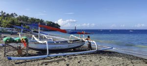
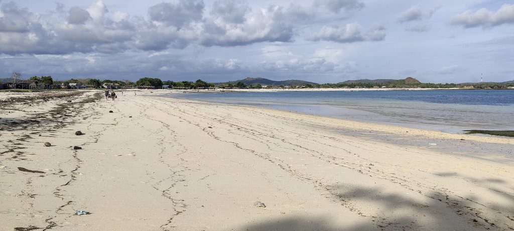
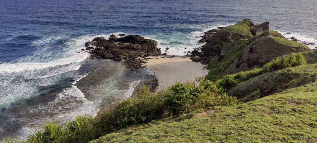
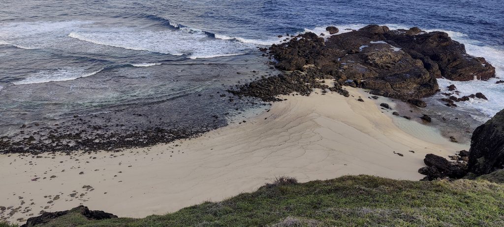
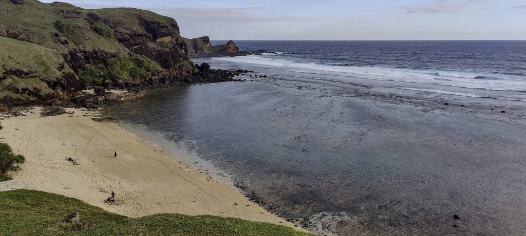
Moto GP race track that leads to the well-hidden Tenggara beach. Sandy, wide, and empty, like many others. At the end of the beach, after crossing a small square, we find the trail to the Tanjung Bong peninsula.

Beach merchant tables
Wide sandy beach
Islets in the background
Looking back to the beach
Golf.. ah no, it’s Dave

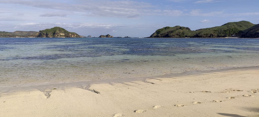
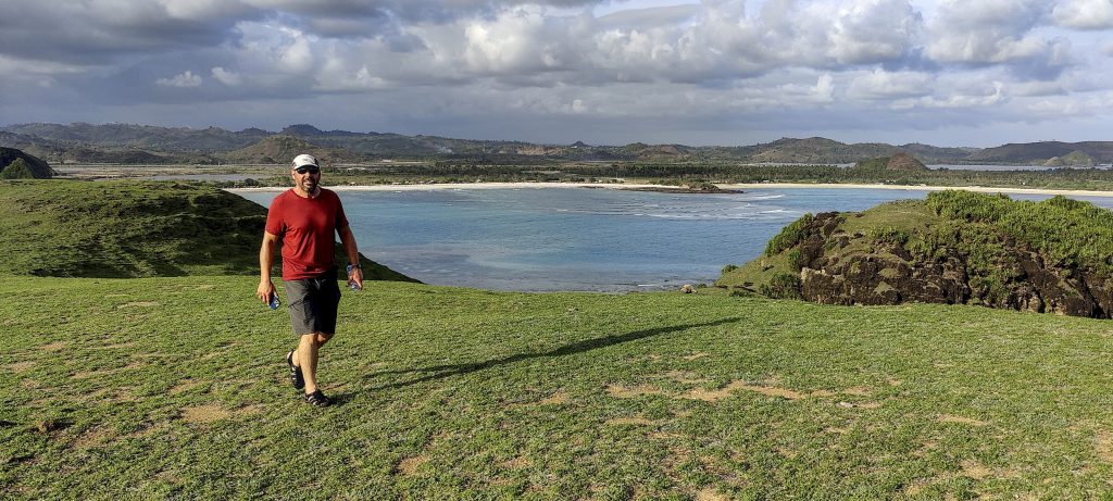
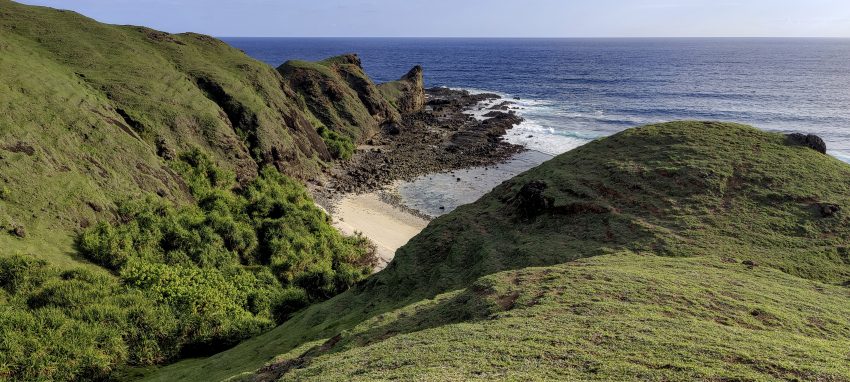
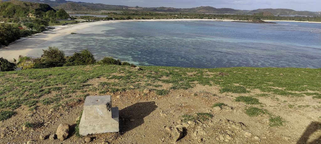
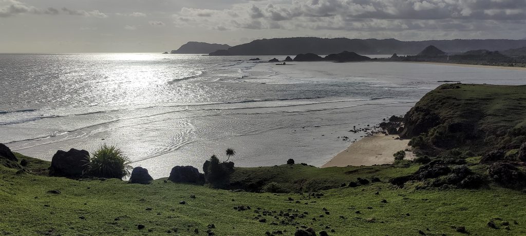
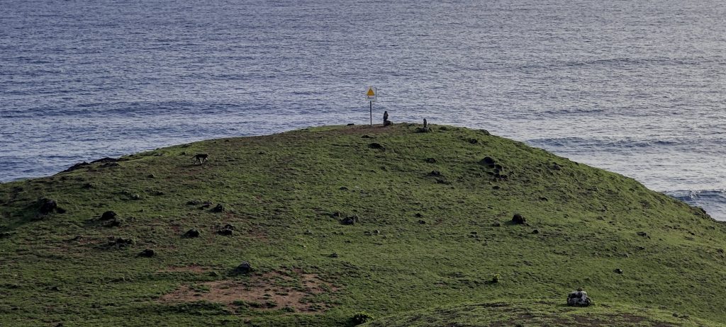
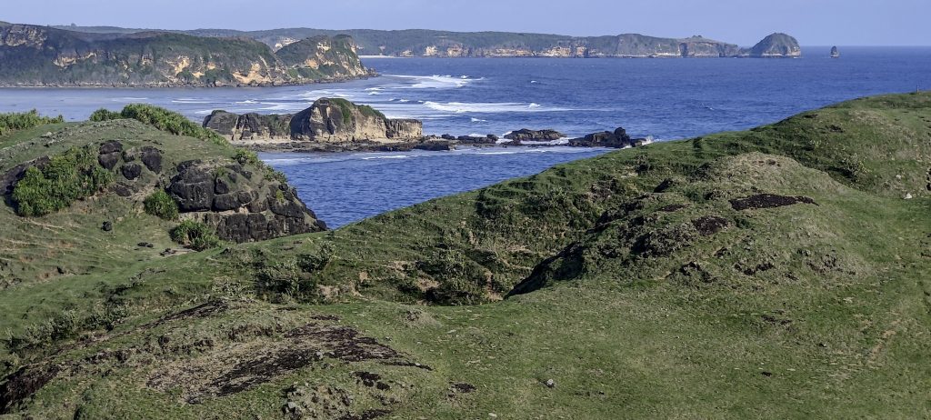
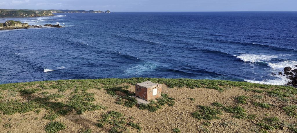
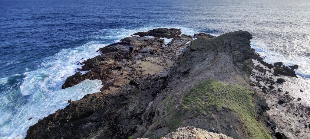
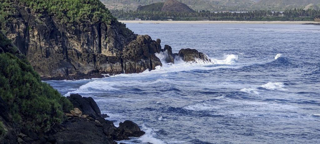
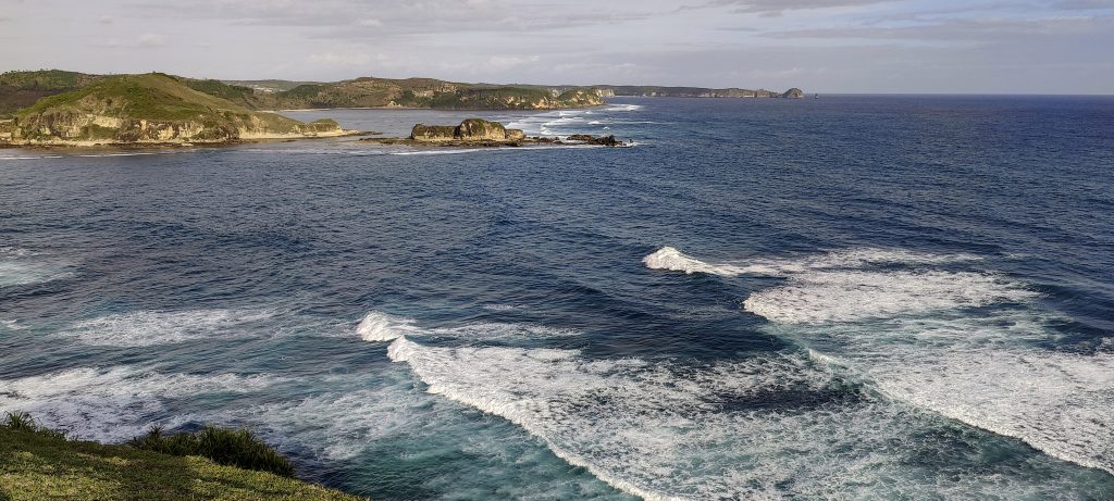
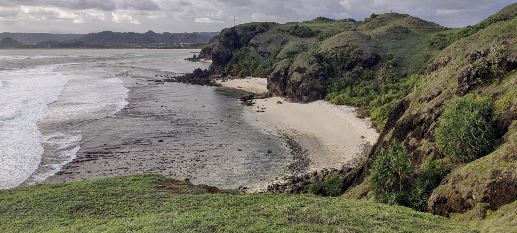
The hills and precipices, covered with low grass, are more reminiscent of England than of an island on the equator. We climb the first higher hill, and it is immediately clear that the highest point is a couple of hundred meters away. Both on the first hill and at the highest point, we find triangulation columns. From the top, there are great views of the surrounding bays and wild beaches. A few more minutes, and I reach the end of the islet.

Triangulation pillar on the lower peak
Few more empty beaches
Peakbagging monkeys
Nice view of remote islets and cliffs
High point with triangulation pillar
I go around the very end of the headland. There is an easy path leading to it.
Head
Clifs

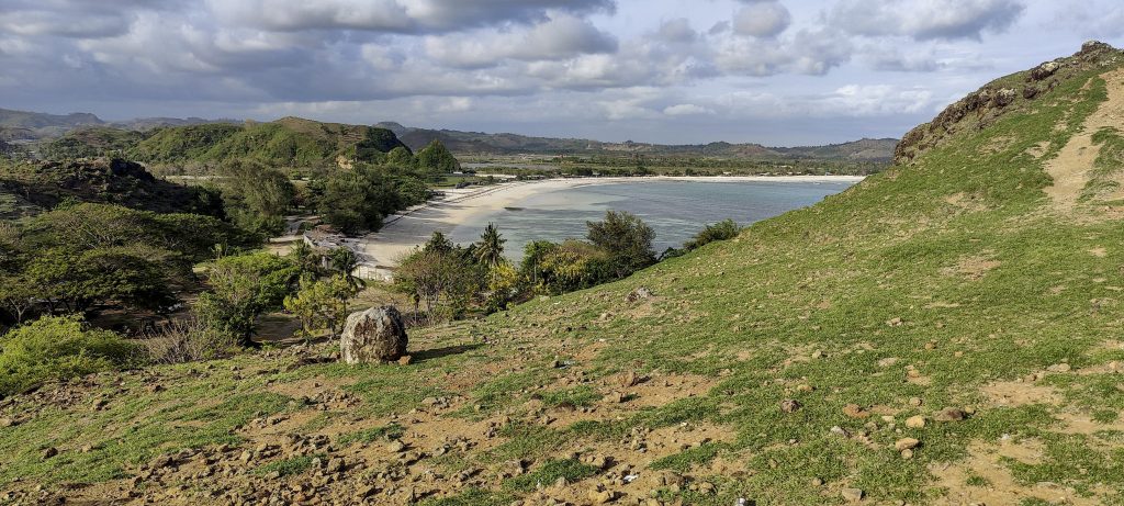
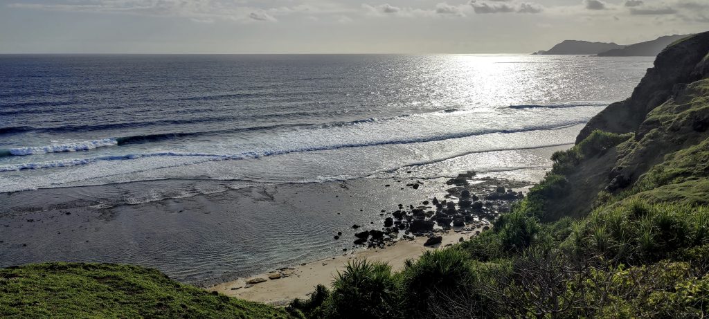
We head back, visiting another hill overlooking the Indian Ocean, which has been submerged by the tide. On the way, we find and measure the lowest point of the saddle. It is located where a new, but still unfinished, tarmac road has been built. On the way back, I see that the actual saddle, maybe 5 meters lower, could be a few hundred meters away, in the bush near the farmhouse. Anyway, 39 meters of prominence is not bad either.

Calm and clear evening
Islets again
Sandy beaches
More or less the entire cape
One more beach
Ocean..
Giant milkweed. Calotropis gigantea ??

We’re on our way to the hotel, with an early flight tomorrow to Surabaya, on the island of Java, where we are scheduled to climb the Gunung Lawu and Gunung Slamet mountains.


Bukit Bongo59 m altitude
39 m prominence
RangesAsia - Malay Archipelago - Nusa Tengarra
Countries/regionsIndonesia - Nusa Tenggara Barat
Distance1.10 km up1.50 km down
Elevation58 m gain58 m loss
Time
0h20 up
0h05 other
0h30 down
0h55 total
Trailhead0 m altitude-8.9125550, 116.3191110
Difficultiesnone
LinksGPX trail
  • Malay Archipelago II 2022
  • « Gunung Rinjani
  • Lombok »

Mountain Ranges

Anatolia
Central Anatolia
Pontic Mountains
Southeast Anatolia
Taurus Mountains
Western Anatolia
Andes
Puna de Atacama
Atlas Mountains
High Atlas
Northwestern Atlas
Central America Ranges
Costa Rica-Panama Ranges
Central Central America
East China
Taiwan
Eastern Europe Ranges
Southeast Baltic Plains
Iberian Peninsula
Cordillera Cantabrica
Castile Ranges
Portugal-Galicia
Pyrenees
Intermountain West
Great Basin Ranges
Korea-Amur Area
Taebaek Sanmae
Malay Archipelago
Java
Nusa Tengarra
Sulawesi
Sumatra
Mid-Atlantic Islands
North Atlantic Islands
Mongolia Ranges
Altai
Gobi Desert Ranges
Hangay Mountains
Northwest Europe
Great Britain
North France-West Rhine Area
Pacific Ranges
Cascade Range
Northwest U.S. Coast Ranges
Sierra Nevada
Central and Southern California Ranges
Philippines
Central Philippines
Luzon
Mindanao
Southeast Asia
Malay Peninsula
Southeast South America
Pampas
Sierras de Cordoba
Southern Africa
Malawi Highlands
West Africa Mountains
Bight of Benin
Cameroon Mountains
Guinea Highlands

Countries / regions

Algeria
Ain Guezzam
Ain Salah
Aïn Témouchent
El Bayadh
Ghardaïa
Oran
Ouargla
Saïda
Sidi Bel Abbès
Tamanrasset
Argentina
Catamarca
Ciudad Autónoma de Buenos Aires
Córdoba
Jujuy
Salta
Tucumán
Belgium
Brussels Capital Region
Flemish Region
Cameroon
Southwest
China
Taiwan
Costa Rica
Alajuela
Cartago
Guanacaste
Heredia
Limón
San José
Czechia
Prague
Denmark
Greenland
France
Hauts-de-France
Occitania
Germany
Berlin
Niedersachsen
Indonesia
Bali
Jambi
Jawa Tengah
Jawa Timur
Nusa Tenggara Barat
Sulawesi Tengah
Sulawesi Utara
Sumatera Barat
Lithuania
Vilnius County
Mongolia
Bayankhongor
Govi-Altai
Khovd
Omnogovi
Ovorkhangai
Ulan Bator
Zavkhan
Morocco
Béni Mellal-Khénifra
Drâa-Tafilalet
Fez-Meknes
Marrakesh-Safi
Souss-Massa
Tangier-Tetouan-Al Hoceima
Mozambique
Zambezia
Netherlands
Gelderland
Noord-Holland
Zeeland
Nicaragua
Chinandega
Managua
Masaya
Rivas
Philippines
Bicol Region (V)
Cagayan Valley (II)
Calabarzon (IV-A)
Central Luzon (III)
Cordillera Administrative Region
Davao Region
Metro Manila
Soccsksargen (XII)
Western Visayas (VI)
Poland
Greater Poland Voivodeship
Masovian Voivodeship
Portugal
Castelo Branco
Leiria
Lisbon
Madeira
Santarém
Qatar
Ad-Dawhah
São Tomé and Príncipe
São Tomé Province
Sierra Leone
Northern Province
Western Area
Singapore
South Korea
Gyeongsangnam-do
Seoul
Spain
Aragón
Asturias
Castilla-La Mancha
Castilla y León
Catalonia
Islas Canarias
Switzerland
Zürich
Turkey
Antalya
Bitlis
Erzincan
Hakkâri
Igdir
Isparta
Kahraman Maras
Muğla
United Kingdom
England
Scotland
United States
California
Delaware
Florida
Maryland
Nevada
New Jersey
New York
Pennsylvania
South Carolina
Utah

TRIPS

2024
Southern Africa 2024
Mid-Atlantic Islands 2024
North America 2024
Anatolia 2024
Korea-Amur Area 2024
East China 2024
2023
Mongolia Ranges 2023
Philippines 2023
West Africa III 2023
West Africa II 2023
Iberian Peninsula 2023
West Africa 2023
Central America 2023
2022
Andes 2022
Northwest Europe 2022
Malay Archipelago III 2022
Malay Archipelago II 2022
Anatolia Mountains 2022
Iberian Peninsula 2022
Atlas Mountains 2022
North France-West Rhine Area 2022

archaeology (3) climb (157) food (2) hike (155) p30 (17) p50 (4) p100 (24) p300 (12) p600 (17) p1000 (11) p1500 (76) ribu (10) sight (46) summary (16) trig (44) ultra (76)

1 591 km walked, 121 298 m climbed

©2025 p600.org | WordPress Theme by Superbthemes.com