Skip to content
Menu
p600.org
  • home
  • map
  • trips
  • about
p600.org

Mount Apo

hike | 2023-04-16

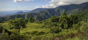
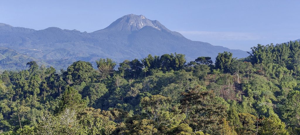
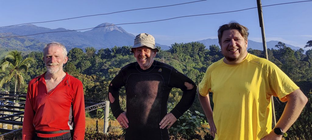
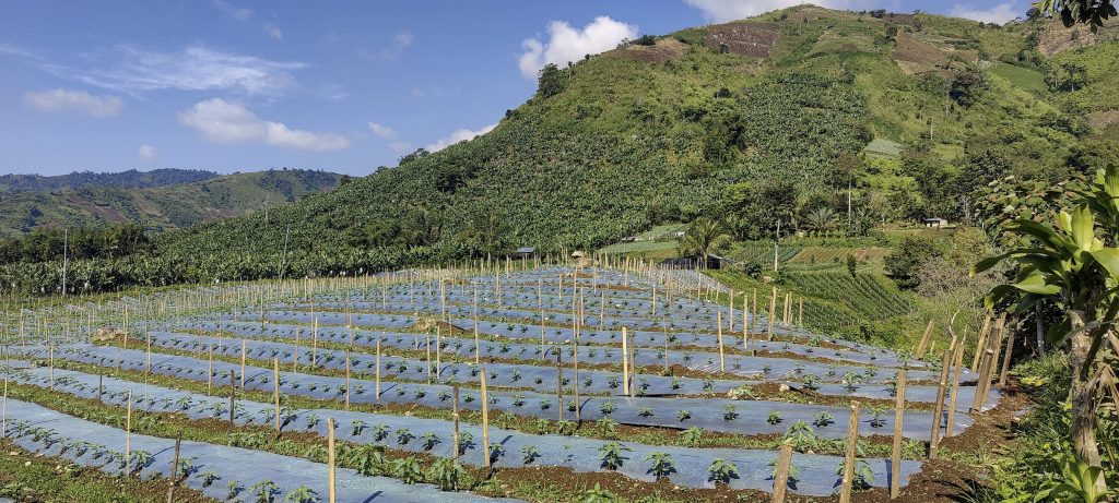
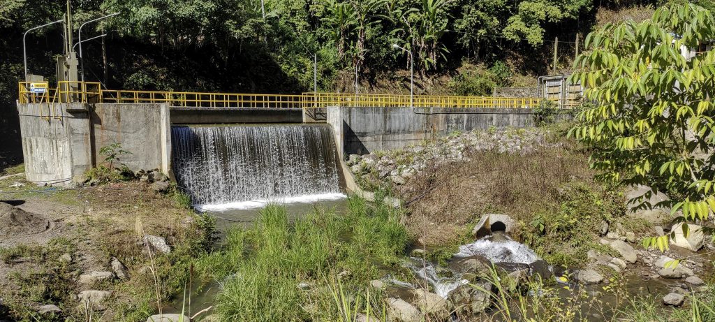
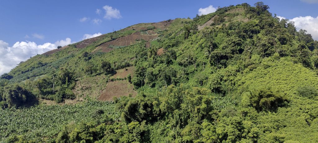
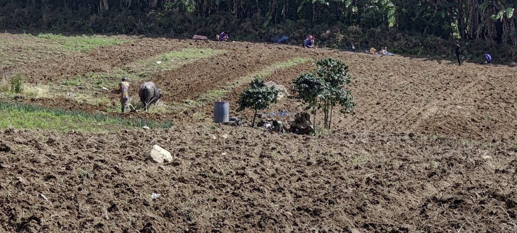
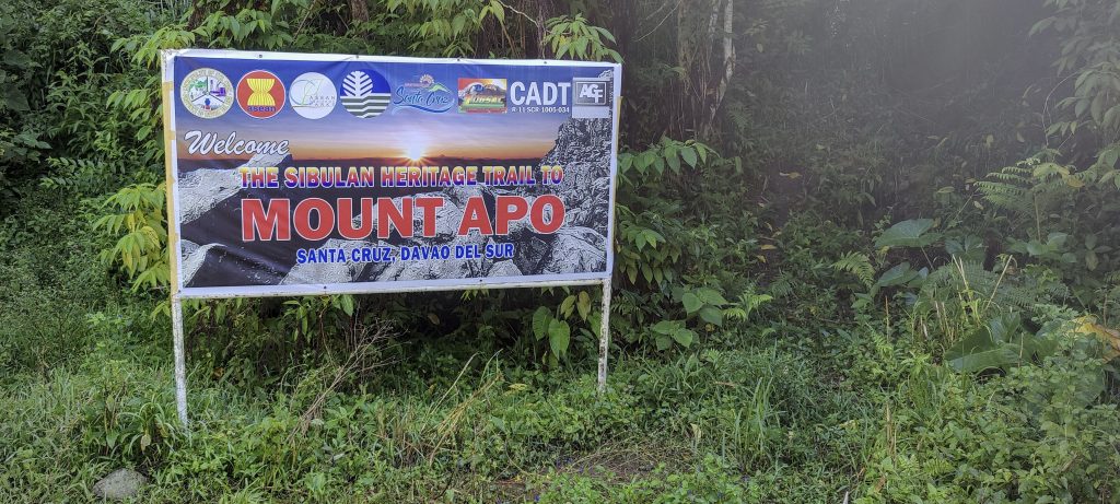
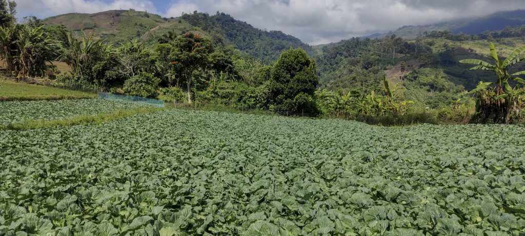
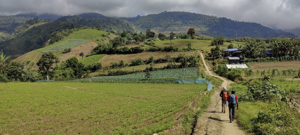
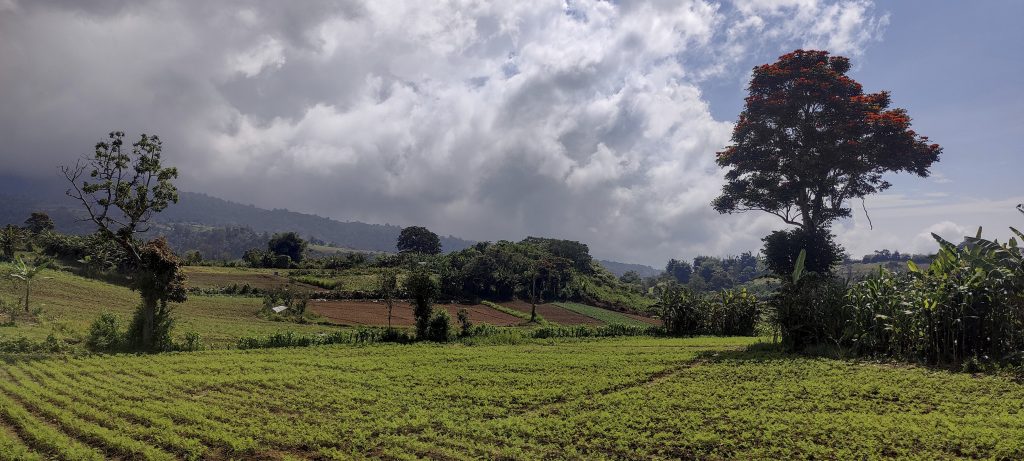
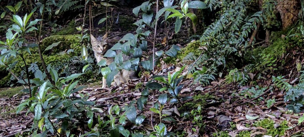
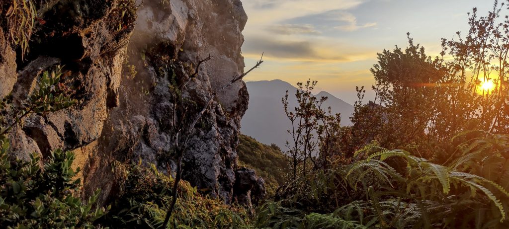
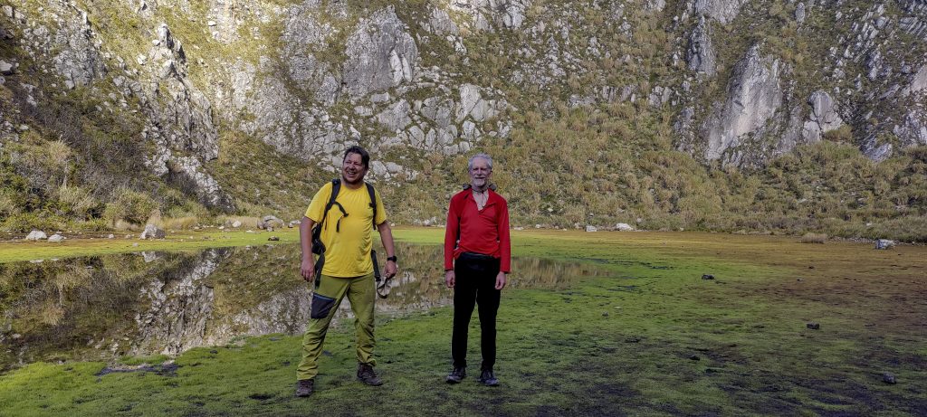
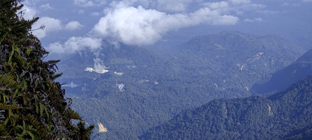
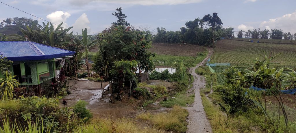
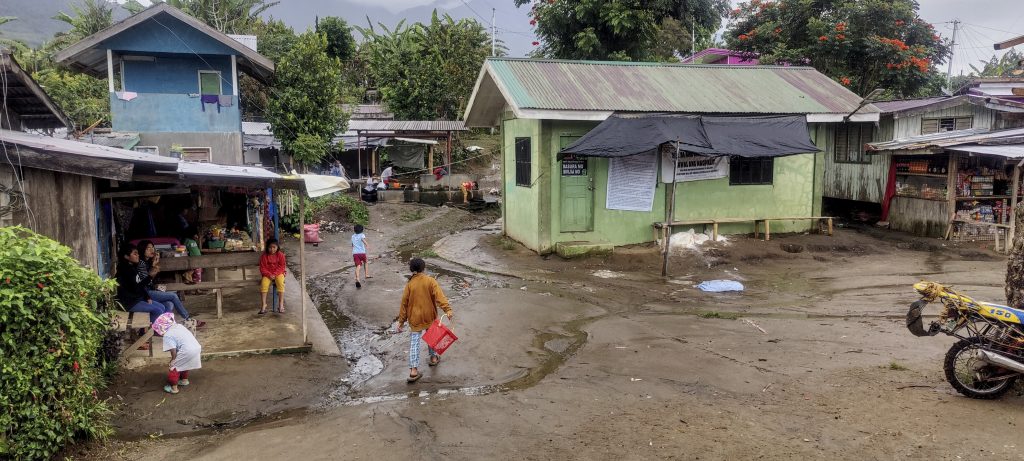
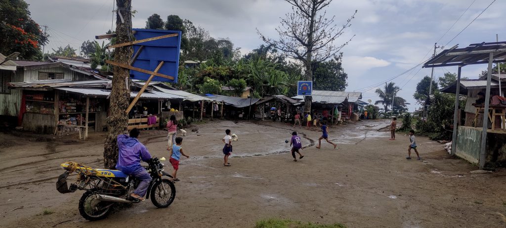
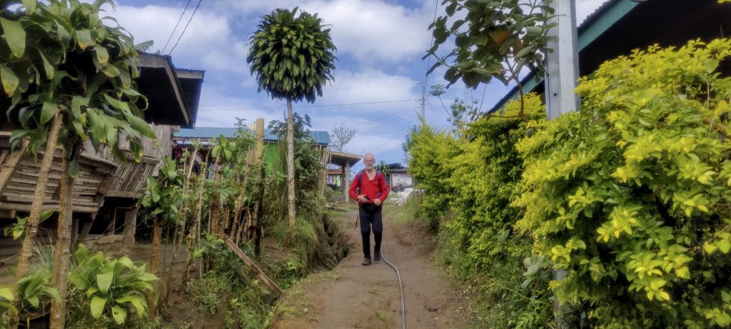
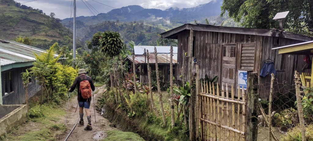
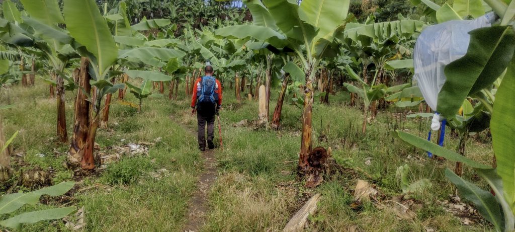
The highpoint of the Philippines is Mount Apo, located on Mindanao island. Naturally, it also claims the title of the island’s highest point. Globally, it ranks as the 99th most prominent mountain, boasting an altitude of 2,954 metres. There are several compelling reasons to ascend it. Apart from being an active stratovolcano, many local tribes regard it as a sacred ground. The trail, I soon discovered, was laden with intrigue, and the panoramas from the higher altitudes were simply breathtaking. We parked our vehicle roadside, changed, and embarked on our trek to the summit. Our route took us across agricultural expanses and over a dam via a steel bridge. The trail then skirted the fields, leading us to Culan’s last village. Here, we refreshed with cold beverages and registered our presence. Another two kilometers ushered us to the Tumpis settlement. After a brief hiatus by the local church, we resumed our quest towards the peak.

  • Day 1. From the car park at 1140m to the campsite at 2255m in 5h20
  • Day 2. From the camp at 2255m to the summit at 2954m in 3h15. Then down to the car park in 6h00 (including lunch brake).
Getting closer to Mount Apo
Many military block posts
Local butcher’s shop
Trikes are often equipped with an umbrella.
Rob, Petter and I (from left to right) with Mount Apo and cables in the background
Small dam near the park entrance
Oxen are used for ploughing
Fertile agricultural fields at the foot of the Mount Apo
Fire trees add interest to the landscape

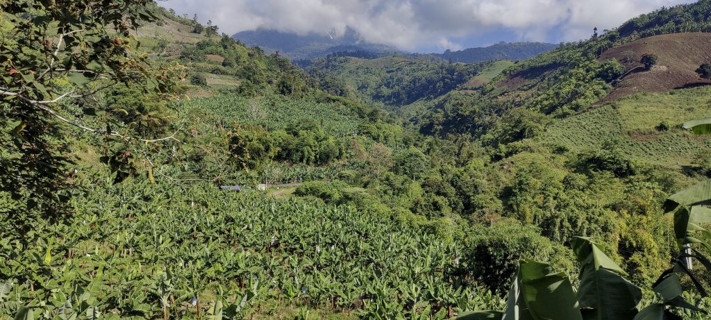
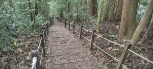
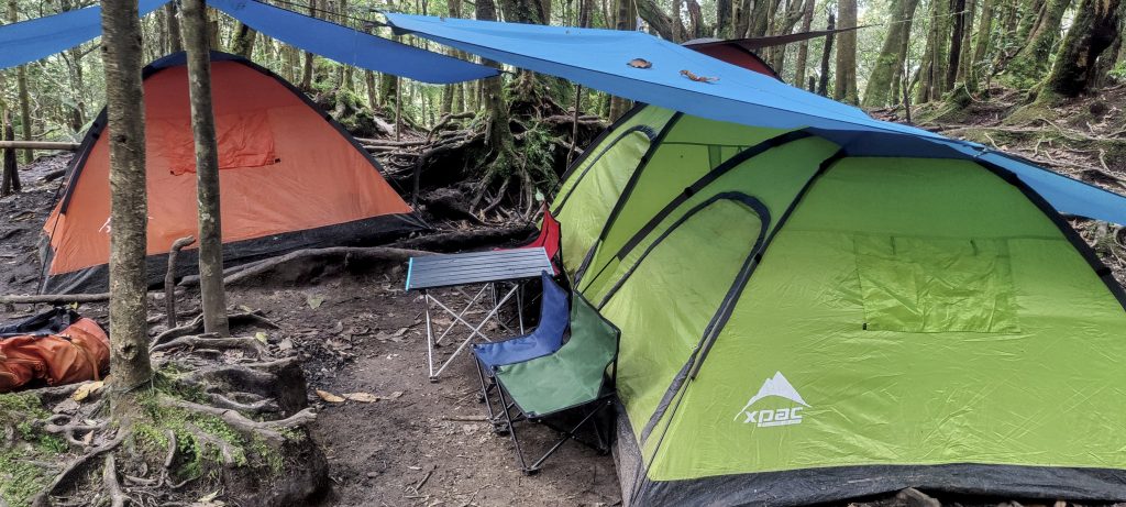
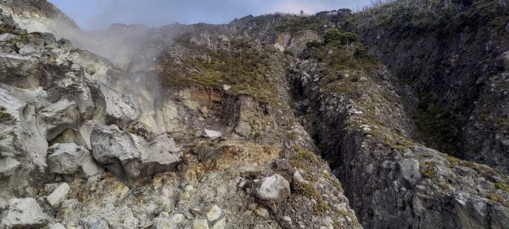
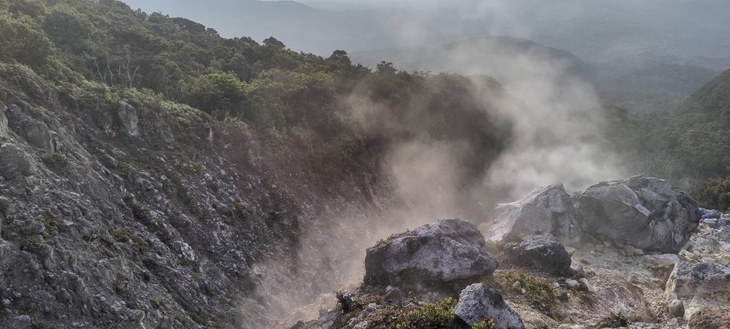
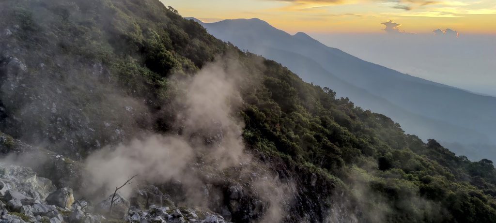
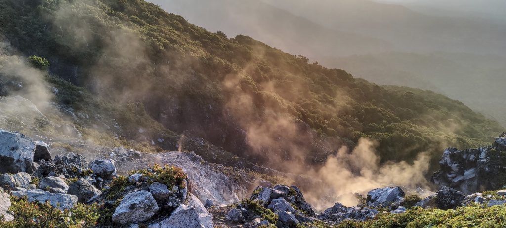
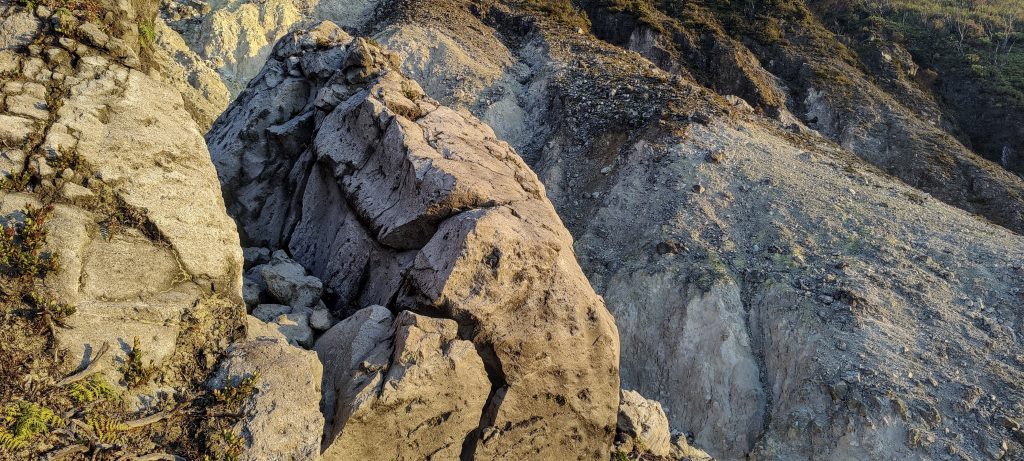
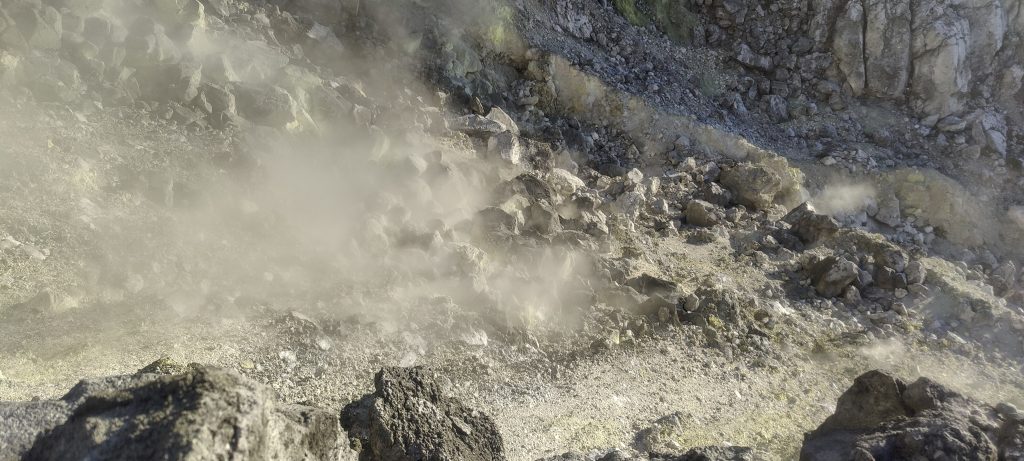
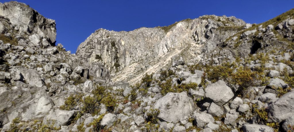
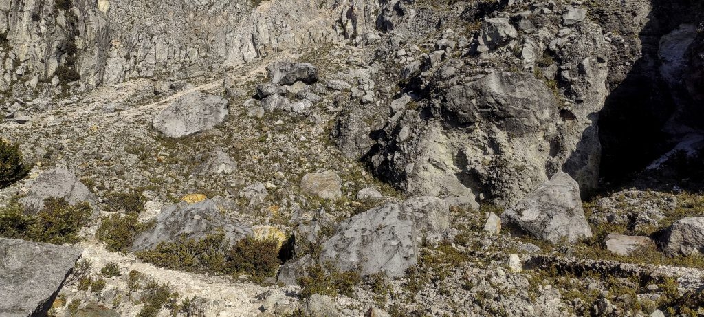
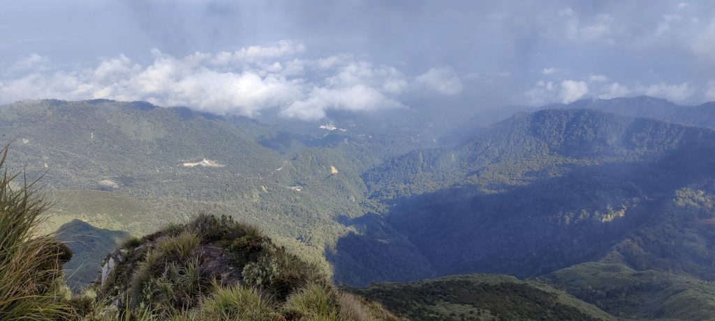
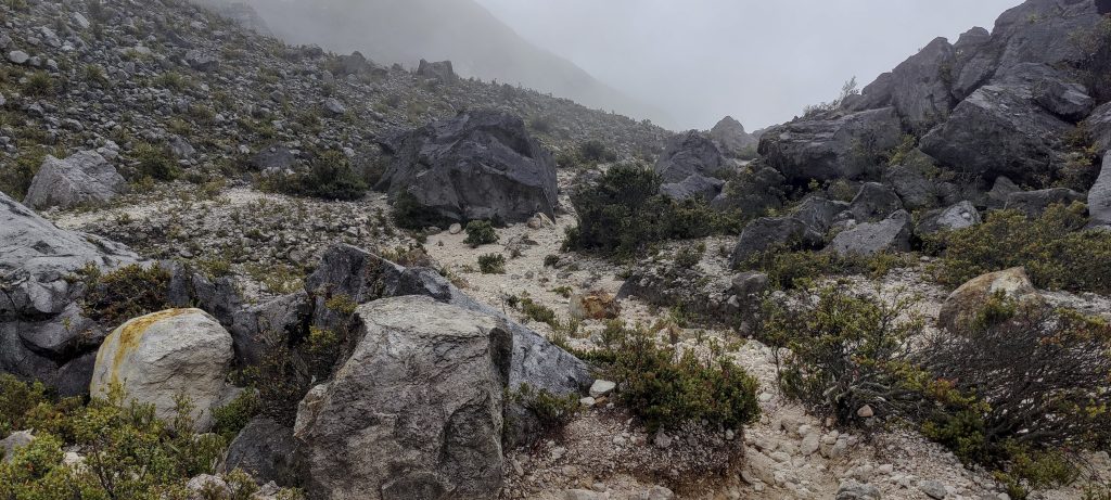
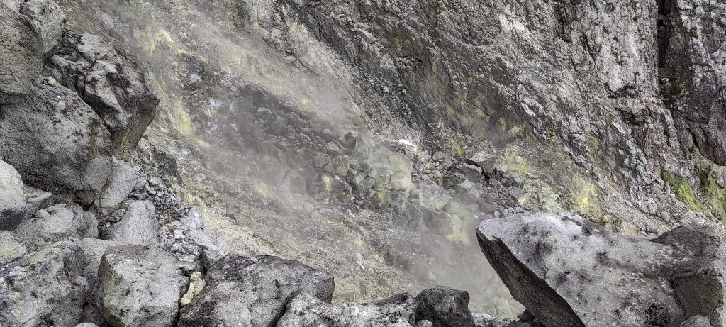
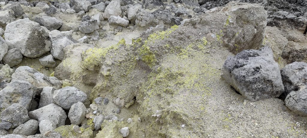
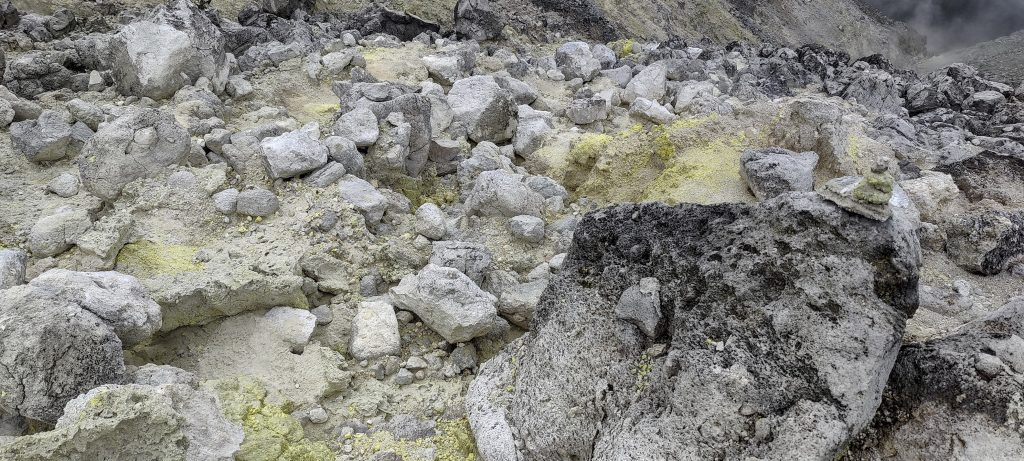
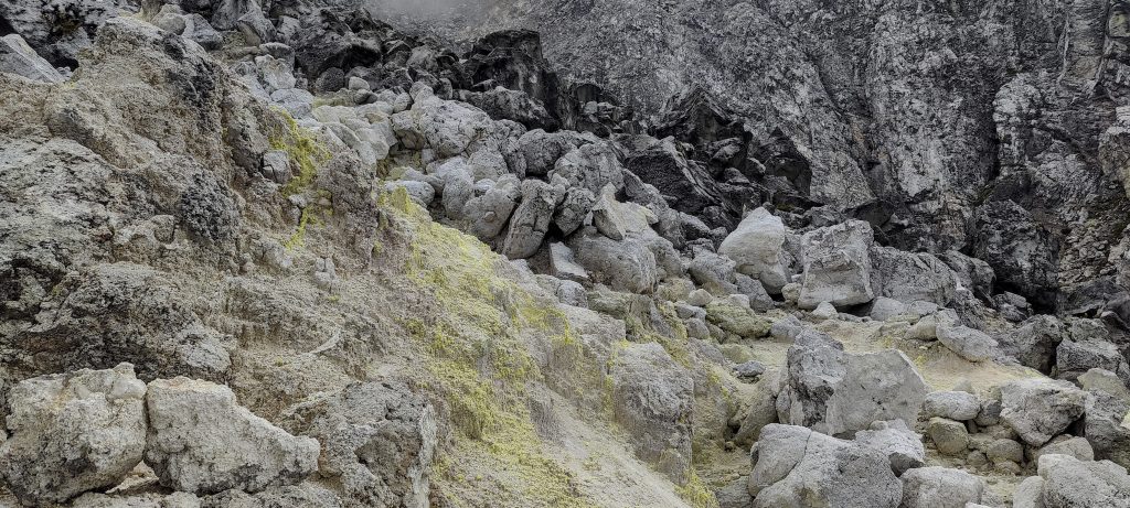
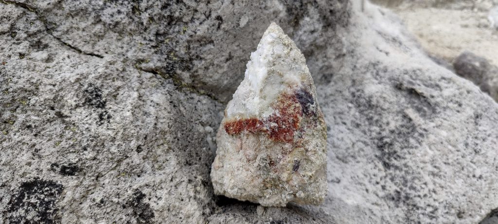
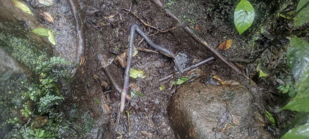
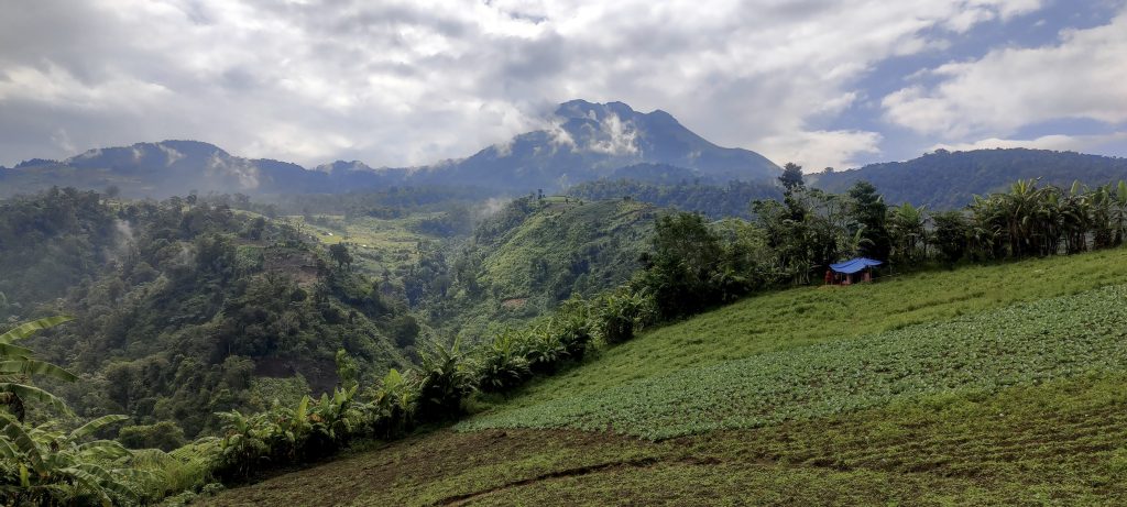
We soon found ourselves venturing into the jungle, tackling steeper terrain. Our path led us past Camp 1 and the Timikaran Camp 2, bustling with several individuals and pitched tents. The camp’s name pays homage to the endemic Timikaran tree species found in the vicinity. After pausing for lunch and covering another half-hour of trail, we reached our designated campsite. Here, we set up our tents, allowing ample time for relaxation, considering it was just post-lunch and we had the entire afternoon ahead. Albert recommended a visit to Boulders Opening to observe active vents, an idea we readily embraced. The spot was around half a kilometer away, and we strolled to an old lava flow area. Upon arrival, the sound and sight of active vents greeted us. The air was tinged with the aroma of sulfur, accompanied by wisps of smoke—an engaging and intriguing spectacle to behold.

Our tents and the campsite
The locals call this fungus – ‘elephant ear’.
The Boulder Opening is an active vent,
More smoke around
Professor of mathematics, explaining the meaning of the mountain prominence to Albert
Our delicious dinner is ready
Locals mention that there are small cats in the jungle, so one found our camp 🙂

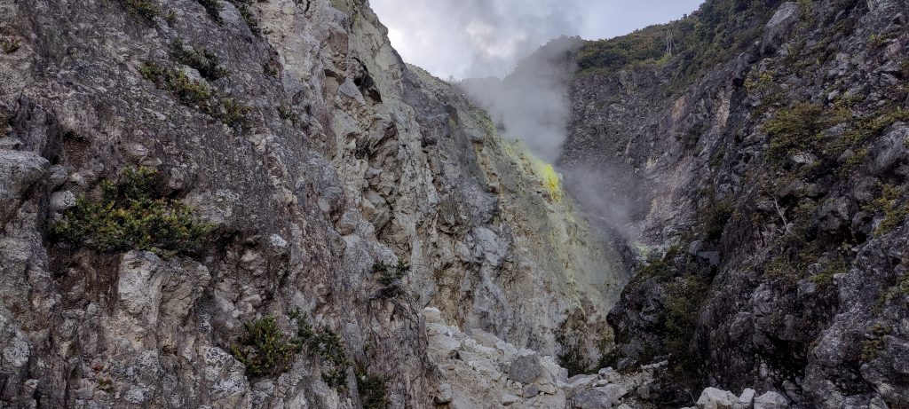
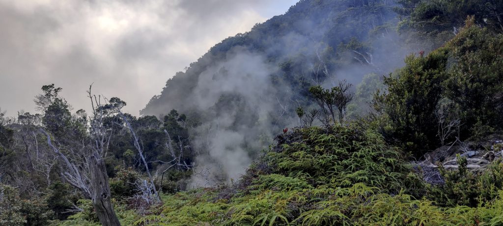
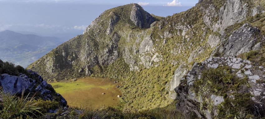
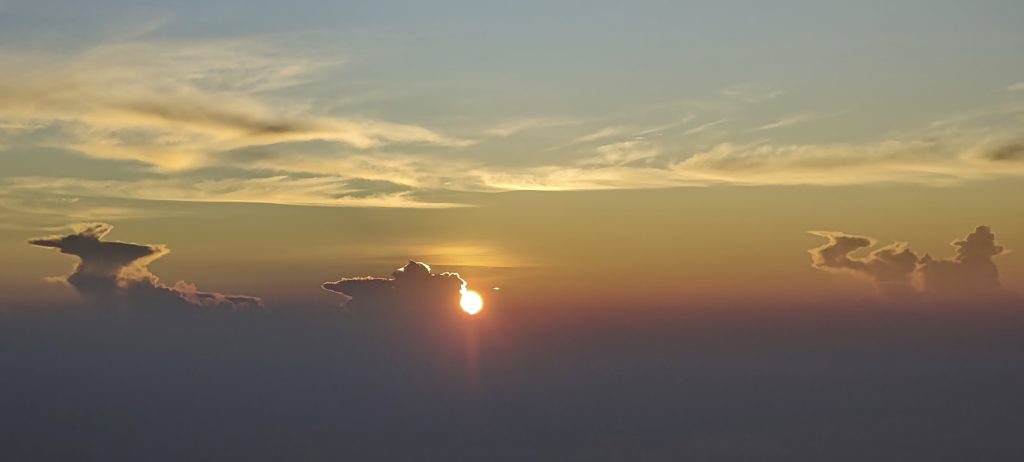
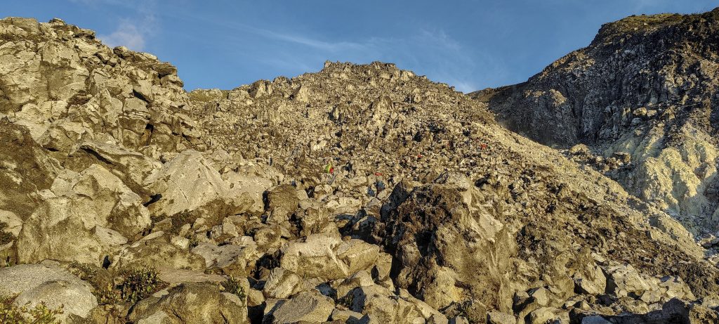
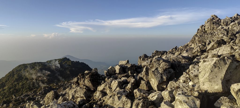
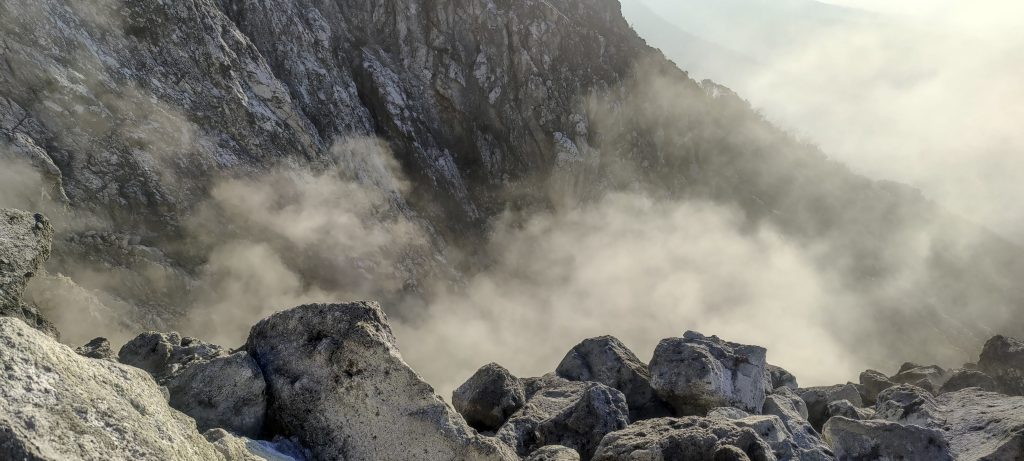
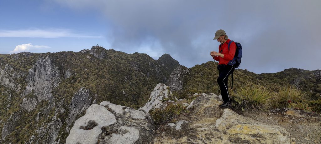
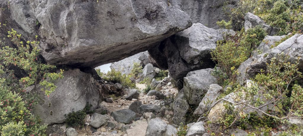
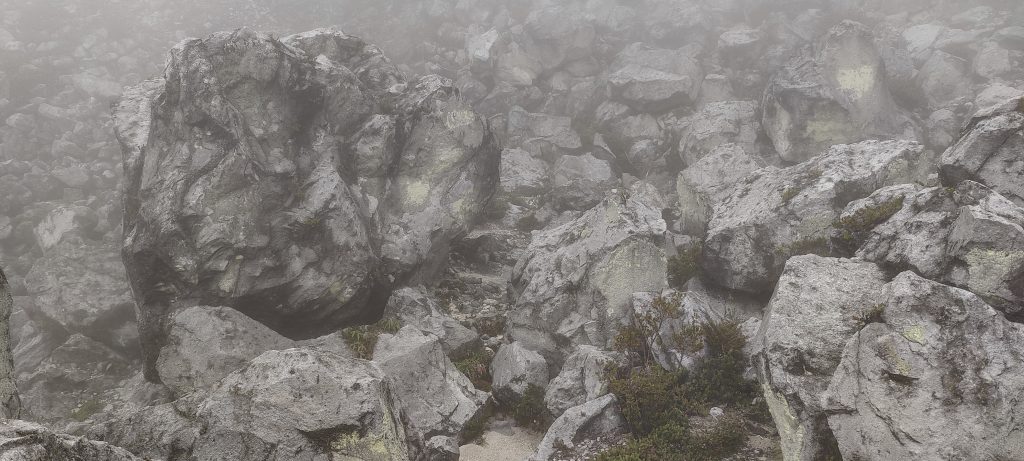
A multitude of individuals from Timikaran Camp 2 commence their ascent around 1 am. I can hear the strains of good music emanating from their loudspeakers as they pass by my tent at 2 am. Our day begins at 4 am, with a cup of coffee to invigorate us before we swiftly catch up with this group. To our surprise, they haven’t covered a significant distance. Indeed, when we reach the summit, we encounter only a handful of people, implying that we have overtaken several teams. Beyond Boulders Opening, we encounter numerous new vents emitting the distinct sulfur gases. Although the path isn’t glaringly obvious, its necessity is minimal. Following this, we traverse several hundred vertical meters of uncomplicated scrambling across boulder fields, eventually encountering well-defined trails leading to the sub-peaks and, ultimately, the true summit.

Boulder Opening in the morning
Lots of vents on the way up
Sunrise
Light scrambling above the tree line
Sulphur gases
Boulder field
Summit block is ahead
Terrain is fairly easy higher up
Small lake in the crater at the top
Me and Rob (from left to right) at the lake in the crater
Rob measuring the lower east summit
Petter and Rob with a hand level, double checking and making sure we are at the highest point.
Petter, Rob and I (from left to right) on the summit

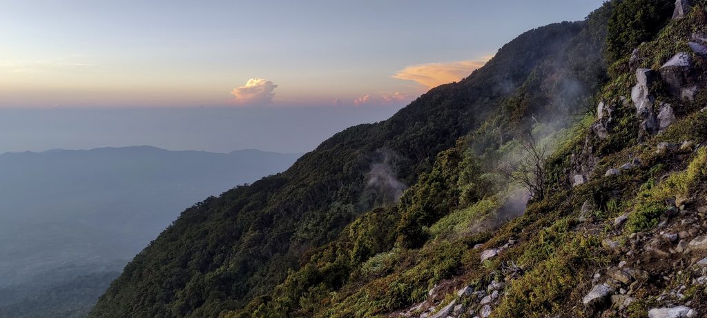
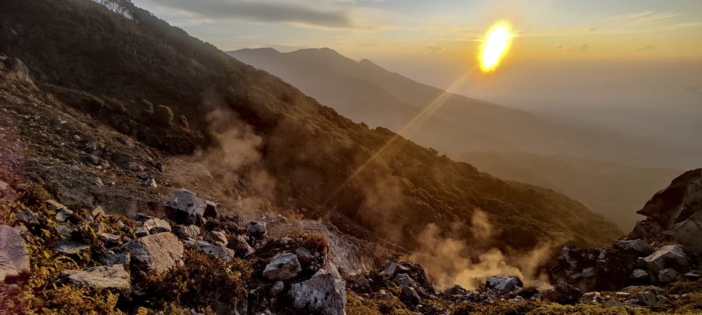
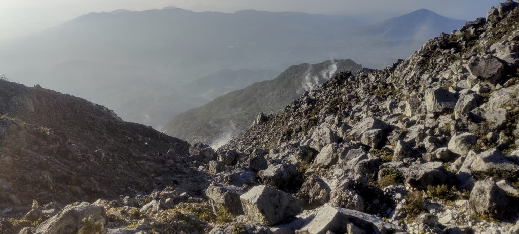
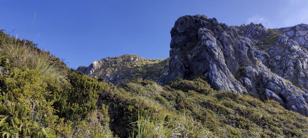
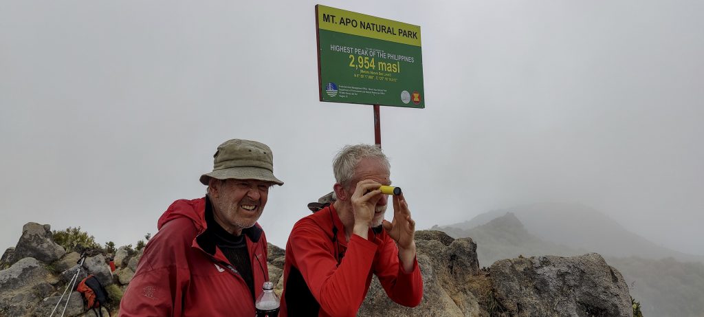
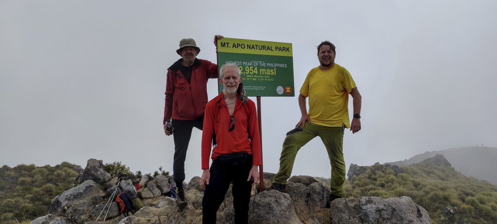
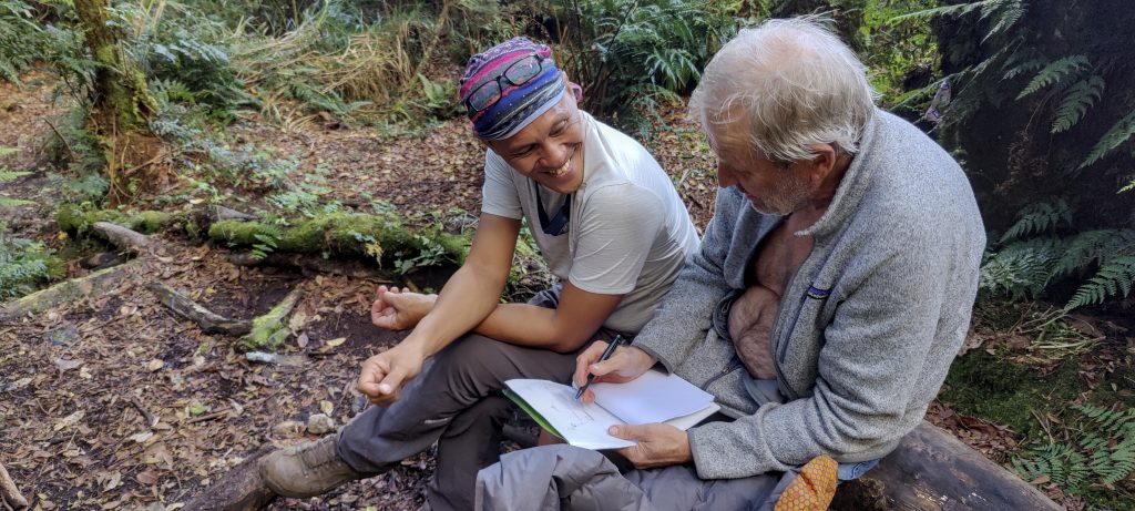
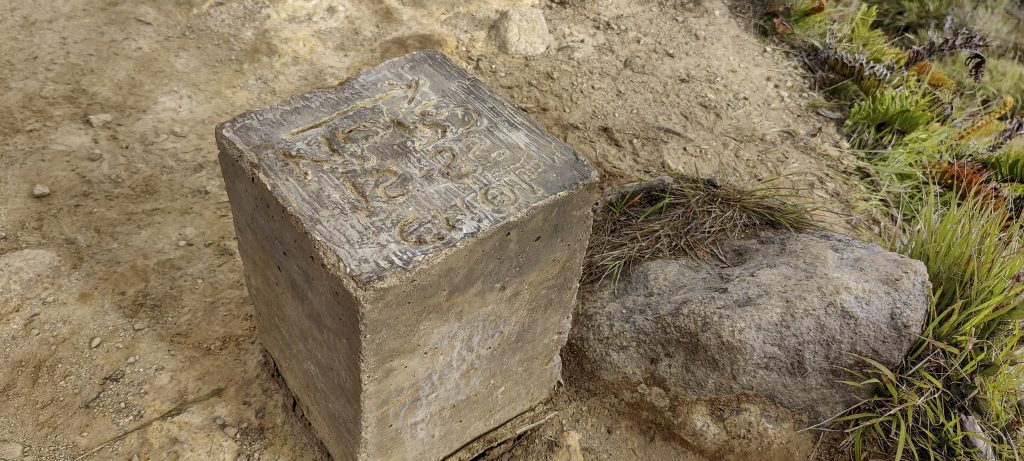
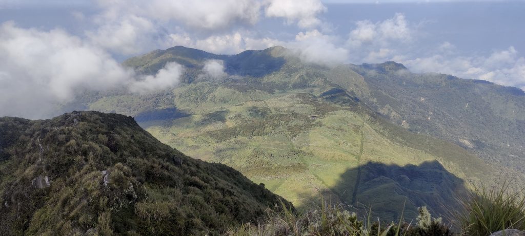
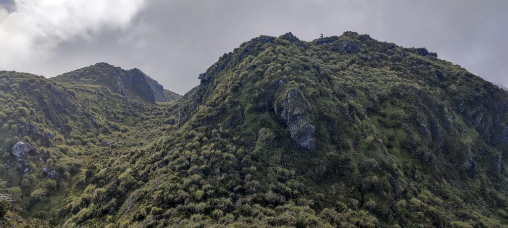
The summit is marked with a plaque, but on the lower summit, we find a plaque with a misleading height of about one hundred and fifty meters more than it actually is. There are a few other people on the top, Albert signs and gives us certificates. It’s a nice touch. The views around aren’t bad, but clouds are gathering, and soon the visibility isn’t as good as it was twenty minutes before.

Likely regional boundary marker

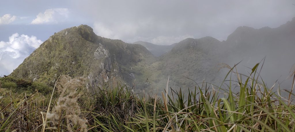
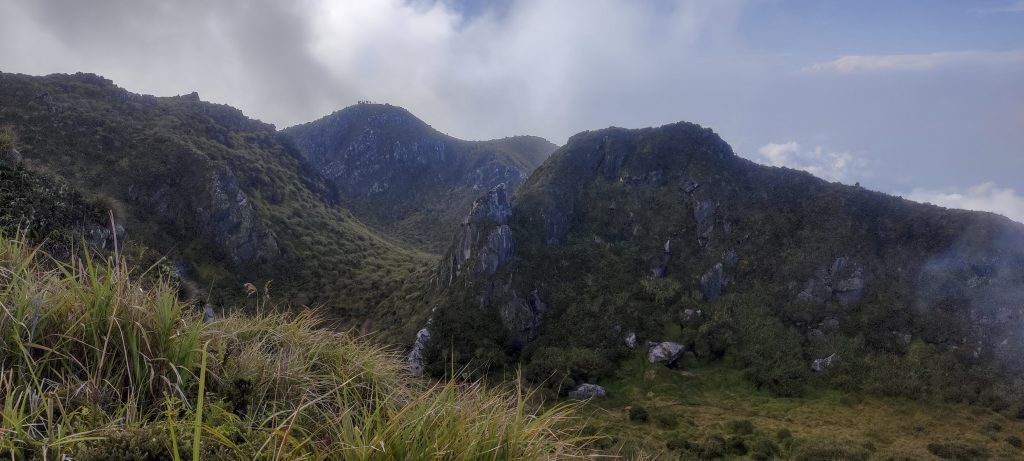
On the way up, we also visit the slightly lower northeastern summit, then climb the highest central peak, followed by the westernmost peak, and finally on the way back, we have to climb the southern summit. So, we visit four of the highest peaks on the mountain.

Views from the summit to the lower peaks
Looks like a geothermal power station
However, many of these berries along the way have doubts about whether they are edible.
I have never seen a size like this warm. This one is about 40 cm long.
Cicadas
Heavy rain on the way down

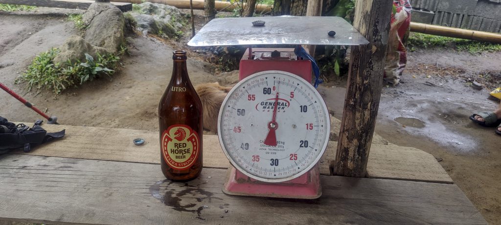
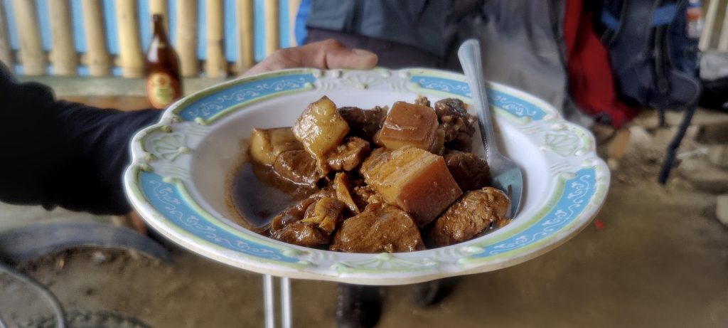
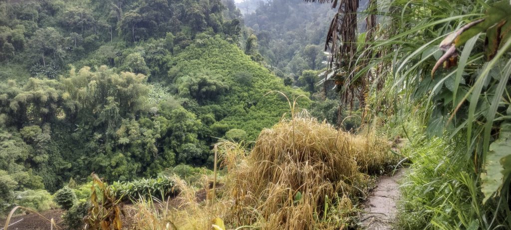
On the way down, we get caught in a heavy tropical downpour and spend half an hour in the local church, waiting for the rain to stop. But the rain stops as quickly as it started, and we descend to the village of Culan, where we take a short break with a cold beer and a snack. It’s a very refreshing moment.

Return to the village of Culan
Beer is sold in ‘proper’ size bottles. Porters quickly prepared a traditional snack for us
Rob descending
Beautiful jungle seen from the trail

After reaching the car, we change and head back to Davao. An excellent start to the trip. One more ultra mountain, one more range highpoint, one more island highpoint, and finally one more country highpoint are completed. Tomorrow, before heading to Mount Matutum, we will also detour to Puting Bato, the highest point of Samal Island.


Mount Apo2954 m altitude
2954 m prominence
904.86 km isolation
RangesPhilippines - Mindanao
Countries/regionsPhilippines - Davao Region
Distance9.50 km up9.50 km down
Elevation1873 m gain1873 m loss
Time
8h00 up
16h20 other
6h00 down
30h20 total
Trailhead2954 m altitude6.9552220, 125.3170000
RouteFrom the village of Culan, where we checked in, we followed gentle slopes through agricultural fields and then entered the jungle. We set up camp just below the tree line, and there was a good trail leading up to the Boulder Opening with its active vents. Later, we scrambled over boulders and then followed fairly well-defined trails to the crater lake. The last section to the summit was steeper but not difficult, with a good trail to follow. On the descent, we took the same route.
DifficultiesBoulder field that required us to jump over boulders.
LinksGPX trail
  • Philippines 2023
  • « Bukit Timah
  • Puting Bato »

Mountain Ranges

Anatolia
Central Anatolia
Pontic Mountains
Southeast Anatolia
Taurus Mountains
Western Anatolia
Andes
Puna de Atacama
Atlas Mountains
High Atlas
Northwestern Atlas
Central America Ranges
Costa Rica-Panama Ranges
Central Central America
East China
Taiwan
Eastern Europe Ranges
Southeast Baltic Plains
Iberian Peninsula
Cordillera Cantabrica
Castile Ranges
Portugal-Galicia
Pyrenees
Intermountain West
Great Basin Ranges
Korea-Amur Area
Taebaek Sanmae
Malay Archipelago
Java
Nusa Tengarra
Sulawesi
Sumatra
Mid-Atlantic Islands
North Atlantic Islands
Mongolia Ranges
Altai
Gobi Desert Ranges
Hangay Mountains
Northwest Europe
Great Britain
North France-West Rhine Area
Pacific Ranges
Cascade Range
Northwest U.S. Coast Ranges
Sierra Nevada
Central and Southern California Ranges
Philippines
Central Philippines
Luzon
Mindanao
Southeast Asia
Malay Peninsula
Southeast South America
Pampas
Sierras de Cordoba
Southern Africa
Malawi Highlands
West Africa Mountains
Bight of Benin
Cameroon Mountains
Guinea Highlands

Countries / regions

Algeria
Ain Guezzam
Ain Salah
Aïn Témouchent
El Bayadh
Ghardaïa
Oran
Ouargla
Saïda
Sidi Bel Abbès
Tamanrasset
Argentina
Catamarca
Ciudad Autónoma de Buenos Aires
Córdoba
Jujuy
Salta
Tucumán
Belgium
Brussels Capital Region
Flemish Region
Cameroon
Southwest
China
Taiwan
Costa Rica
Alajuela
Cartago
Guanacaste
Heredia
Limón
San José
Czechia
Prague
Denmark
Greenland
France
Hauts-de-France
Occitania
Germany
Berlin
Niedersachsen
Indonesia
Bali
Jambi
Jawa Tengah
Jawa Timur
Nusa Tenggara Barat
Sulawesi Tengah
Sulawesi Utara
Sumatera Barat
Lithuania
Vilnius County
Mongolia
Bayankhongor
Govi-Altai
Khovd
Omnogovi
Ovorkhangai
Ulan Bator
Zavkhan
Morocco
Béni Mellal-Khénifra
Drâa-Tafilalet
Fez-Meknes
Marrakesh-Safi
Souss-Massa
Tangier-Tetouan-Al Hoceima
Mozambique
Zambezia
Netherlands
Gelderland
Noord-Holland
Zeeland
Nicaragua
Chinandega
Managua
Masaya
Rivas
Philippines
Bicol Region (V)
Cagayan Valley (II)
Calabarzon (IV-A)
Central Luzon (III)
Cordillera Administrative Region
Davao Region
Metro Manila
Soccsksargen (XII)
Western Visayas (VI)
Poland
Greater Poland Voivodeship
Masovian Voivodeship
Portugal
Castelo Branco
Leiria
Lisbon
Madeira
Santarém
Qatar
Ad-Dawhah
São Tomé and Príncipe
São Tomé Province
Sierra Leone
Northern Province
Western Area
Singapore
South Korea
Gyeongsangnam-do
Seoul
Spain
Aragón
Asturias
Castilla-La Mancha
Castilla y León
Catalonia
Islas Canarias
Switzerland
Zürich
Turkey
Antalya
Bitlis
Erzincan
Hakkâri
Igdir
Isparta
Kahraman Maras
Muğla
United Kingdom
England
Scotland
United States
California
Delaware
Florida
Maryland
Nevada
New Jersey
New York
Pennsylvania
South Carolina
Utah

TRIPS

2024
Southern Africa 2024
Mid-Atlantic Islands 2024
North America 2024
Anatolia 2024
Korea-Amur Area 2024
East China 2024
2023
Mongolia Ranges 2023
Philippines 2023
West Africa III 2023
West Africa II 2023
Iberian Peninsula 2023
West Africa 2023
Central America 2023
2022
Andes 2022
Northwest Europe 2022
Malay Archipelago III 2022
Malay Archipelago II 2022
Anatolia Mountains 2022
Iberian Peninsula 2022
Atlas Mountains 2022
North France-West Rhine Area 2022

archaeology (3) climb (157) food (2) hike (155) p30 (17) p50 (4) p100 (24) p300 (12) p600 (17) p1000 (11) p1500 (76) ribu (10) sight (46) summary (16) trig (44) ultra (76)

1 591 km walked, 121 298 m climbed

©2025 p600.org | WordPress Theme by Superbthemes.com