Skip to content
Menu
p600.org
  • home
  • map
  • trips
  • about
p600.org

Volcán Cosigüina

hike | 2023-01-07
859 m altitude, 828 m prominence, 43.27 km isolation

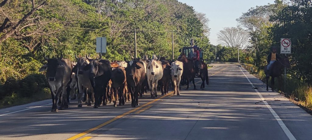
After breakfast we say goodbye to Renee. She and Dave have successfully climbed some peaks in Honduras and yesterday we climbed together Volcán San Cristóbal in Nicaragua. Today she is on her way to Managua to fly home, Dave and I head for the Gulf of Fonseca, where the Cosigüina volcano rises on the coast.

On the way to the mountain
A reasonably good and popular walk to the viewpoint

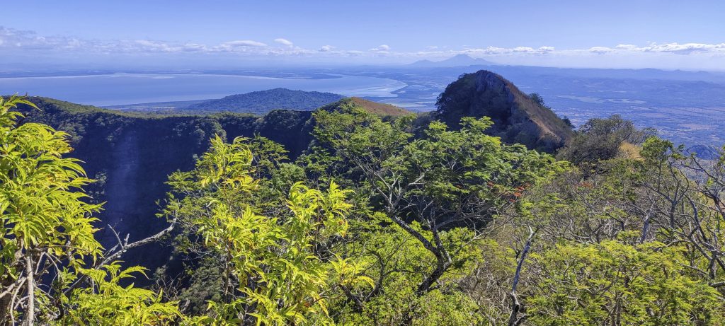
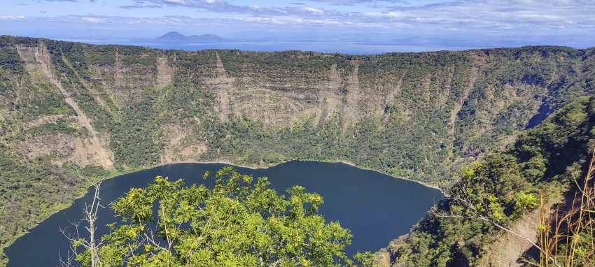
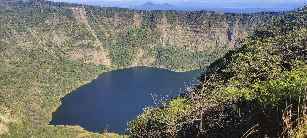
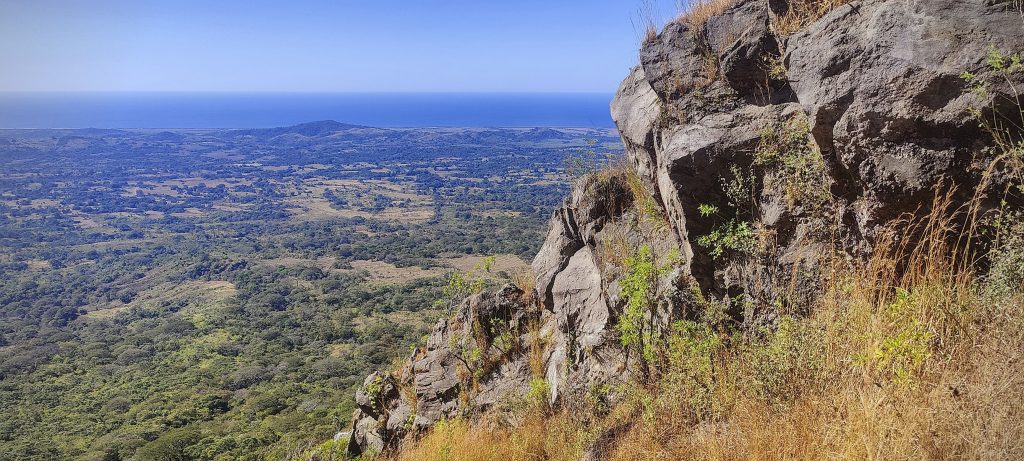
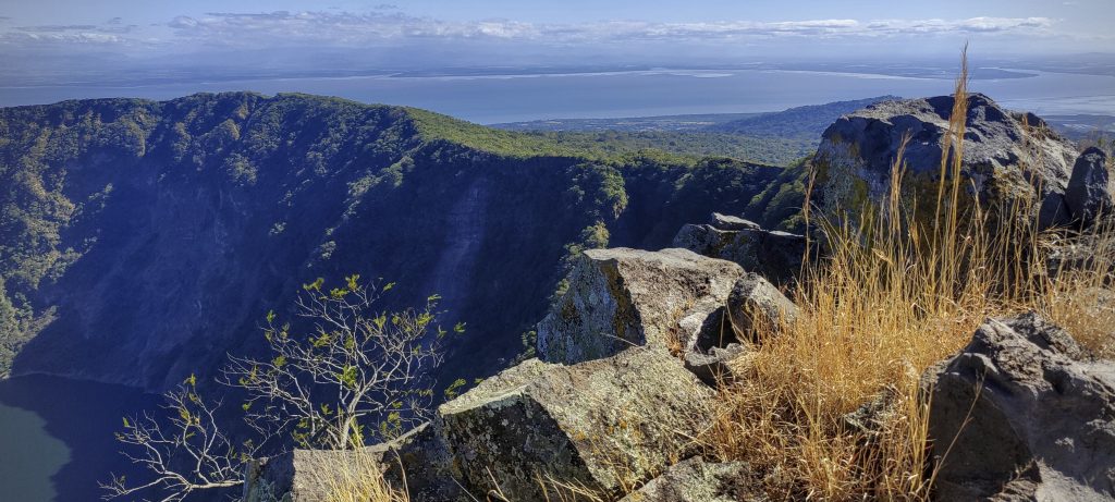
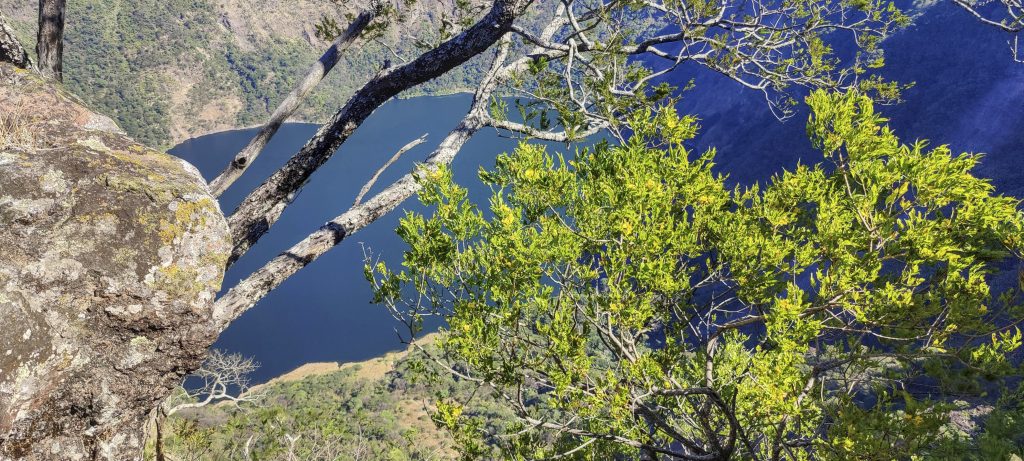
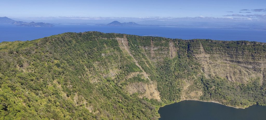
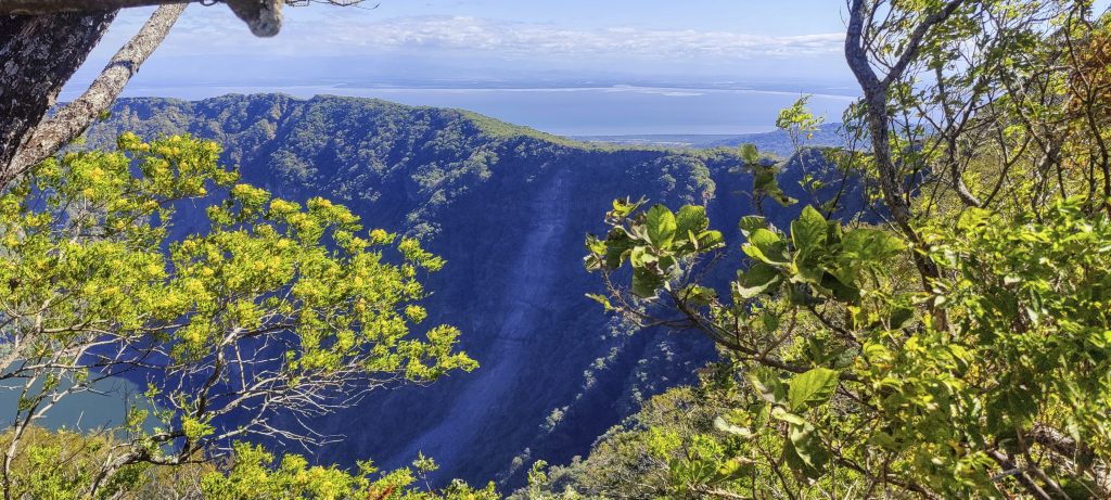
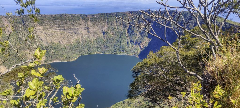
And indeed, much to our surprise, we ended up parking a lot closer to the trailhead than we had planned. All the maps showed a track, but in reality we found a wide gravel road. We park the car in the designated car park and enjoy an easy walk in the shade of the forest. There is a good tourist trail to the crater viewpoint. The crater is very deep and a few hundred metres below, at the bottom of the crater, there is a lake. It is very beautiful, but the highest point is almost two kilometres away.

A spectacular crater with a lake
The actual summit can be seen in the distance (right).

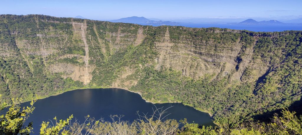
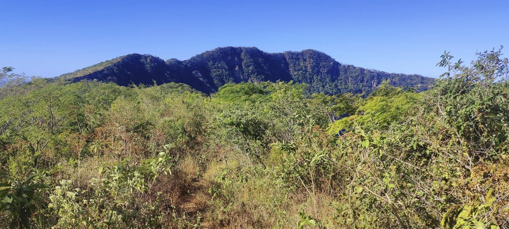
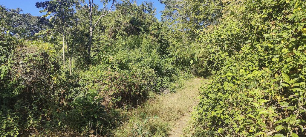
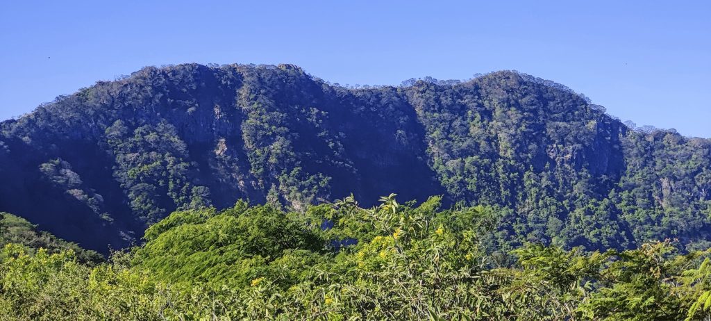
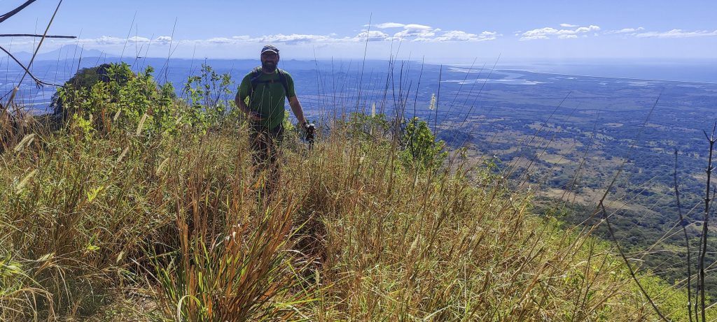
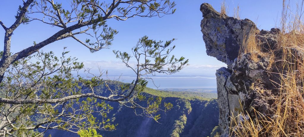
When I was gathering information about the summit, I saw trails in several sections of the satellite images. Often the trail follows the crater ridge and people like to walk on the rim. This time it was no exception, from the viewpoint we walked about a kilometre along a trail that was easy to follow. Along the way we climbed some lower peaks and traversed the slopes several times. After a kilometre, the path becomes less obvious and we have to traverse slippery, steep grassy slopes. There are two bands of rock to climb and cross, but nothing too difficult. There were a couple of times where we lost the path, but on the descent it was much easier to follow.

Volcanoes of El Salvador and Honduras
A closer look at the true summit (right)
View point in the distance
Lake from the rim with El Salvador volcanoes in the background

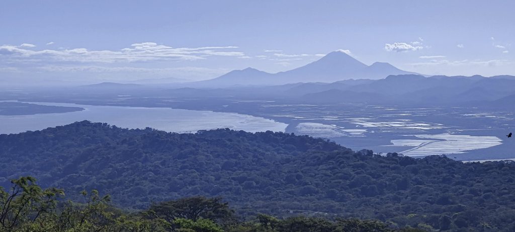
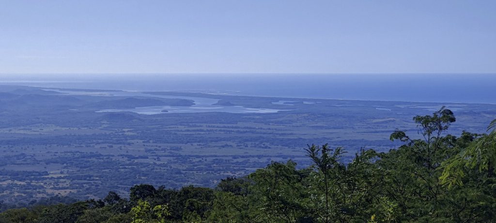
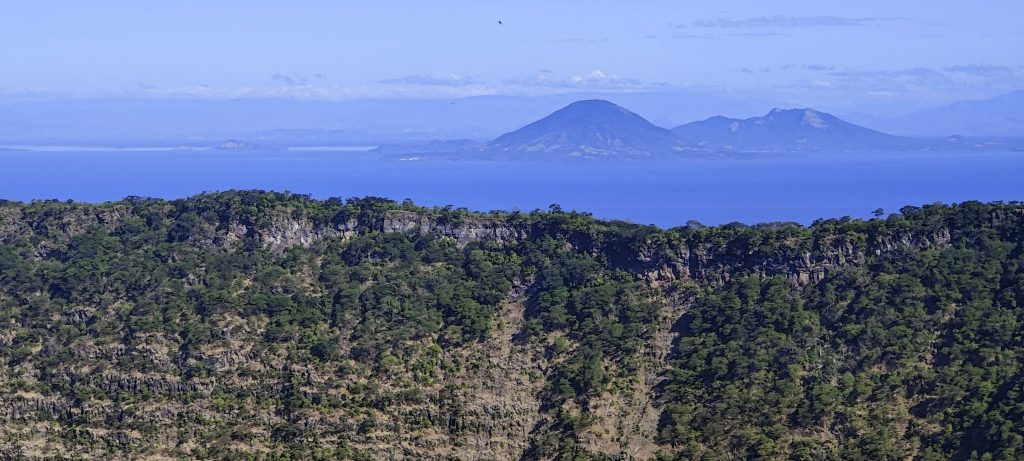
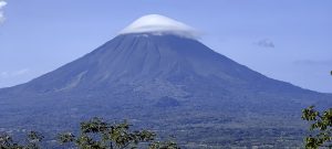
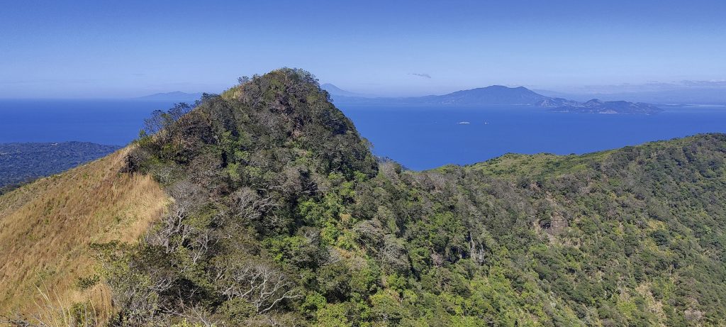
The sun is beating down and the wind is very light. Somehow, over slippery grass, we reach the top. The view is magnificent, with El Salvador’s San Miguel volcano in the distance. It is quiet, there is no rumbling, only today we found out that after a few weeks its activity has decreased and it can be climbed again. To the east, in the Gulf of Fonseca, we can see Volcán del Tigre, an island highpoint in Honduras. The Pacific Ocean to the west and the relatively flat southeast.

The last few metres to the top are easy to do
Stone bands for crossing
View from above

We take a break and return the same way. This time it is a bit more optimal, we can follow the path almost all the time. A short stop at a viewpoint, a tourist trail, and we are back at the car.

Dave at the summit
The true summit in retrospect
Views from the rim
Rim of the crater

It’s still midday and we’re on our way to Lake Nicaragua, home to the world’s most prominent lake mountain. We make a short detour and stop at the urbanised summit of Las Cumbres.

Going downhill

Volcán Cosigüina 859 m altitude
828 m prominence
43.27 km isolation
Ranges Central America Ranges - Central Central America
Countries/regions Nicaragua - Chinandega
Distance 4.40 km up 4.30 km down
Elevation 309 m gain 309 m loss
Time
1h35 up
0h10 other
1h25 down
3h10 total
Trailhead 549 m altitude 12.9739160, -87.5497220
Difficulties

Bushwhacking from the viewing platform to the actual summit

Links GPX trail
  • Central America 2023
  • « Volcán San Cristóbal
  • Las Cumbres »

Mountain Ranges

Anatolia
Taurus Mountains
Western Anatolia
Andes
Puna de Atacama
Atlas Mountains
High Atlas
Northwestern Atlas
Central America Ranges
Costa Rica-Panama Ranges
Central Central America
Eastern Europe Ranges
Southeast Baltic Plains
Iberian Peninsula
Cordillera Cantabrica
Castile Ranges
Portugal-Galicia
Pyrenees
Malay Archipelago
Java
Nusa Tengarra
Sulawesi
Sumatra
Northwest Europe
Great Britain
North France-West Rhine Area
Southeast South America
Pampas
Sierras de Cordoba
West Africa Mountains
Bight of Benin
Cameroon Mountains

Countries / regions

Algeria
Ain Guezzam
Ain Salah
Aïn Témouchent
El Bayadh
Ghardaïa
Oran
Ouargla
Saïda
Sidi Bel Abbès
Tamanrasset
Argentina
Catamarca
Ciudad Autónoma de Buenos Aires
Córdoba
Jujuy
Salta
Tucumán
Belgium
Brussels Capital Region
Flemish Region
Cameroon
Southwest
Costa Rica
Alajuela
Cartago
Guanacaste
Heredia
Limón
San José
Czechia
Prague
Denmark
Greenland
France
Hauts-de-France
Germany
Berlin
Niedersachsen
Indonesia
Bali
Jambi
Jawa Tengah
Jawa Timur
Nusa Tenggara Barat
Sulawesi Tengah
Sulawesi Utara
Sumatera Barat
Lithuania
Vilnius County
Morocco
Béni Mellal-Khénifra
Drâa-Tafilalet
Fez-Meknes
Marrakesh-Safi
Souss-Massa
Tangier-Tetouan-Al Hoceima
Netherlands
Gelderland
Noord-Holland
Zeeland
Nicaragua
Chinandega
Managua
Masaya
Rivas
Poland
Greater Poland Voivodeship
Masovian Voivodeship
Portugal
Castelo Branco
Leiria
Lisbon
Santarém
São Tomé and Príncipe
São Tomé Province
Spain
Aragón
Asturias
Castilla-La Mancha
Castilla y León
Switzerland
Zürich
Turkey
Antalya
Isparta
Muğla
United Kingdom
England
Scotland
United States
Delaware
Florida
Maryland
New Jersey
New York
South Carolina
Pennsylvania

TRIPS

2023
West Africa II 2023
Iberian Peninsula 2023
West Africa 2023
Central America 2023
2022
Andes 2022
Northwest Europe 2022
Malay Archipelago III 2022
Malay Archipelago II 2022
Anatolia Mountains 2022
Iberian Peninsula 2022
Atlas Mountains 2022
North France-West Rhine Area 2022

archaeology (3) climb (72) food (2) hike (71) p30 (6) p100 (9) p300 (8) p600 (13) p1000 (5) p1500 (34) ribu (4) sight (35) summary (11) ultra (34)

843 km walked, 65 330 m climbed

©2023 p600.org | WordPress Theme by Superbthemes.com