Skip to content
Menu
p600.org
  • home
  • map
  • trips
  • about
p600.org

Dund Sayhni Nuru

hike | 2023-06-09

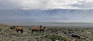
Embarking from Ulaanbaatar towards Dalanzadgad, we encounter a mostly smooth road, marred only by occasional potholes across a hundred kilometers, which still permits rapid travel. Gathering supplies near the airport at dawn, we journey several hundred kilometers to Mandalgobi. Here, we enjoy a pleasant lunch in a quaint restaurant, unexpectedly operated by the owner’s timid children peeking over a bar twice their height. By the afternoon, we’re exploring Dalanzadgad, a city 600 kilometers from Ulaanbaatar, serving as the hub for roughly 20,000 residents and the capital of Ömnögovi Aimag. Its proximity to Dund Sayhni Nuru, our next peak challenge, positions it perfectly for our night’s rest, preparing us for the adventures that lie ahead.

That night, we stay in local accommodation in yurts
A tourist-tuned yurt has a light bulb, power sockets, a ventilator, a table, and a few beds. It generally provides most of what a backpacker might need, but I still miss having windows. I wonder how people satisfy their curiosity without windows.

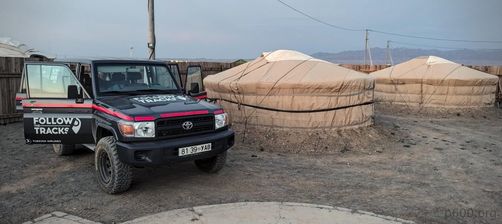
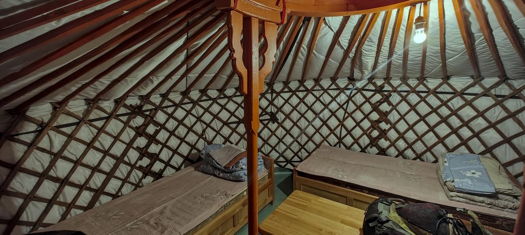
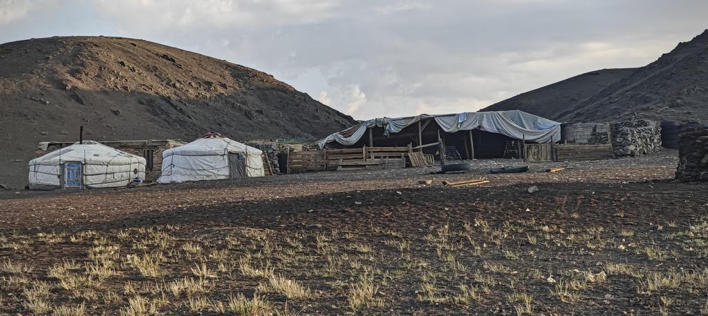
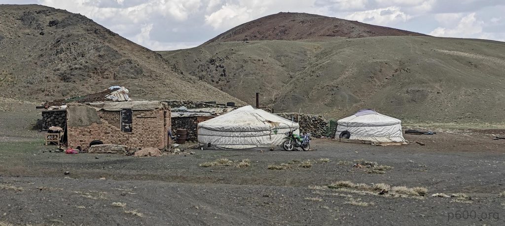
Despite being prepared for a night under the stars in the steppe, the allure of a cozy hotel in Dalanzadgad proves too enticing to ignore. The reality of securing accommodations outside Ulaanbaatar hits us hard, with options scarce and digital footprints virtually nonexistent. Yet, fortune smiles upon us at the hotel reception, where we’re told of no vacancies but are offered a local homestay instead. We eagerly follow a local’s car for a few kilometers to our homestay, where the sight of a traditional yurt awaits us. This unexpected turn of events sets the stage for a memorable and authentic first night in the Mongolian countryside.

We drive a few kilometers off-road towards the mountain base and simply park the car at one of the small bumps before starting to walk.

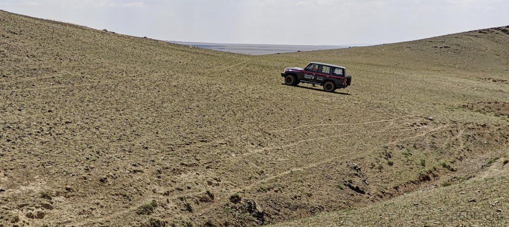
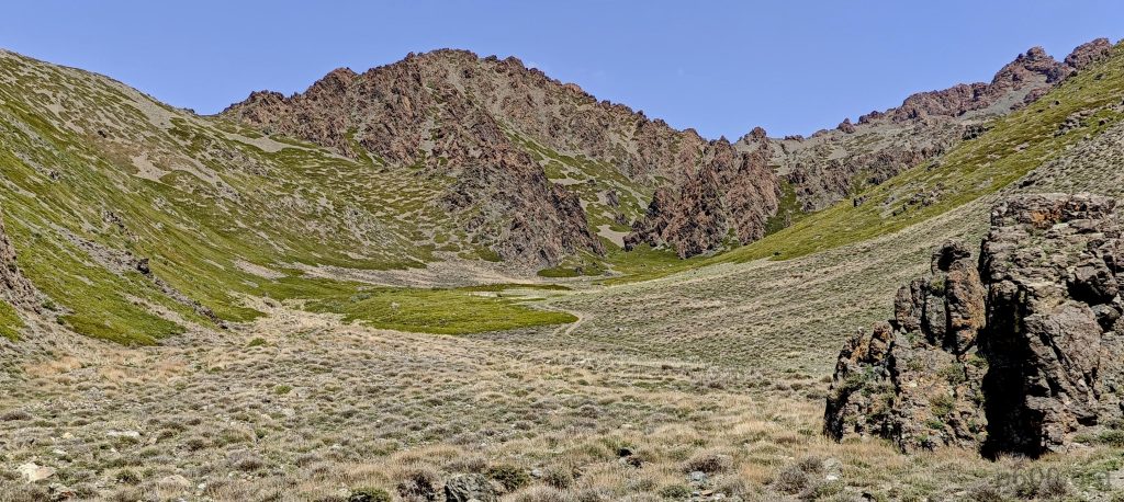
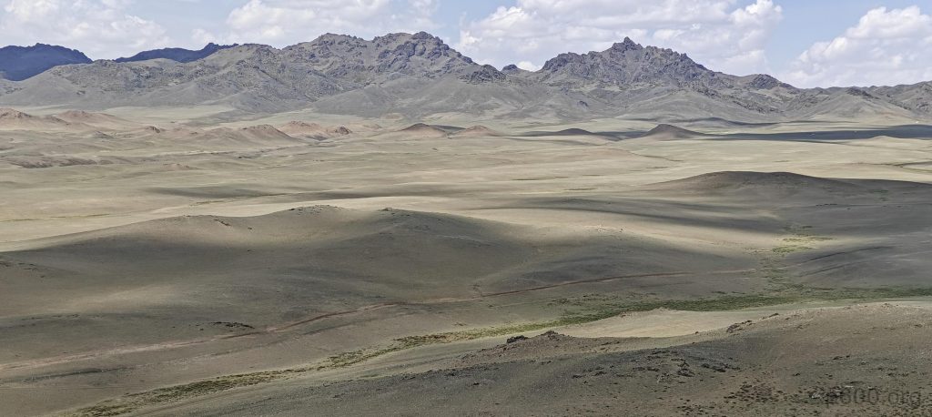
With the dawn breaking, we set off southwest to Bayandalaj village, journeying an additional fifty-plus kilometers. Eventually, we divert from the paved road, aiming directly for the summit. The path ahead isn’t entirely off-road, thanks to discernible tracks guiding our way. We navigate successfully for about twelve kilometers until a deep ravine bars our progress, signaling unmistakably that it’s time to leave the car behind and proceed on foot.

Hills are bathed in the morning light
The landscape is easy to walk through
Few small ups and downs, not bad
The summit ridge lies ahead of us.

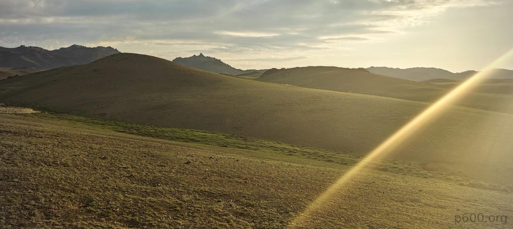
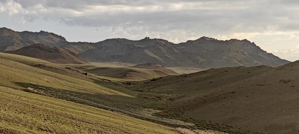
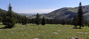
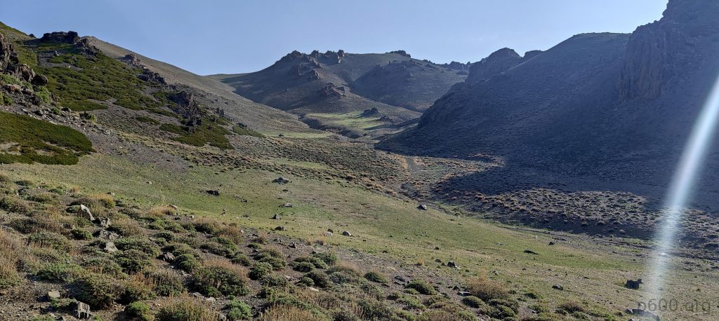
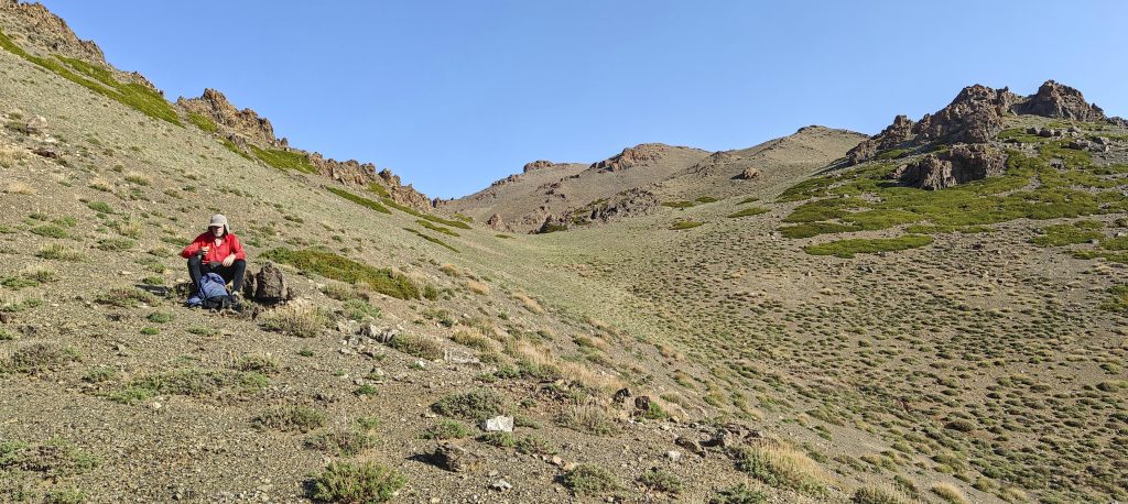
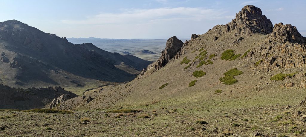
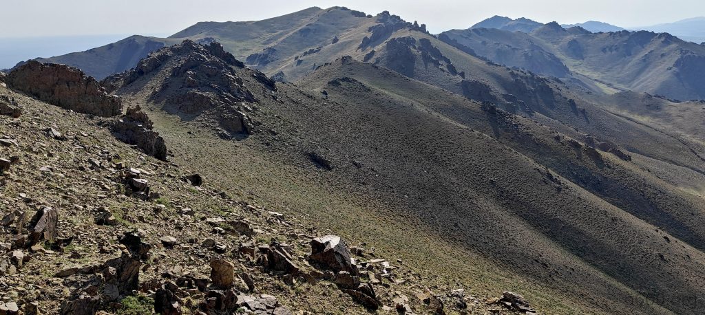
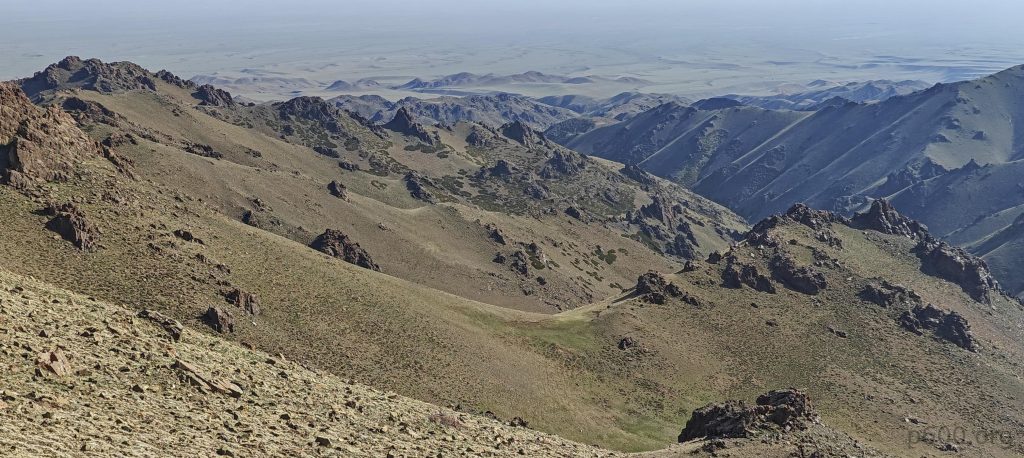
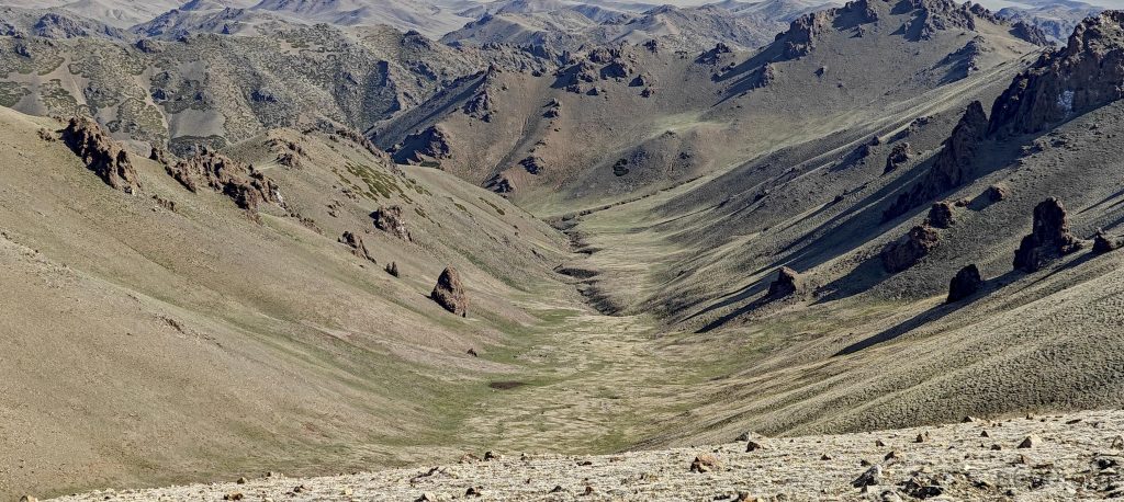
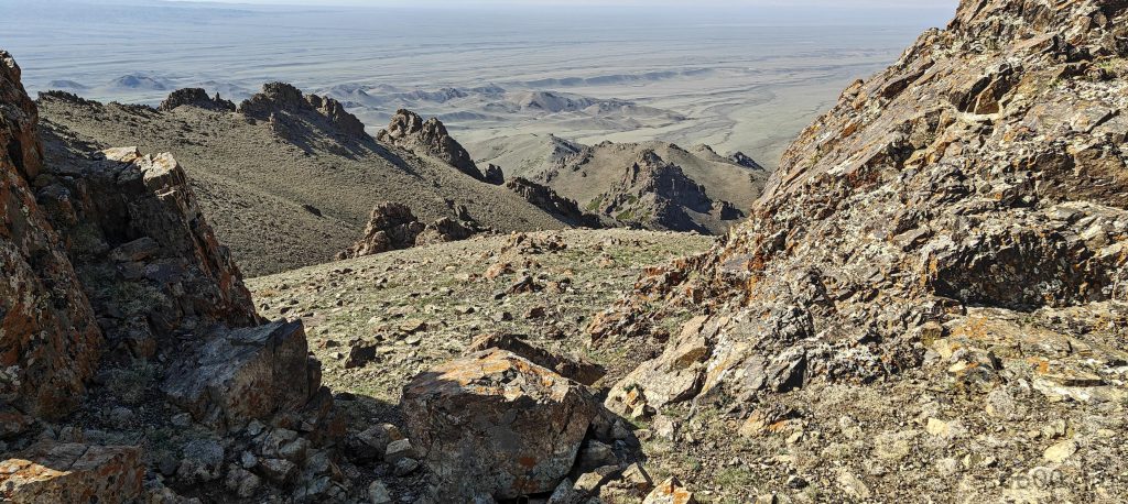
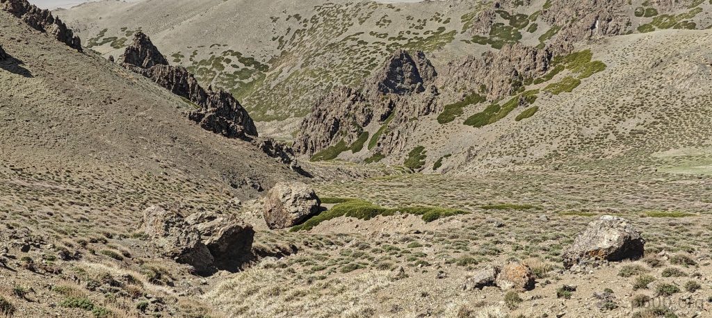
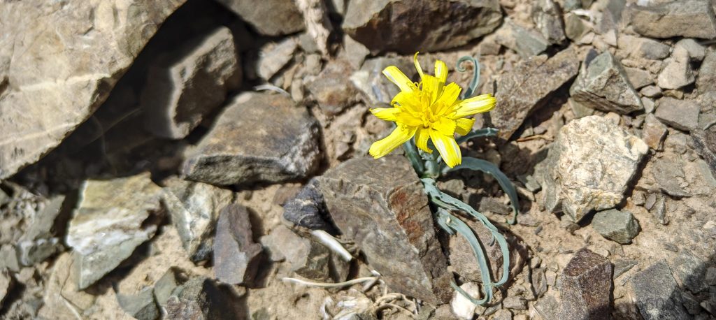
The morning greets us with perfect temperatures, balancing between cool and warm, enhancing the enjoyment of our walk. The land unfolds with mild inclinations, proving to be hiker-friendly. Within an hour, we find ourselves at the mountain’s base, ready to tackle the ascent. Our climb, though direct, becomes gradually steeper with each new slope. Navigating one slope after another, we soon arrive at the ridge, leading us unmistakably towards the summit. With the ridge well-defined and straightforward, our progress towards the peak is quick and unimpeded.

An interesting 50×50-meter square field is adorned with a small shrine at its center, while its perimeter is marked with stones
Looking back, our car is parked somewhere behind these bumps
Finally, we reach steeper slopes
After a few kilometers of walking, we take our first short break, enjoying the nice views in front of us
We came from this valley
Iris flowers dotting the slopes
Gazing towards the flatlands to the south
Observing the ridge to the east, we ascend it from the right side
Taking in the panoramic views from the ridge

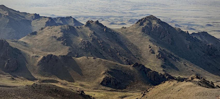
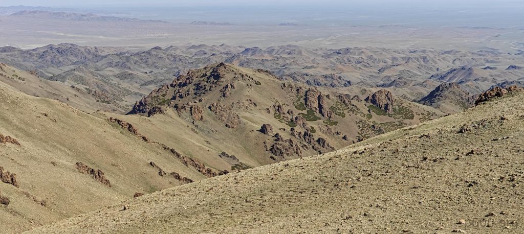
This mountain features three lesser sub-summits, spaced a few kilometers apart, with the tallest named Middle Beauty. Curiously, our map shows Eastern Beauty about 30 kilometers southeast, possibly in another mountain range, standing slightly shorter at 2815 meters, unlike the towering Dund Sayhni Nuru. Though it’s speculative, there’s a chance that to the northwest lies a counterpart known as Western Beauty, completing this geographical trio of aesthetic nomenclature.

The highpoint of Middle Beauty is visible from the lower southeast sub-summit
A valley lies on the north side
Scenic views to the southwest
We came from on this southeast ridge

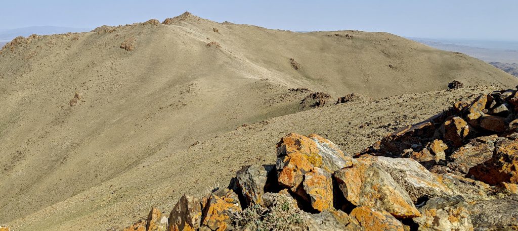
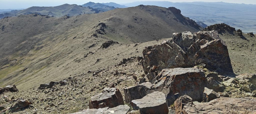
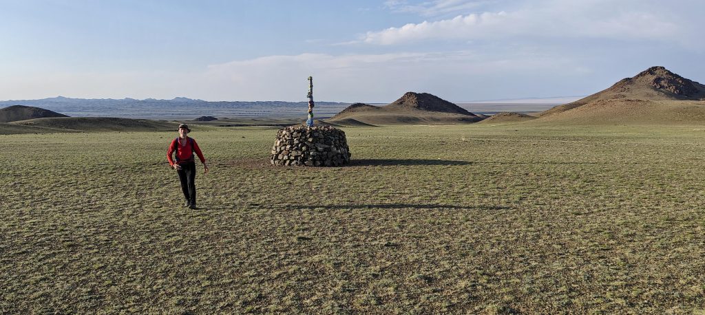
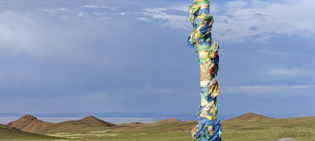
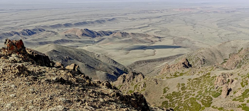
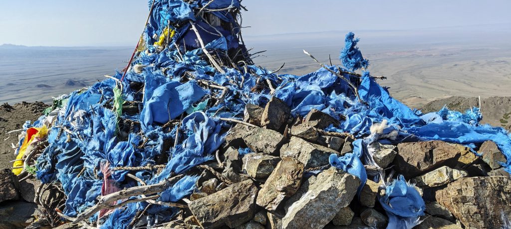
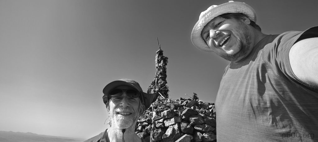
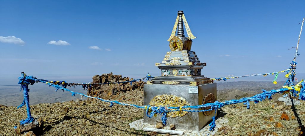
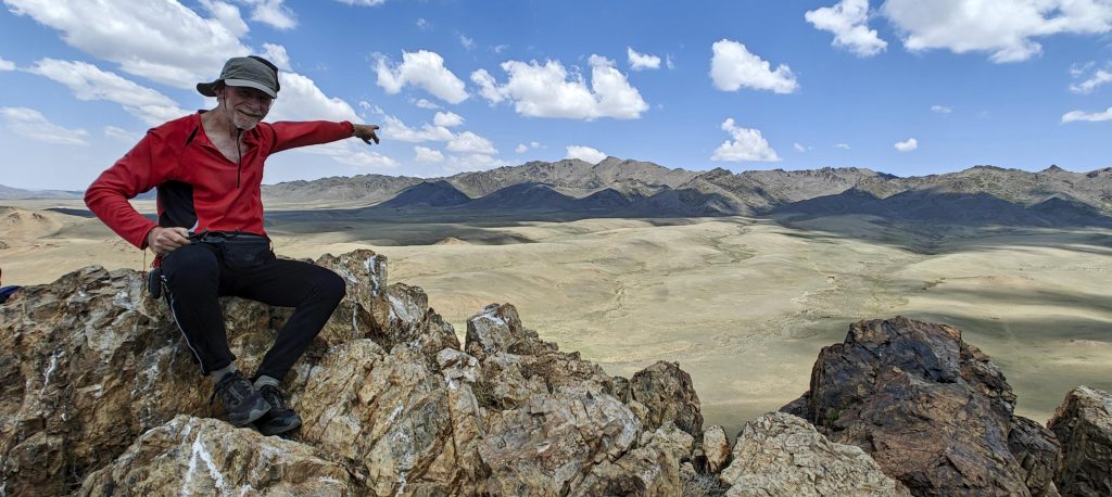
Upon reaching the summit, we encountered a familiar blue shrine. Deciding to extend our exploration, we ventured towards the northwest sub-peak. Despite Rob’s handheld level indicating it was slightly lower, curiosity propelled us forward. Intriguingly, just below the summit, we spotted a striking white bar, which, upon closer inspection, revealed itself to be another radiant shrine.

At the highpoint, there is a typical cairn and a blue-colored shrine
My selfie skills are not the best, but I’m learning. Here’s a selfie of Rob and me at the summit
The northwest sub-summit with a white shrine is slightly lower. A few white pixels are visible in the photo :).
Rob is approaching the lower northeast sub-summit
There is a shining gold-silver shrine below the northwest sub-summit, the one that appeared white from a distance
The clear skies offer impressive views in all directions
The mountain rises at the outskirts of the Gobi Desert
Ridges extending to the west from the northwest sub-summit
Birds (??) greet us at the west sub-summit

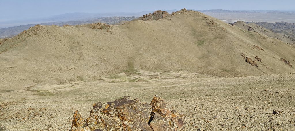
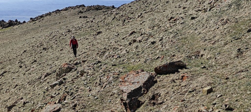
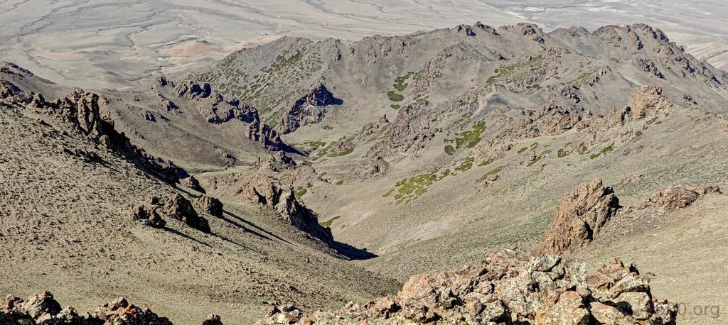
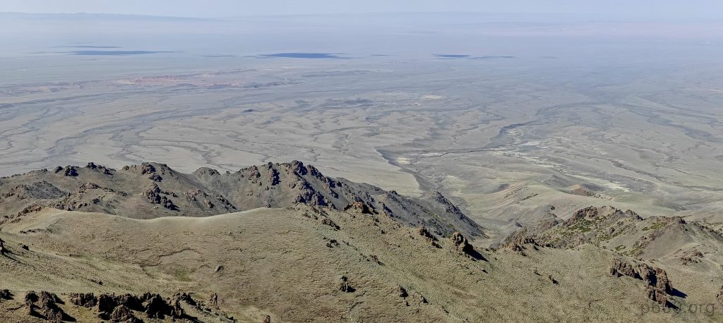
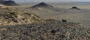
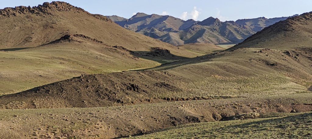
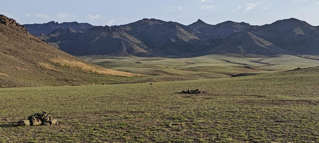
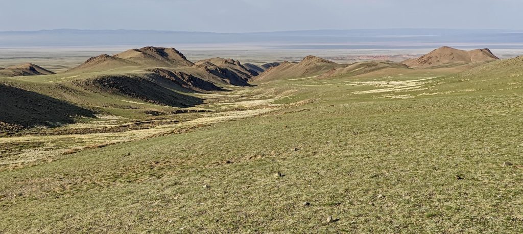
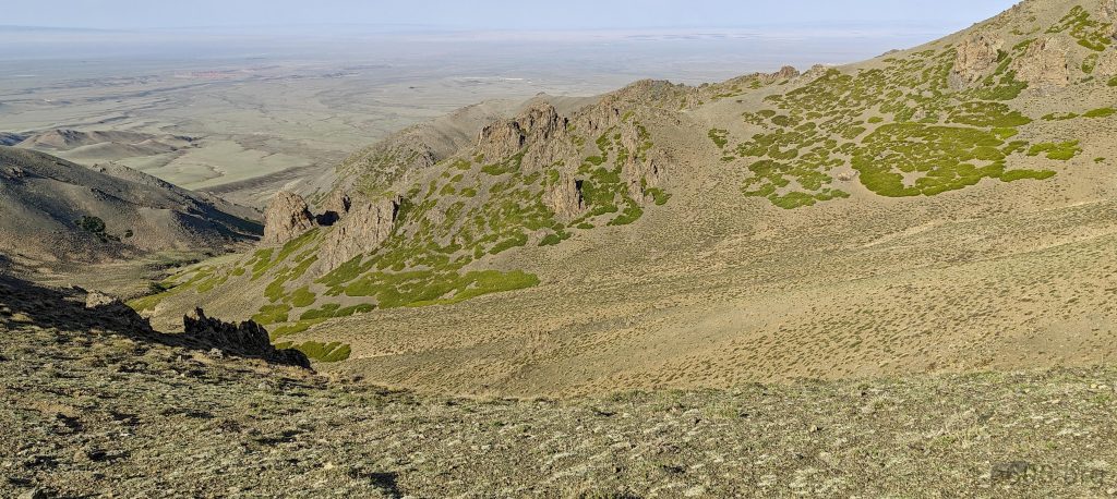
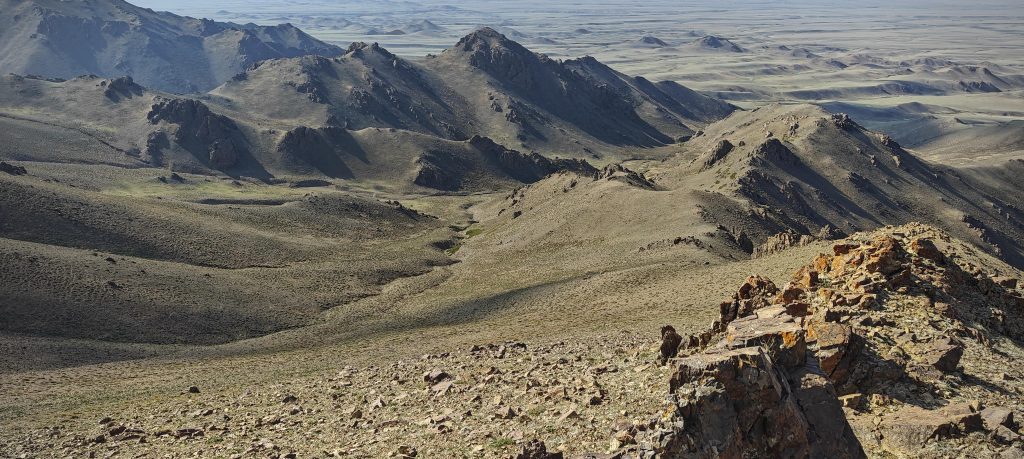
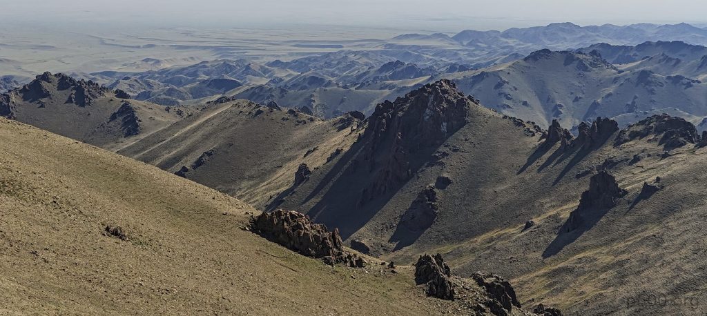
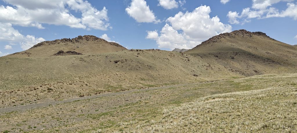
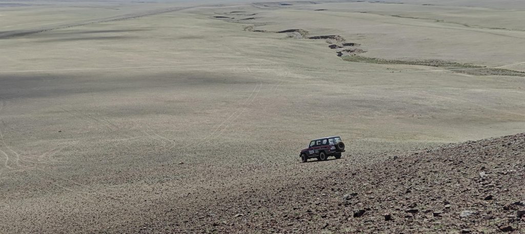
Descending along the same ridge, we begin our descent earlier, just before reaching the southeast sub-peak. Roughly half a mile from there, we reconnect with our initial ascent route. The terrain proves manageable, mirroring the ascent’s quality and challenge. Quickly, we find ourselves on flatter ground, noticing car tracks that suggest a closer parking spot might have been feasible for the summit approach. Despite this realization, the impact on our journey is minimal; we proceed for another half hour before veering off to explore two minor elevations, P61 and P40 (Dund Saynhi Nuru – Peak 2332m and Dund Saynhi Nuru – Peak 2305m), enjoying an effortless scramble and the panoramic views it offers. Back at the car, we indulge in a simple lunch of sardines and noodle soup. Our journey continues, and nearing the paved road, we encounter a P30 peak, prompting Rob to push our vehicle to its limits. Ultimately, we walk the final stretch, a reminder that our trusty car, unlike our ambition, has its bounds.

This camel ?? skeleton reminds me of South America, where tons of animal bones lie on the slopes
Looking back at the ridge and the car tracks in the valley below
A huge mixed herd of sheep and goats moving around, managed by motorbike-riding shepherds
Rob on P60 or P40 peak (left)
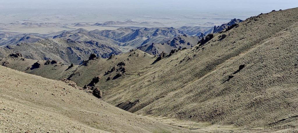
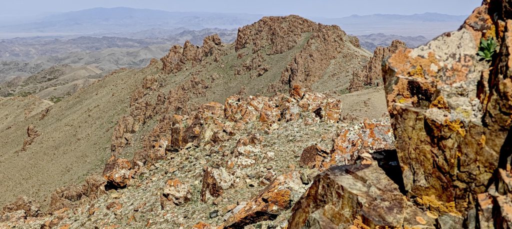
P60 and P40 peaks which we detoured on the way back (right)
Impressive blood-red-colored rocks dominate these small peaks. Richard suggested looking for and bringing home blue-colored rocks, but so far, we haven’t had any luck..
Looking back at the Dund Sayhni Nuru range from the P30 peak
Local yurts
Close to the paved road, we spotted one more cairn at the top of P30, and of course, we could not resist visiting it

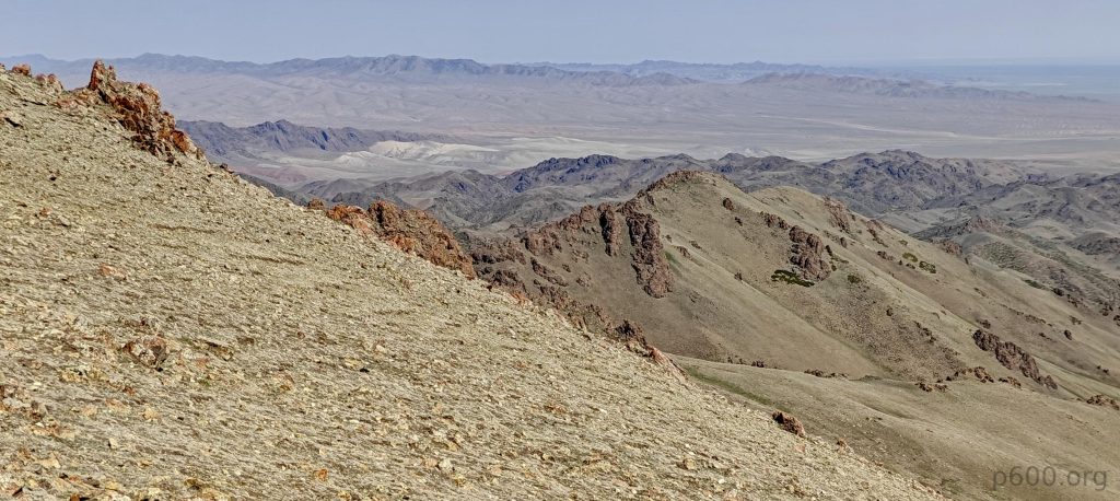
Celebrating a momentous day, we’ve triumphantly scaled our first ultra-prominent Mongolian peak, claiming the Gobi Desert Ranges Highpoint. Our path to this milestone was riddled with uncertainties, yet it all came together flawlessly. Fueled by optimism, we eyed the possibility of traversing the Gobi Desert towards Myangan Yamaat. However, our return to Dalanzadgad was prompted by encountering a formidable sandstorm, initially aiming to cross the Gobi Desert and take a shortcut directly to the next mountain. Confronted by a wall of sand and mere meters of visibility, we made the prudent decision to retract our steps and drive 150 km back. This detour allowed us to enrich our expedition by visiting additional minor peaks like Peak 1156, Bulgan, Peak 1158, Bulgan, and Ich-Tevsh-Ula.

Despite the altered route, reaching each highpoint filled us with a sense of accomplishment, quietly nurturing the hope to explore more peaks—perhaps 5, or even 8. Therefore, our journey presses on, with our enthusiasm unwavering and our ambitions reaching ever higher.


+-
2 km
1 mi
'CyclOSM | Map data: ©, OpenStreetMap contributors'
Dund Sayhni Nuru2830 m altitude
1531 m prominence
224.96 km isolation
RangesMongolia Ranges - Gobi Desert Ranges
Countries/regionsMongolia - Omnogovi
Distance7.20 km up9.40 km down
Elevation941 m gain941 m loss
Time
2h50 up
0h10 other
4h00 down
7h00 total
Trailhead2186 m altitude43.5830550, 103.8129160
RouteOur hike starts across a flat steppe, gradually leading to steeper yet manageable slopes mixed with stones, rocks, and grass for easy navigation. Enjoying the ridge walk, we aim for the southeast sub-summit, then the true summit, and on to the northwest sub-summit. On the way back, we begin our descent half a mile before the southwest sub-peak, a detour that, while not drastically beneficial, adds to our adventure, allowing us to explore additional minor peaks en route.
DifficultiesLocating the optimal turn-off from the paved road to approach the mountain base was tricky, as numerous ravines limited our path, directing us to drive solely towards the ridge.
LinksGPX trail
  • Mongolia Ranges 2023
  • « Tsetseegün Uul
  • Peak 1156, Bulgan »

Mountain Ranges

Anatolia
Central Anatolia
Pontic Mountains
Southeast Anatolia
Taurus Mountains
Western Anatolia
Andes
Puna de Atacama
Atlas Mountains
High Atlas
Northwestern Atlas
Central America Ranges
Costa Rica-Panama Ranges
Central Central America
East China
Taiwan
Eastern Europe Ranges
Southeast Baltic Plains
Iberian Peninsula
Cordillera Cantabrica
Castile Ranges
Portugal-Galicia
Pyrenees
Intermountain West
Great Basin Ranges
Korea-Amur Area
Taebaek Sanmae
Malay Archipelago
Java
Nusa Tengarra
Sulawesi
Sumatra
Mid-Atlantic Islands
North Atlantic Islands
Mongolia Ranges
Altai
Gobi Desert Ranges
Hangay Mountains
Northwest Europe
Great Britain
North France-West Rhine Area
Pacific Ranges
Cascade Range
Northwest U.S. Coast Ranges
Sierra Nevada
Central and Southern California Ranges
Philippines
Central Philippines
Luzon
Mindanao
Southeast Asia
Malay Peninsula
Southeast South America
Pampas
Sierras de Cordoba
Southern Africa
Malawi Highlands
West Africa Mountains
Bight of Benin
Cameroon Mountains
Guinea Highlands

Countries / regions

Algeria
Ain Guezzam
Ain Salah
Aïn Témouchent
El Bayadh
Ghardaïa
Oran
Ouargla
Saïda
Sidi Bel Abbès
Tamanrasset
Argentina
Catamarca
Ciudad Autónoma de Buenos Aires
Córdoba
Jujuy
Salta
Tucumán
Belgium
Brussels Capital Region
Flemish Region
Cameroon
Southwest
China
Taiwan
Costa Rica
Alajuela
Cartago
Guanacaste
Heredia
Limón
San José
Czechia
Prague
Denmark
Greenland
France
Hauts-de-France
Occitania
Germany
Berlin
Niedersachsen
Indonesia
Bali
Jambi
Jawa Tengah
Jawa Timur
Nusa Tenggara Barat
Sulawesi Tengah
Sulawesi Utara
Sumatera Barat
Lithuania
Vilnius County
Mongolia
Bayankhongor
Govi-Altai
Khovd
Omnogovi
Ovorkhangai
Ulan Bator
Zavkhan
Morocco
Béni Mellal-Khénifra
Drâa-Tafilalet
Fez-Meknes
Marrakesh-Safi
Souss-Massa
Tangier-Tetouan-Al Hoceima
Mozambique
Zambezia
Netherlands
Gelderland
Noord-Holland
Zeeland
Nicaragua
Chinandega
Managua
Masaya
Rivas
Philippines
Bicol Region (V)
Cagayan Valley (II)
Calabarzon (IV-A)
Central Luzon (III)
Cordillera Administrative Region
Davao Region
Metro Manila
Soccsksargen (XII)
Western Visayas (VI)
Poland
Greater Poland Voivodeship
Masovian Voivodeship
Portugal
Castelo Branco
Leiria
Lisbon
Madeira
Santarém
Qatar
Ad-Dawhah
São Tomé and Príncipe
São Tomé Province
Sierra Leone
Northern Province
Western Area
Singapore
South Korea
Gyeongsangnam-do
Seoul
Spain
Aragón
Asturias
Castilla-La Mancha
Castilla y León
Catalonia
Islas Canarias
Switzerland
Zürich
Turkey
Antalya
Bitlis
Erzincan
Hakkâri
Igdir
Isparta
Kahraman Maras
Muğla
United Kingdom
England
Scotland
United States
California
Delaware
Florida
Maryland
Nevada
New Jersey
New York
Pennsylvania
South Carolina
Utah

TRIPS

2024
Southern Africa 2024
Mid-Atlantic Islands 2024
North America 2024
Anatolia 2024
Korea-Amur Area 2024
East China 2024
2023
Mongolia Ranges 2023
Philippines 2023
West Africa III 2023
West Africa II 2023
Iberian Peninsula 2023
West Africa 2023
Central America 2023
2022
Andes 2022
Northwest Europe 2022
Malay Archipelago III 2022
Malay Archipelago II 2022
Anatolia Mountains 2022
Iberian Peninsula 2022
Atlas Mountains 2022
North France-West Rhine Area 2022

archaeology (3) climb (157) food (2) hike (155) p30 (17) p50 (4) p100 (24) p300 (12) p600 (17) p1000 (11) p1500 (76) ribu (10) sight (46) summary (16) trig (44) ultra (76)

1 591 km walked, 121 298 m climbed

©2025 p600.org | WordPress Theme by Superbthemes.com
Menu
p600.org
  • home
  • map
  • trips
  • about